1900s (20th Century) Maps of Oliver, Indiana
Explore 10 historic maps of Oliver from the 1900s (20th Century). These maps offer a rare glimpse into what life looked like during the 1900s — showing old roads, neighborhoods, homes, and landmarks that have changed or disappeared over time.
Whether you're researching your family's past, planning a metal detecting trip, or studying how Oliver's landscape evolved across the 1900s, these high-resolution maps are a powerful tool for exploring the history of this region.
- Focus on a specific era: All maps on this page are from the 1900s, giving you a focused view of this time period.
- See what’s changed: Compare century-old streets, trails, and buildings to today's modern landscape using overlays and satellite layers.
- Research with precision: Use these maps for genealogy, historical research, land use analysis, or educational projects.
- View, download, or print: Maps are fully viewable online in high resolution, and can be downloaded or printed for your own records.
Start exploring Oliver's history through authentic maps from the 1900s. This is your window into the past.
Oliver, IN maps
(10)- 1903 Map of New Harmony
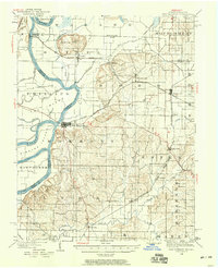
 1903 New Harmony1903 Print · USGSPosey County at the opening of the twentieth century was a landscape of thriving river towns and bustling rail junctions. Genealogists and historians can trace the early footprints of New Harmony and Poseyville, or locate vanished locales like Rapture and Solitude.3 unique versions available
 - 1903 Map of Patoka
 1903 Patoka1903 Print · USGSThe lower Wabash Valley at the start of the twentieth century was a vital crossroads of river trade and rail expansion. Genealogists can trace family roots through settlements like New Harmony and Parker's Settlement or locate the County Farm and Grand Rapids.2 unique versions available
 - 1938 Map of New Harmony, 1958 Print
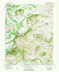
 1938 New Harmony1958 Print · USGSIndiana's southwestern tip along the Wabash River is captured here during the late thirties. Genealogists and local historians can trace family land near the Mumford Hills or locate historic rail stops in Poseyville, Stewartsville, and Griffin.
 - 1956 Map of Vincennes, 1967 Print
 1956 Vincennes1967 Print · USGSSouthern Indiana and the Illinois borderlands are captured here in the mid-fifties, showing the region's dense network of river towns and rail lines. Researchers can trace historic river crossings along the Wabash River or locate landmarks like Wyandotte Cave and Lincoln State Park.4 unique versions available
 - 1957 Map of Vincennes
 1957 Vincennes1957 Print · USGSSouthwest Indiana and the Illinois borderlands come alive in the late 1950s, a period of heavy rail traffic and expanding state forests. Genealogists and historians can trace the riverfronts and rail lines of Vincennes, New Harmony, and the vast Crane Naval Ammunition Depot.
 - 1958 Map of Vincennes
 1958 Vincennes1958 Print · USGSSouthern Indiana and the Illinois borderlands are captured during a mid-century period of heavy rail traffic and military activity. Researchers can trace the sprawling bounds of the Crane Naval Ammunition Depot or locate historic settlements like New Harmony and French Lick.2 unique versions available
 - 1959 Map of Wadesville, 1960 Print
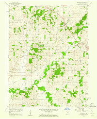 1959 Wadesville1960 Print · USGSPosey County in the late fifties is captured here as a landscape of established farmsteads and rural crossroads. Researchers can trace the legacy of small communities like Wadesville and Oliver or locate family sites at Laurel Hill Cem and Mt Zion Ch.
 - 1959 Map of New Harmony, 1963 Print
 1959 New Harmony1963 Print · USGSThe Indiana-Illinois borderlands of the late fifties are defined here by the winding Wabash River and a landscape dotted with oil wells. Trace ancestral connections at Old Union Ch, The Labyrinth State Mem, or schools like South Terrace Sch.2 unique versions available
 - 1981 Map of Wadesville
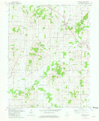 1981 Wadesville1981 Print · USGSPosey County in the early eighties shows a rural landscape transitioning between its agrarian roots and the rise of the energy sector. Researchers can trace family history through Laurel Hill Cem, the South Terrace Sch, and the Louisville and Nashville rail line.
 - 1986 Map of Princeton
 1986 Princeton1986 Print · USGSSouthwestern Indiana is defined by the confluence of the Wabash and White Rivers during the mid-eighties, a period of established rail lines and expanding interstates. Genealogists and historians can trace property locations across numerous townships or locate family sites in Mount Carmel, Poseyville, and Boonville.2 unique versions available
End of results
Showing maps 1-10 of 10
Top cities near Oliver
- Evansville historical maps
- Henderson historical maps
- Mount Vernon historical maps
- Armstrong historical maps
- Grayville historical maps
- Owensville historical maps
See more
Frequently asked questions
- What are the different types of historical maps available for Oliver?
- What is the oldest map of Oliver?
- Where can I purchase historical maps of Oliver for my home or office?
- Where can I download high-res historical maps of Oliver?
- Are there historical topographic maps available for Oliver?
- Is there historical aerial imagery available for Oliver?
- Where are historical maps of Oliver sourced from?