2020s Maps of Putnam County, Indiana
Explore 16 historic maps of Putnam County from the 2020s. These maps offer a rare glimpse into what life looked like during the 2020s — showing old roads, neighborhoods, homes, and landmarks that have changed or disappeared over time.
Whether you're researching your family's past, planning a metal detecting trip, or studying how Putnam County's landscape evolved across the 2020s, these high-resolution maps are a powerful tool for exploring the history of this region.
- Focus on a specific era: All maps on this page are from the 2020s, giving you a focused view of this time period.
- See what’s changed: Compare century-old streets, trails, and buildings to today's modern landscape using overlays and satellite layers.
- Research with precision: Use these maps for genealogy, historical research, land use analysis, or educational projects.
- View, download, or print: Maps are fully viewable online in high resolution, and can be downloaded or printed for your own records.
Start exploring Putnam County's history through authentic maps from the 2020s. This is your window into the past.
Putnam County, IN maps
(16)- 2022 Map of Brazil East, 2022 Print
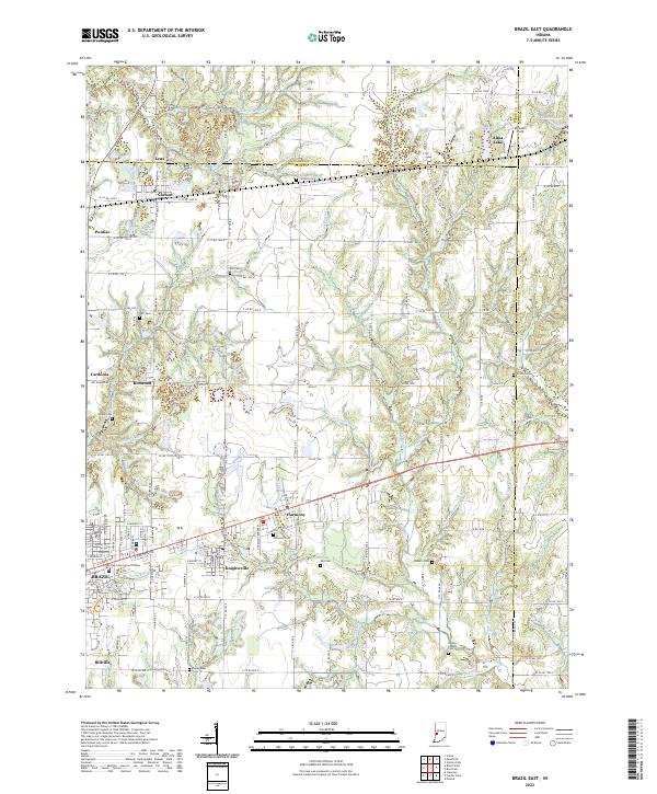 2022 Brazil East2022 Print · USGSWestern Indiana's industrial and agricultural heartland is documented here in the early twenty-first century. Genealogists and historians can trace family locations through numerous sites like Knightsville, Harmony, and the Poplar Cem or Owens Cem.
 - 2022 Map of Center Point, 2022 Print
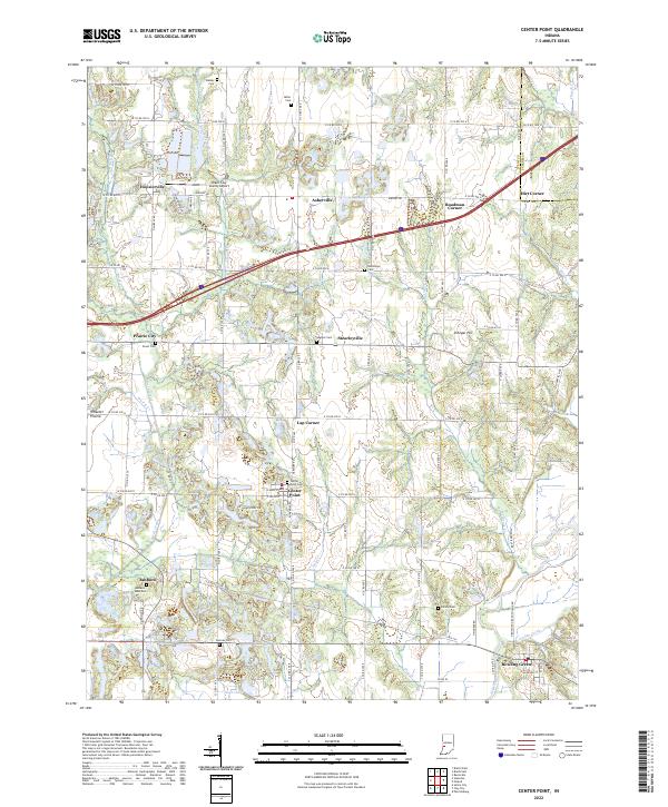 2022 Center Point2022 Print · USGSClay County in the 2020s remains a landscape of deeply rooted rural communities and quiet river bottoms. Genealogists and historians can locate numerous small burial grounds like Ashboro - Moss Cem and Zenor Cem along the banks of Birch Creek.
 - 2022 Map of Greencastle, 2022 Print
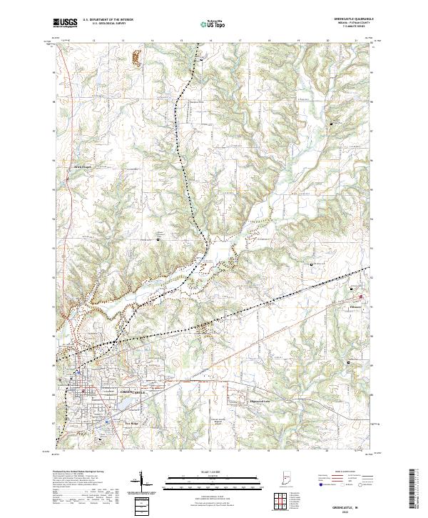 2022 Greencastle2022 Print · USGSGreencastle and its surrounding townships are shown here in the early 2020s, centered on the Depauw University campus. Researchers can trace the Vandalia Trail and locate several historic burial grounds including Wesley Chapel Cem and Forest Hill Cem.
 - 2022 Map of Coatesville, 2022 Print
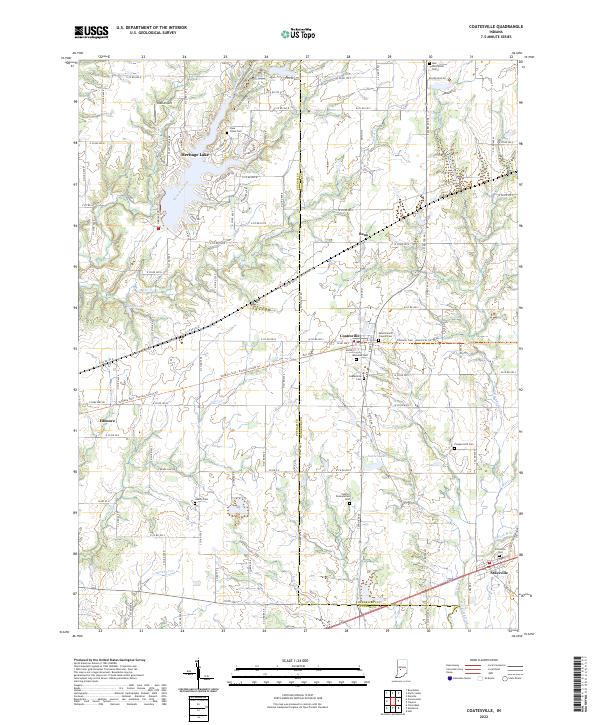 2022 Coatesville2022 Print · USGSThe borderlands of Hendricks and Putnam Counties are captured here in the 2020s, showcasing a landscape defined by historic town centers and rural cemeteries. Researchers can trace the path of the Vandalia Trail or locate family roots at West Branch Friends Cem and Moravian Cem.
 - 2022 Map of Eminence, 2022 Print
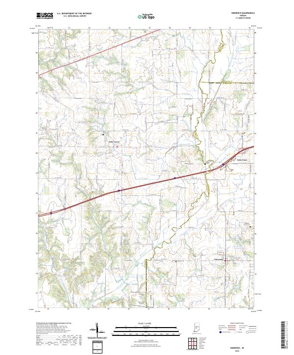 2022 Eminence2022 Print · USGSThe rural landscapes of Putnam and Morgan counties come into focus here in the early 2020s. Researchers can trace local genealogy through sites like Belle Union Branch Cem and explore the rural layout of Eminence and Belle Union.
 - 2022 Map of North Salem, 2022 Print
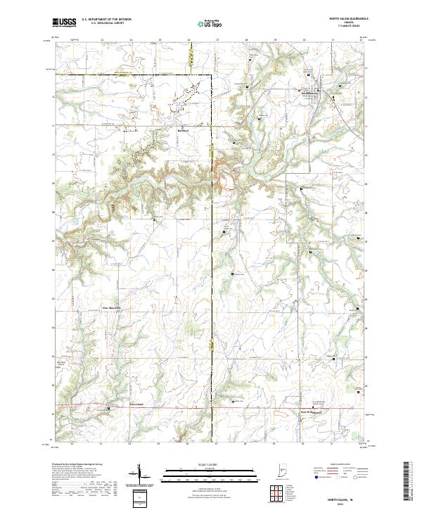 2022 North Salem2022 Print · USGSThe rural borderlands of Hendricks and Putnam counties are documented here in the early twenty-first century. Genealogists can locate numerous small burial sites like Abner Ragan Cem, Roundtown Cem, and Dickerson Cem alongside the historic town of North Salem.
 - 2022 Map of Quincy, 2022 Print
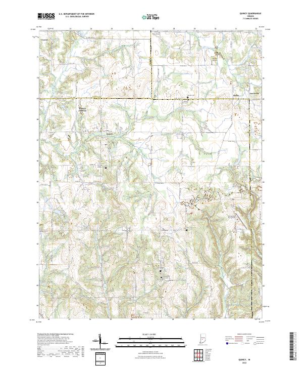 2022 Quincy2022 Print · USGSOwen County's rural landscape is captured here in the early twenty-first century, centered on the historic rail meeting point at Wallace Junction. Researchers can find numerous local landmarks like Mannan Cem, Quincy, and Shenandoah Flying Field.
 - 2022 Map of Cataract, 2022 Print
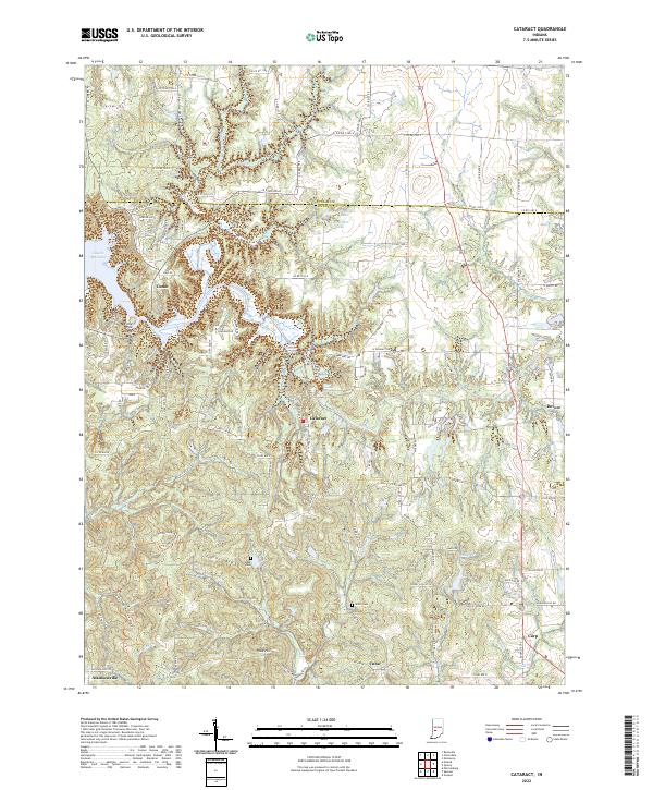 2022 Cataract2022 Print · USGSOwen County at the start of the 2020s remains a landscape defined by the winding Mill Creek and the waters of Cagles Mill Lake. Researchers can trace old family burial grounds like Maze Cem and explore the historic footprints of small towns such as Cataract and Cuba.
 - 2022 Map of Roachdale, 2022 Print
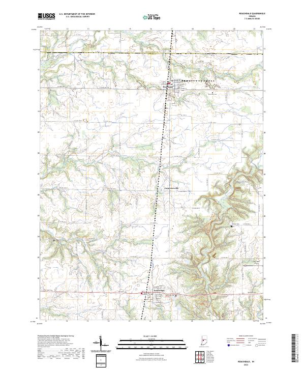 2022 Roachdale2022 Print · USGSNorthwestern Putnam County is showcased in the 2020s, centered on the historic street grids of Roachdale and Bainbridge. Researchers can locate several family and community landmarks, from the Roachdale Cem to the winding paths of the Tall Timbers Trl near Carpentersville.
 - 2022 Map of Cloverdale, 2022 Print
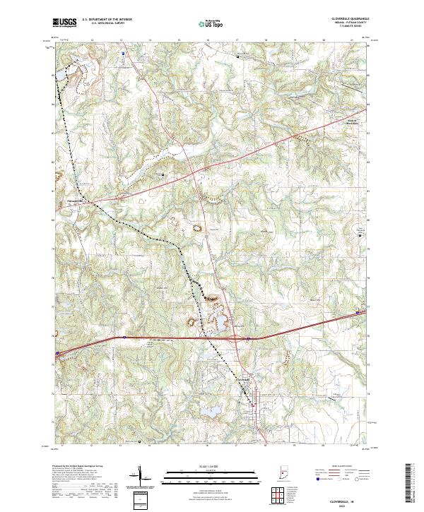 2022 Cloverdale2022 Print · USGSCloverdale and southern Putnam County appear in the early 2020s, showing a landscape where modern interstate transit meets deep-rooted rural settlements. Researchers can trace family history at Old Bethel Cem or explore geographic landmarks like Devils Backbone and Greyhound Lake.
 - 2022 Map of Clinton Falls, 2022 Print
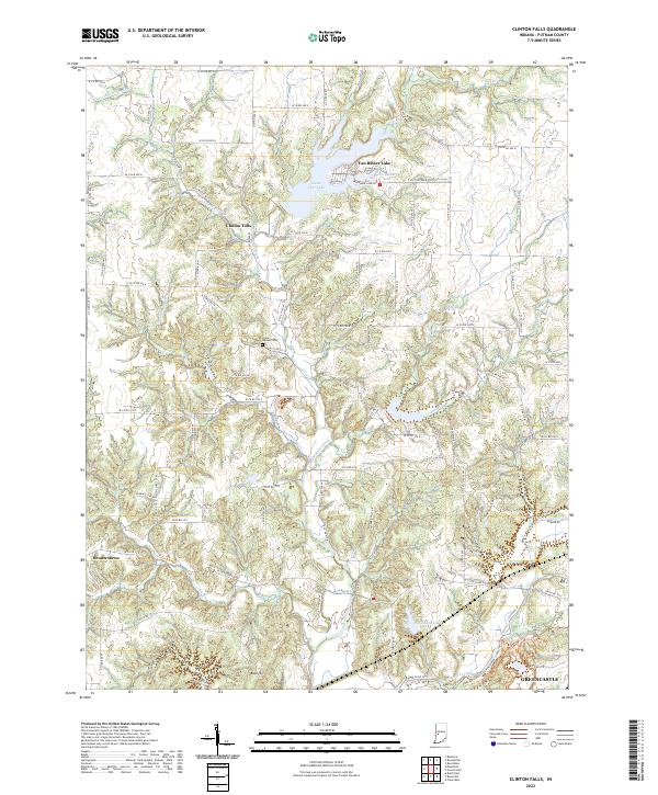 2022 Clinton Falls2022 Print · USGSPutnam County's rural landscape is captured here in the early 2020s, showing a mix of established settlements and modern water reservoirs. Genealogists and hikers can trace the areas around Little Walnut Cem, the village of Clinton Falls, and the Depauw University Nature Park Trails Trl.
 - 2022 Map of Reelsville, 2022 Print
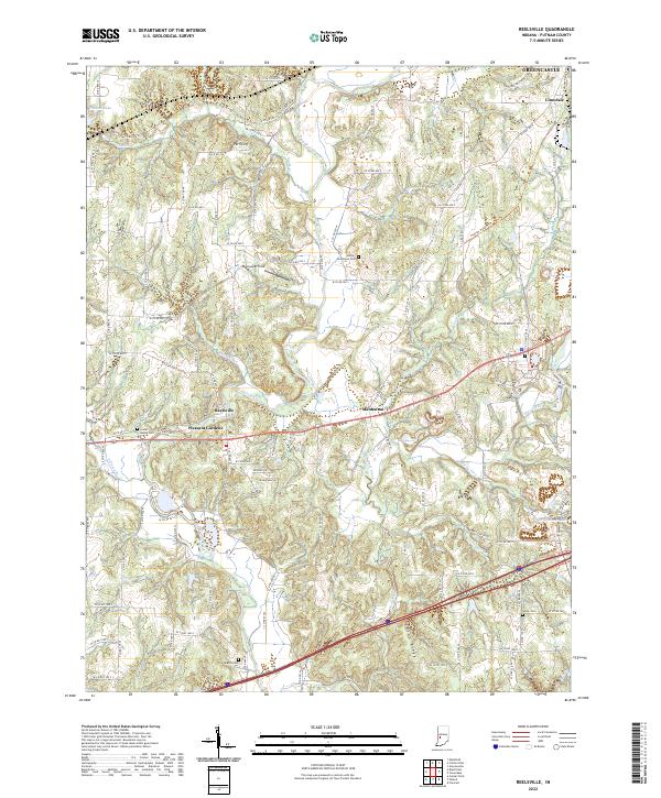 2022 Reelsville2022 Print · USGSReelsville and the surrounding Putnam County countryside appear here in the early 2020s, showing a landscape defined by the deep valley of Big Walnut Creek. Researchers can locate several historic burial sites like Hutcheson Cem and Salem Cem alongside the small communities of Manhattan and Limedale.
 - 2022 Map of Poland, 2022 Print
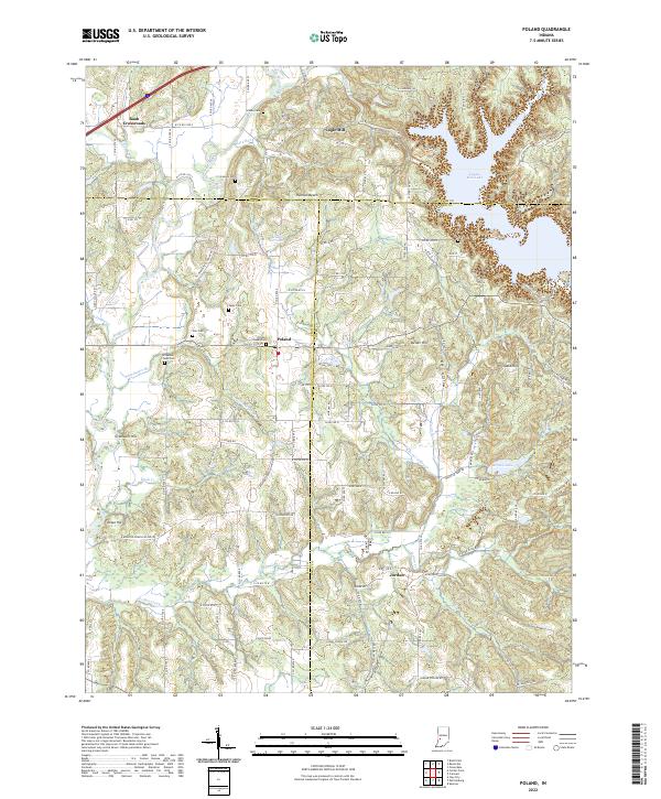 2022 Poland2022 Print · USGSThe rural crossroads of Owen and Clay counties are captured here in the early twenty-first century. Genealogists and local historians can trace family roots through numerous sites like Poland Chapel Cem, Raab Crossroads, and the old Wilkerson - Nees Cem.
 - 2022 Map of Bellmore, 2022 Print
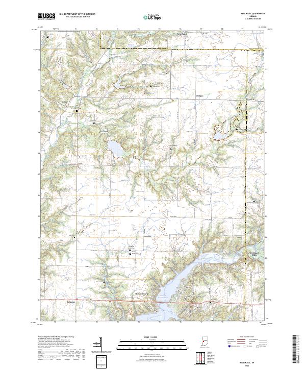 2022 Bellmore2022 Print · USGSThe borderlands of Parke and Putnam counties are documented here in recent years, centered on the waters of Cecil M Harden Lake. Researchers can trace local history through a high density of rural burial sites like Seybold Cem and Bruin Cem, alongside settlements like Portland Mills and Hollandsburg.
 - 2022 Map of Mansfield, 2022 Print
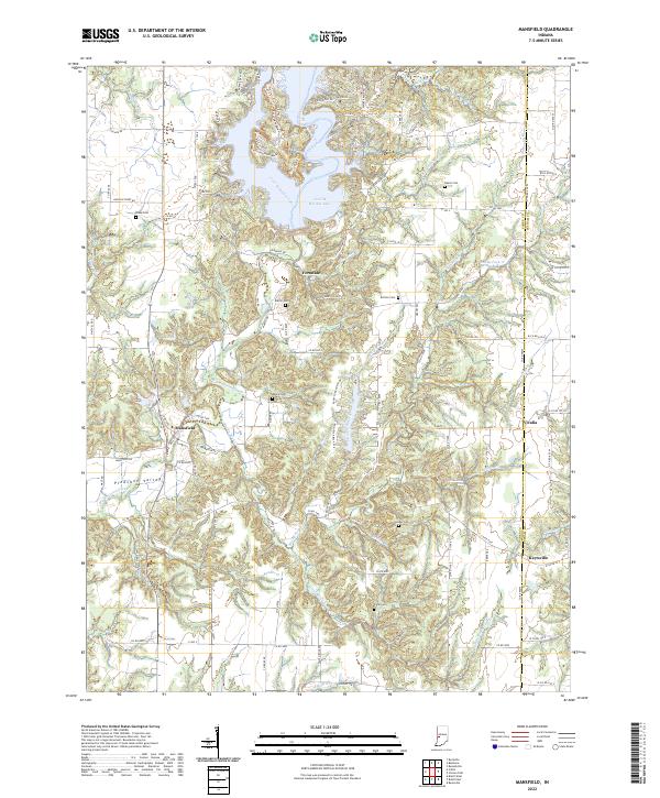 2022 Mansfield2022 Print · USGSThe rural border of Parke and Putnam counties is captured here in the early twenty-first century, centered on the creek-side village of Mansfield. Genealogists and researchers can locate several local burial grounds including Moore Cem and Jacks Cem, or trace the recreational expansion around Cecil M Harden Lake.
 - 2022 Map of Russellville, 2022 Print
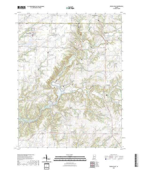 2022 Russellville2022 Print · USGSThe rural landscape of northwest Putnam County comes into focus here in the early 2020s, defined by the winding Big Raccoon Creek. Genealogists and historians can locate numerous family burial sites, including Hebron Cem, Sutherlin Cem, and Pickle Cem.
End of results
Showing maps 1-16 of 16
Top cities of Putnam County
- Greencastle historical maps
- Cloverdale historical maps
- Roachdale historical maps
- Fillmore historical maps
- Russellville historical maps
Frequently asked questions
- What are the different types of historical maps available for Putnam County?
- What is the oldest map of Putnam County?
- Where can I purchase historical maps of Putnam County for my home or office?
- Where can I download high-res historical maps of Putnam County?
- Are there historical topographic maps available for Putnam County?
- Is there historical aerial imagery available for Putnam County?
- Where are historical maps of Putnam County sourced from?