1900s (20th Century) Maps of Putnam County, Indiana
Explore 36 historic maps of Putnam County from the 1900s (20th Century). These maps offer a rare glimpse into what life looked like during the 1900s — showing old roads, neighborhoods, homes, and landmarks that have changed or disappeared over time.
Whether you're researching your family's past, planning a metal detecting trip, or studying how Putnam County's landscape evolved across the 1900s, these high-resolution maps are a powerful tool for exploring the history of this region.
- Focus on a specific era: All maps on this page are from the 1900s, giving you a focused view of this time period.
- See what’s changed: Compare century-old streets, trails, and buildings to today's modern landscape using overlays and satellite layers.
- Research with precision: Use these maps for genealogy, historical research, land use analysis, or educational projects.
- View, download, or print: Maps are fully viewable online in high resolution, and can be downloaded or printed for your own records.
Start exploring Putnam County's history through authentic maps from the 1900s. This is your window into the past.
Putnam County, IN maps
(36)- 1908 Map of Clay City
 1908 Clay City1908 Print · USGSIndiana's coal and timber country comes alive in the years before the Great War, showing a landscape defined by deep river valleys and early rail lines. Genealogists can trace hundreds of family sites near Clay City and Center Point, or locate historic gathering places like Wesley Chapel and Roadman School.
 - 1910 Map of Clay City
 1910 Clay City1910 Print · USGSClay County at the height of its rail-and-river era shows a landscape shaped by coal transport and agriculture. You can trace the Wabash and Erie Canal, locate the Feederdam Bridge, and find dozens of family-named schoolhouses like Dutch Knob School.2 unique versions available
 - 1949 Map of Quincy
 1949 Quincy1949 Print · USGSOwen County’s rural townships are captured in the late 1940s, centered on the railroad hub at Quincy. Genealogists can trace family landmarks like Little Mount Cem, Montgomery Chapel, and the vanished School No. 2 near the Morgan County line.2 unique versions available
 - 1950 Map of Brazil East, 1952 Print
 1950 Brazil East1952 Print · USGSClay County at mid-century was a landscape defined by coal and transit, as massive industrial earthworks reshaped the outskirts of its communities. Genealogists and historians can trace the foundations of Brazil and Knightsville or locate rural landmarks like Wesley Chapel and Calcutta Cem.
 - 1951 Map of Clinton Falls, 1953 Print
 1951 Clinton Falls1953 Print · USGSPutnam County in the early fifties shows a landscape of small schools and rural churches connected by creek-side roads. Researchers can trace family history through sites like Brunerstown Sch, Long Branch Ch, and the New York Central rail line.
 - 1951 Map of Mansfield, 1953 Print
 1951 Mansfield1953 Print · USGSParke and Putnam Counties are captured here in the early fifties, documenting the rural character of the West-Central Indiana highlands. Genealogists can locate family-named sites such as Roach Cem, Miller Cem, and community landmarks like Zion Chapel or the village of Ferndale.2 unique versions available
 - 1952 Map of Reelsville, 1954 Print
 1952 Reelsville1954 Print · USGSPutnam County's mid-century landscape is defined here by the crossing of major rail lines and the winding Eel River. Genealogists and local historians can locate the Reelsville High Sch and several family-named burial grounds like Boone-Hutcheson Cem.2 unique versions available
 - 1953 Map of Indianapolis, 1965 Print
 1953 Indianapolis1965 Print · USGSCentral Indiana and the Illinois borderlands are captured in the mid-sixties, showing the growth of Indianapolis and its industrial rail corridors. Genealogists and historians can trace the development of outlying towns like Zionsville or Beech Grove and find landmarks such as Atterbury AAF and Turkey Run State Park.4 unique versions available
 - 1955 Map of Russellville, 1957 Print
 1955 Russellville1957 Print · USGSNorthwestern Putnam County in the mid-1950s is defined by the winding Raccoon Creek and the busy Baltimore and Ohio rail line. Genealogists and local historians can locate numerous family burial sites like Golder Cem and trace the original footprints of Russellville and Fincastle.
 - 1956 Map of Indianapolis
 1956 Indianapolis1956 Print · USGSCentral Indiana in the mid-fifties is captured during a period of industrial growth and military presence. Genealogists and historians can trace the rail networks of the New York Central or locate regional landmarks like Fort Benjamin Harrison and Camp Atterbury.
 - 1956 Map of Cloverdale, 1957 Print
 1956 Cloverdale1957 Print · USGSCloverdale and Putnamville are captured in the mid-1950s as the classic National Road corridor meets the local rail economy. Genealogists and historians can trace numerous family burial grounds like Gost Cem and landmarks such as the Township Sch or the Monon railroad tracks.
 - 1956 Map of Cataract, 1957 Print
 1956 Cataract1957 Print · USGSOwen County's landscape is defined by its state forests and the waters of the lake in the mid-fifties. Researchers can trace the Monon rail line or locate rural landmarks like Cataract Falls, Ernie Pyle Island, and Mill Grove Ch.6 unique versions available
 - 1956 Map of Eminence, 1957 Print
 1956 Eminence1957 Print · USGSCentral Indiana's rural townships are captured in the mid-1950s at the junction of Putnam and Morgan counties. Researchers can trace family sites like the Broadstreet Cem, visit Belle Union, or locate the Walnut Chapel along Mill Creek.
 - 1957 Map of Indianapolis
 1957 Indianapolis1957 Print · USGSCentral Indiana in the mid-fifties is captured here as a crossroads of major rail lines and nascent federal highways. Genealogists and historians can trace family-named ridges like Poplar Ridge or locate strategic sites like Camp Atterbury and Speedway.2 unique versions available
 - 1957 Map of Center Point, 1958 Print
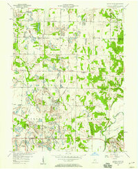 1957 Center Point1958 Print · USGSClay County at the dawn of the space age reveals a landscape defined by the PENNSYLVANIA railroad and scattered farming hamlets. Genealogists can trace family roots through the Gremes Cem and Killion Cem or locate old community centers like Center Point and Bowling Green.3 unique versions available
 - 1957 Map of Poland, 1958 Print
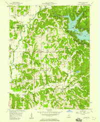 1957 Poland1958 Print · USGSCataract Lake and the Cagle Mill Dam emerge as major landmarks in the Indiana countryside of the mid-1950s. Genealogists can trace family names at Raab Crossroads or locate rural sites like Greeley Ch, Nier Cem, and Township Sch.4 unique versions available
 - 1958 Map of Roachdale, 1959 Print
 1958 Roachdale1959 Print · USGSPutnam County in the late fifties was a hub of transit where the Monon and Baltimore and Ohio railroads met. Genealogists and local historians can trace the rural landscape through the Roachdale Cem, Haw Creek Ch, and the Ernie Pyle Memorial Highway.
 - 1958 Map of Quincy, 1959 Print
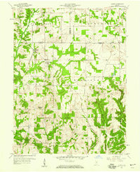 1958 Quincy1959 Print · USGSOwen County is captured in the late fifties at a time when the rail-and-river landscape still defined local life. Genealogists can trace family names at Hudson Hill Cem and Mannan Cem or locate the village of Quincy near the historic Treaty Boundary.2 unique versions available
 - 1958 Map of Coatesville, 1959 Print
 1958 Coatesville1959 Print · USGSThe Hendricks and Putnam county line comes alive in the late 1950s, showing a landscape defined by crossing rail lines and rural hamlets. Genealogists can trace family names at Canaan Ch Cem and Liberty Cem or explore the rail hubs at Coatesville and Reno.
 - 1958 Map of North Salem, 1959 Print
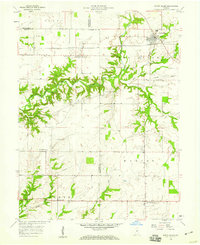 1958 North Salem1959 Print · USGSCentral Indiana's farming heartland comes to life in the late fifties, centered on the village of North Salem. Genealogists and local historians can trace the paths of the Baltimore and Ohio railroad and find rural landmarks like Mt Olivet Ch and New Maysville.3 unique versions available
 - 1958 Map of Greencastle, 1959 Print
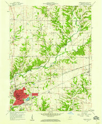 1958 Greencastle1959 Print · USGSGreencastle and its surrounding Putnam County townships are captured here during a peak era for the region's rail-and-river network. Researchers can locate family landmarks like Brick Chapel, trace the Monon rail line, or find ancestors at Forest Hill Cem.
 - 1960 Map of Brazil East
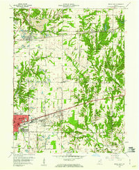 1960 Brazil East1960 Print · USGSClay County at the dawn of the 1960s shows a landscape of busy coal pits and industrial towns. Genealogists and historians can trace family locations near Knightsville, search for burials at Calcutta Cem, or follow the path of the Pennsylvania Railroad.3 unique versions available
 - 1962 Map of Indianapolis
 1962 Indianapolis1962 Print · USGSCentral Indiana and the Illinois borderlands are captured here in the early sixties, showing the region's dense rail networks and growing urban centers. Genealogists and historians can locate family-named landmarks and institutions like Crown Hill Cem, Indiana University, and the Indianapolis Motor Speedway.
 - 1963 Map of Bellmore, 1964 Print
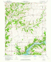 1963 Bellmore1964 Print · USGSEastern Parke County is captured here just as the landscape was transforming with the completion of the Mansfield Reservoir. Researchers can trace old family burial grounds like Lough Cem or follow the rail lines through Guion and Milligan.3 unique versions available
 - 1963 Map of Russellville, 1964 Print
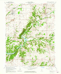 1963 Russellville1964 Print · USGSMid-century Putnam County and Montgomery County meet here in the early 1960s, showing a landscape defined by the Raccoon Creek valley. Genealogists can locate family names at Sutherlin Cem or James Cem and trace the original path of the Baltimore and Ohio railroad through Russellville.2 unique versions available
Showing maps 1-25 of 36
Top cities of Putnam County
- Greencastle historical maps
- Cloverdale historical maps
- Roachdale historical maps
- Fillmore historical maps
- Russellville historical maps
Frequently asked questions
- What are the different types of historical maps available for Putnam County?
- What is the oldest map of Putnam County?
- Where can I purchase historical maps of Putnam County for my home or office?
- Where can I download high-res historical maps of Putnam County?
- Are there historical topographic maps available for Putnam County?
- Is there historical aerial imagery available for Putnam County?
- Where are historical maps of Putnam County sourced from?