Old Maps of Shelbyville, Indiana for Hiking & Exploration
Hike through history with 14 historic maps of Shelbyville. Explore old trails, ghost towns, and forgotten backroads — perfect for outdoor adventurers and local explorers.
- Rediscover forgotten places: Map out old mining camps, roads, and footpaths that no longer exist on modern maps.
- Layer with modern tools: Combine with LiDAR or satellite views to plan hikes through historical terrain.
- Made for exploration: Popular among hikers, overlanders, and local history lovers.
Use these maps to find adventure and explore the hidden past of Shelbyville.
Shelbyville, IN maps
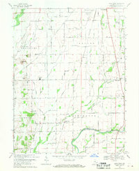
(14)- 1942 Map of Columbus
 1942 Columbus1942 Print · USGSBartholomew and Shelby counties are shown during the early years of the war, as military installations and rail lines reshaped the rural Indiana landscape. Genealogists can trace family-named sites and established communities like St Louis Crossing, Hope, and the sprawling Camp Atterbury.
 - 1948 Map of Lewis Creek
 1948 Lewis Creek1948 Print · USGSShelby County in the late 1940s reveals a productive rural landscape of small crossroads and family-named landmarks. Genealogists can trace property roots near Smithland or locate local burial sites like Eberhart Cem and Parrish Cem along the Pennsylvania rail line.2 unique versions available
 - 1950 Map of Edinburg
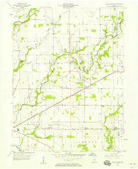
 1950 Edinburg1950 Print · USGSMid-century Shelby and Bartholomew Counties are captured here as the military presence at Atterbury meets a deeply rooted farming landscape. Researchers can locate dozens of country landmarks like Jollity Church, Tennehill Bridge, and the Shelby Township School.2 unique versions available
 - 1953 Map of Shelbyville, 1954 Print
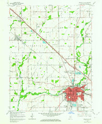
 1953 Shelbyville1954 Print · USGSShelbyville and the surrounding townships thrive in the early fifties as the county seat grows along the Blue River. Genealogists can trace family names at St Joseph Cem and Brandywine Ch, or explore the rail-linked settlements of Fairland and Little Marion.2 unique versions available
 - 1953 Map of Cincinnati, 1965 Print
 1953 Cincinnati1965 Print · USGSThe Ohio River valley and the industrial heartland of Indiana and Ohio are captured here during the mid-century peak of rail and river commerce. Genealogists and historians can trace connections between Cincinnati and outlying military sites like Camp Atterbury and Bakalar AFB.3 unique versions available
 - 1956 Map of Rays Crossing, 1958 Print
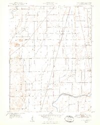
 1956 Rays Crossing1958 Print · USGSShelby County farm country comes to life in this mid-century survey, showing the rail-dependent hamlets and river valleys before the modernization of Indiana's rural landscape. Genealogists can trace family footprints near Rays Crossing, the Township Sch, and Mt Pisgah Ch.5 unique versions available
 - 1957 Map of Cincinnati
 1957 Cincinnati1957 Print · USGSThe Ohio River valley and its surrounding highlands thrived during the mid-fifties industrial peak, centered on the bustling Cincinnati and Dayton metropolitan hubs. Researchers can trace the extensive rail networks and military sites like Wright-Patterson AFB and Camp Atterbury.
 - 1962 Map of Shelbyville, 1964 Print
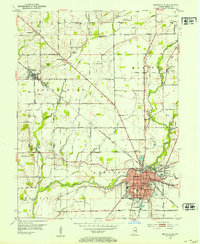
 1962 Shelbyville1964 Print · USGSShelbyville and its surrounding townships are captured in the early sixties as mid-century suburbs began to expand alongside established rural centers. Genealogists and local historians can locate several country churches, including Old Union Ch and Brandywine Ch, or trace the tracks of the New York Central railroad.4 unique versions available
 - 1968 Map of Lewis Creek, 1970 Print
 1968 Lewis Creek1970 Print · USGSShelby County farmland is captured here in the late sixties, showing a landscape defined by the Penn Central rail corridor and river valleys. Researchers can trace rural lineages through family landmarks like Patterson Cem, Eberhart Cem, and Winchester Ch.3 unique versions available
 - 1986 Map of Greensburg
 1986 Greensburg1986 Print · USGSSoutheastern Indiana in the mid-eighties shows a balance of growing industrial centers and deeply rooted rural communities. Family historians can trace landmarks like the Highland Center School, South Park Cemetery, and the Bartholomew County Courthouse among the river forks.2 unique versions available
 - 1986 Map of New Castle
 1986 New Castle1986 Print · USGSEast Central Indiana remains a patchwork of thriving county seats and rail-side hamlets in the mid-eighties. Genealogists and historians can locate family landmarks such as East Hill Cemetery, Little Blue River Church, and the transit lines of the CONRAIL railroad.2 unique versions available
 - 2022 Map of Lewis Creek, 2022 Print
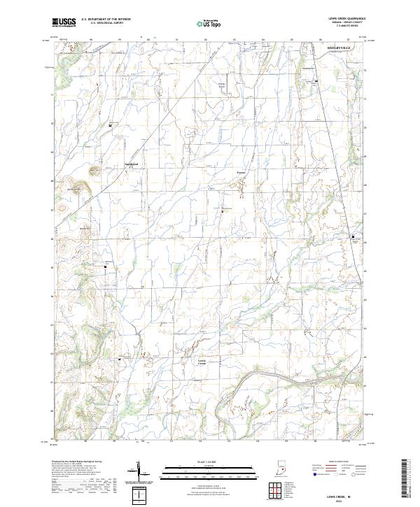 2022 Lewis Creek2022 Print · USGSShelby County in the early 2020s remains a landscape of deep-rooted farmsteads and rural crossroads south of SHELBYVILLE. Local researchers can trace family lands near Smithland or locate generational resting places at Patterson Cem and the Lewis Creek Baptist Cem.
 - 2022 Map of Shelbyville, 2022 Print
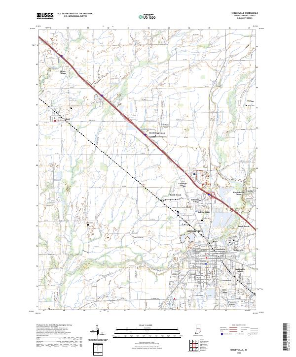 2022 Shelbyville2022 Print · USGSShelbyville and its neighboring townships appear here in the early 2020s, showing a landscape of river-valley agriculture and suburban expansion. Genealogists and historians can locate numerous family-named landmarks and burial sites, from Forest Hill Cem to Center Cem and the Shelbyville Municipal Airport.
 - 2022 Map of Rays Crossing, 2022 Print
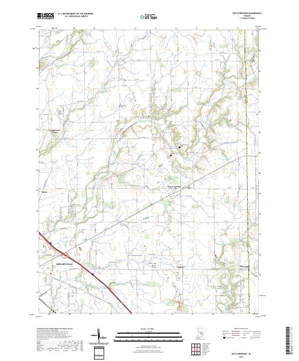 2022 Rays Crossing2022 Print · USGSShelby County farmland and the river valleys east of the county seat are captured in this recent survey. Researchers can trace rural lineages through Dewitt Cem or explore the smaller crossroads of Rays Crossing, Meltzer, and Blue Ridge.
End of results
Showing maps 1-14 of 14
Top cities near Shelbyville
- Indianapolis historical maps
- Greenfield historical maps
- Needham historical maps
- New Palestine historical maps
- Marion historical maps
- Morristown historical maps
See more
Top neighborhoods of Shelbyville
- Walkerville historical maps
- Rolling Ridge historical maps
- Riley Village historical maps
- Brent Woods historical maps
- Hildebrand Village historical maps
- Lantana Estate historical maps
Frequently asked questions
- What are the different types of historical maps available for Shelbyville?
- What is the oldest map of Shelbyville?
- Where can I purchase historical maps of Shelbyville for my home or office?
- Where can I download high-res historical maps of Shelbyville?
- Are there historical topographic maps available for Shelbyville?
- Is there historical aerial imagery available for Shelbyville?
- Where are historical maps of Shelbyville sourced from?