2020s Maps of Vigo County, Indiana
Explore 13 historic maps of Vigo County from the 2020s. These maps offer a rare glimpse into what life looked like during the 2020s — showing old roads, neighborhoods, homes, and landmarks that have changed or disappeared over time.
Whether you're researching your family's past, planning a metal detecting trip, or studying how Vigo County's landscape evolved across the 2020s, these high-resolution maps are a powerful tool for exploring the history of this region.
- Focus on a specific era: All maps on this page are from the 2020s, giving you a focused view of this time period.
- See what’s changed: Compare century-old streets, trails, and buildings to today's modern landscape using overlays and satellite layers.
- Research with precision: Use these maps for genealogy, historical research, land use analysis, or educational projects.
- View, download, or print: Maps are fully viewable online in high resolution, and can be downloaded or printed for your own records.
Start exploring Vigo County's history through authentic maps from the 2020s. This is your window into the past.
Vigo County, IN maps
(13)- 2021 Map of Dennison, 2021 Print
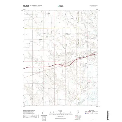 2021 Dennison2021 Print · USGSCovers Vigo County, including Weaver, State Line, and other nearby areas
 - 2022 Map of Brazil West, 2022 Print
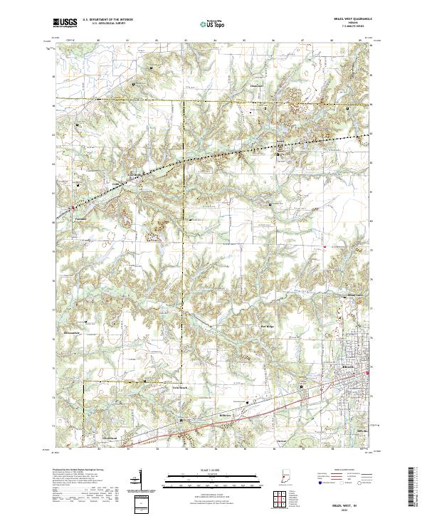 2022 Brazil West2022 Print · USGSClay and Vigo counties meet in this western Indiana corridor during the early 2020s, revealing a landscape shaped by local industry and early transit. Researchers can trace family sites at Saint Marys Cem or locate old rail stops like Coal Bluff and Fontanet.
 - 2022 Map of Sandford, 2022 Print
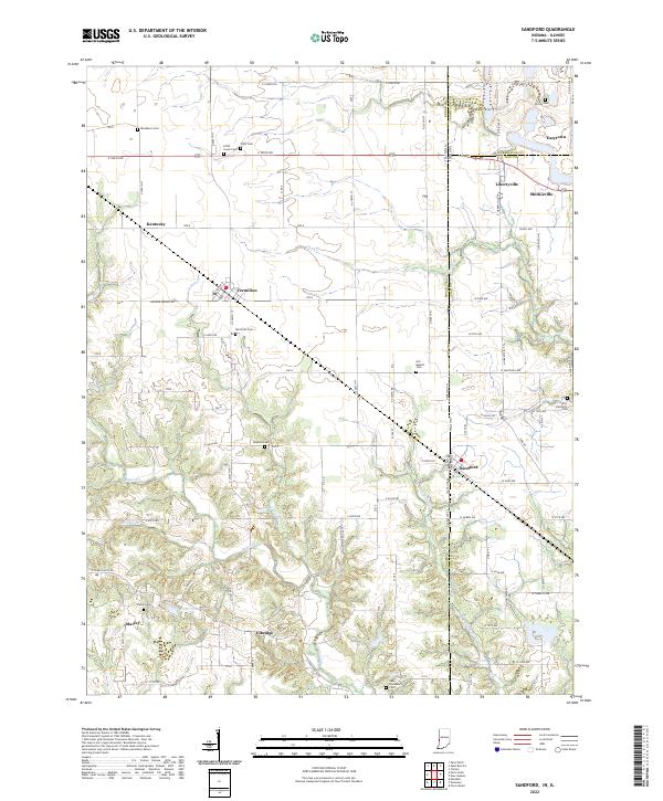 2022 Sandford2022 Print · USGSThe Illinois-Indiana borderlands are captured here in the early twenty-first century, showing a landscape of rural communities and historic cemeteries. Researchers can locate family burial plots at Vermilion Cem or Guymon Cem and trace the paths of Sugar Cr and Little Sugar Cr.
 - 2022 Map of Rosedale, 2022 Print
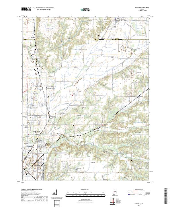 2022 Rosedale2022 Print · USGSCrossing the Parke and Vigo county line in the early 2020s, this area shows the transition from rural drainage ditches to the northern suburbs of Terre Haute. Researchers can locate numerous local burial sites like Rukes Cem and Haven Cem, or trace the paths of Otter Creek and Gundy Ditch.
 - 2022 Map of Hutton, 2022 Print
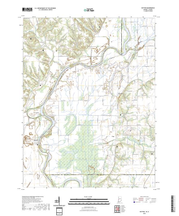 2022 Hutton2022 Print · USGSThe Wabash River floodplain on the Illinois-Indiana border reveals a complex network of bayous and ponds. Genealogists can trace family footprints across several rural burial grounds including Shattuck Cem, Darwin Cem, and Lykens Cem.
 - 2022 Map of Saline City, 2022 Print
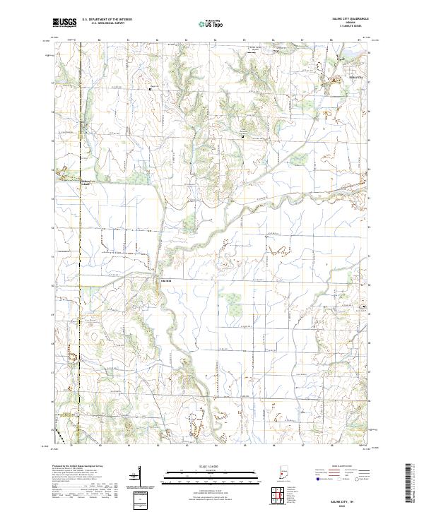 2022 Saline City2022 Print · USGSClay County at the start of the 2020s shows a landscape deeply tied to the winding Eel River and its managed drainage ditches. Local historians can trace family roots through sites like Staggs Cem and Zion Gummere Cem, or locate the settlements of Saline City and Old Hill.
 - 2022 Map of Lewis, 2022 Print
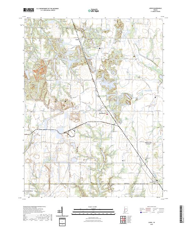 2022 Lewis2022 Print · USGSVigo County rural life and old transportation corridors are preserved here in the early twenty-first century. Family history researchers can locate numerous burial sites like Liberty Cem and Armstrong Cem or trace the historic path of the Wabash and Erie Canal.
 - 2022 Map of Seelyville, 2022 Print
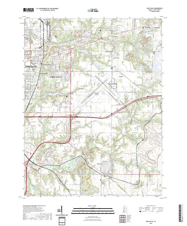 2022 Seelyville2022 Print · USGSEastern Vigo County in the early 2020s shows the continued growth of Terre Haute alongside historical remnants like the Wabash and Erie Canal. Researchers can trace local lineages through numerous burial sites such as Highland Lawn Cem, Coltrin Cem, and Baker Cem.
 - 2022 Map of Staunton, 2022 Print
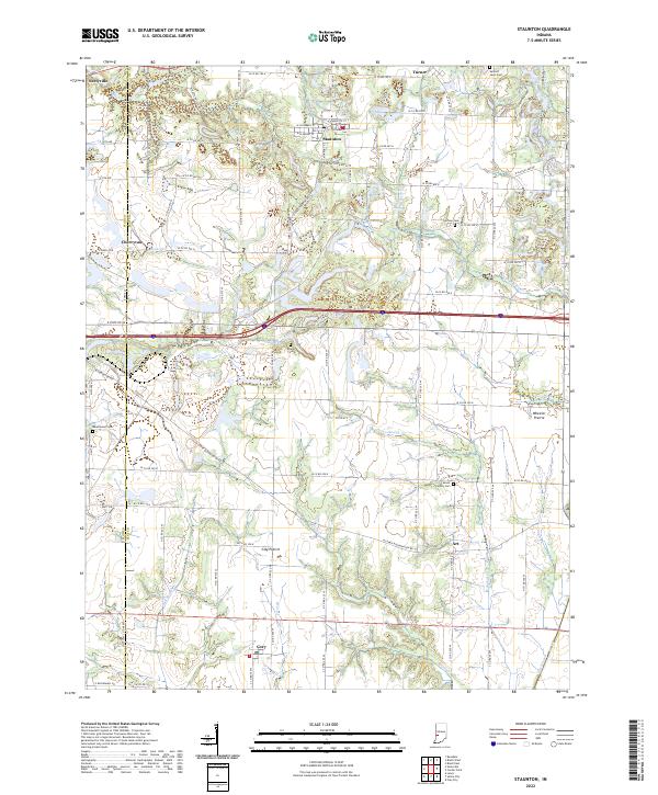 2022 Staunton2022 Print · USGSThe rural landscapes of Clay and Vigo counties are captured here in the early twenty-first century as agricultural traditions meet modern growth. Researchers can trace family sites near Staunton, Cory, and Seelyville or locate ancestors at German Cem and Mount Calvary Cem.
 - 2022 Map of Pimento, 2022 Print
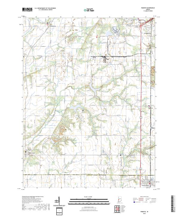 2022 Pimento2022 Print · USGSThe borderlands of Vigo and Sullivan County are captured in this modern survey, showing rural communities as they appeared in the early 2020s. Genealogists can locate Union Cem and Kester Cem while tracing the settlements of Pimento and Prairieton.
 - 2022 Map of New Goshen, 2022 Print
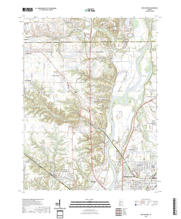 2022 New Goshen2022 Print · USGSThe Wabash River valley north of Terre Haute is shown here in the early 2020s, revealing a landscape shaped by coal mining and higher education. Researchers can trace the Wabash and Erie Canal or locate historic sites like Saint Mary-of-the-Woods College and Sky King Airport.
 - 2022 Map of Terre Haute, 2022 Print
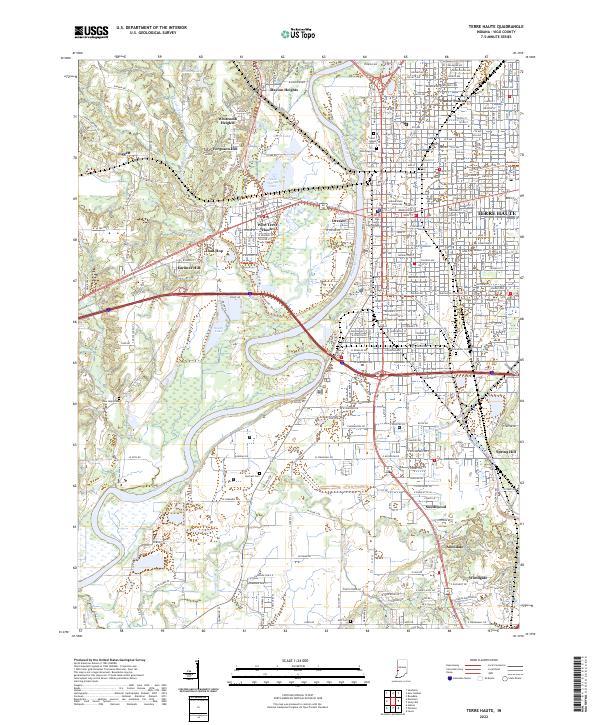 2022 Terre Haute2022 Print · USGSTerre Haute and the Wabash River valley are documented here in the early 2020s, showing the city's modern street grid alongside its historic institutional core. Researchers can trace the layout of Indiana State University and locate neighborhood landmarks like Twelve Points and Toad Hop.
 - 2024 Map of Dennison, 2024 Print
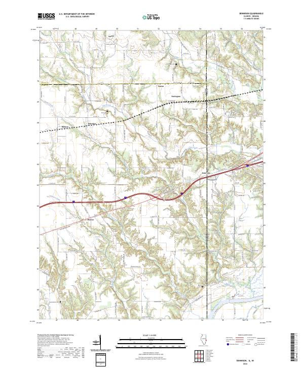 2024 Dennison2024 Print · USGSNear the Illinois-Indiana border, this modern survey details the rural crossroads and river valley terrain between Dennison and Weaver. Genealogists can trace family landmarks like Cumberland Cem and Black Cem along the Wabash River corridor.
End of results
Showing maps 1-13 of 13
Top cities of Vigo County
- Terre Haute historical maps
- West Terre Haute historical maps
- Prairieton historical maps
- Prairie Creek historical maps
- Seelyville historical maps
- Riley historical maps
Frequently asked questions
- What are the different types of historical maps available for Vigo County?
- What is the oldest map of Vigo County?
- Where can I purchase historical maps of Vigo County for my home or office?
- Where can I download high-res historical maps of Vigo County?
- Are there historical topographic maps available for Vigo County?
- Is there historical aerial imagery available for Vigo County?
- Where are historical maps of Vigo County sourced from?