Old Maps of Terre Haute, Indiana for Academic Research
Study the evolution of Terre Haute with 37 high-resolution historic maps. Whether you're teaching, researching, or modeling changes in land use, these maps provide essential visual documentation of urban, environmental, and geographic change.
- Analyze long-term change: Track patterns in development, transportation, and natural features.
- Ideal for environmental or urban studies: Support academic projects with primary historical map data.
- Use in the classroom or lab: Educators and researchers rely on these maps to bring historical context to life.
These maps are a powerful tool for teaching, research, and visualizing how Terre Haute has changed over the decades.
Terre Haute, IN maps
(37)- 1941 Map of Seelyville
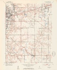
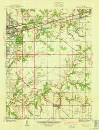 1941 Seelyville1941 Print · USGSVigo County at the start of the 1940s shows the industrial expansion of Terre Haute toward Seelyville. Trace family roots at Highland Lawn Cemetery or locate old industrial sites like the Binkley Mine and the Central Canal (Abandoned).2 unique versions available
 - 1941 Map of Terre Haute
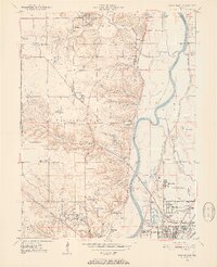
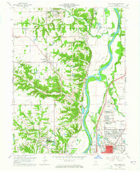
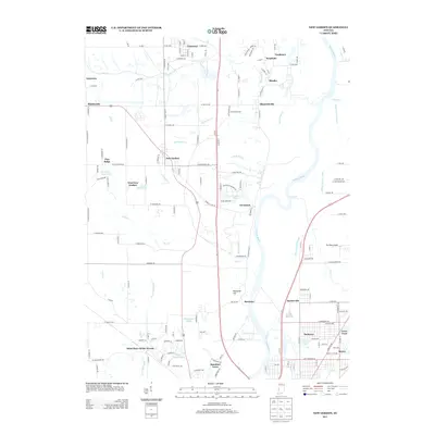
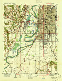 1941 Terre Haute1941 Print · USGSTerre Haute and the Wabash River valley are shown in high detail just before the mid-century industrial boom. Genealogists and local historians can trace family roots through dozens of named sites like Toad Hop, Woodlawn Cemetery, and Gerstmeyer High School.
 - 1948 Map of Terre Haute
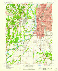
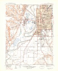 1948 Terre Haute1948 Print · USGSTerre Haute and its riverfront neighborhoods are shown here in the late 1940s, just as the regional rail and coal economy reached its peak. Researchers can trace the dense urban grid of schools and churches, find the old Duane Yards, or locate the site of Toad Hop across the Wabash River.2 unique versions available
 - 1950 Map of Rosedale, 1952 Print
 1950 Rosedale1952 Print · USGSThe rail-and-creek landscape of Parke and Vigo counties comes alive in this mid-century survey. Trace family roots and vanished rail stops through settlements like Atherton, Sandcut, and Burnett, or locate country landmarks like Friendship Ch and Markles Cem.2 unique versions available
 - 1950 Map of New Goshen, 1952 Print
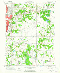
 1950 New Goshen1952 Print · USGSVigo County in the early fifties is captured here as a landscape of river-side industry and emerging suburbs north of Terre Haute. Researchers can locate the historic St Mary-of-the-Woods College or trace the path of the Erie Canal (Abandoned) past Shepardsville and Tecumseh.3 unique versions available
 - 1952 Map of Seelyville, 1953 Print
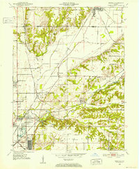
 1952 Seelyville1953 Print · USGSVigo County enters a period of post-war industrial and civic expansion in the early fifties. Genealogists and local historians can trace the foundations of Rose Polytechnic Institute, locate family plots in Highland Lawn Cemetery, and explore the coal-mining heritage near Seelyville and Glen Ayr.2 unique versions available
 - 1953 Map of Indianapolis, 1965 Print
 1953 Indianapolis1965 Print · USGSCentral Indiana and the Illinois borderlands are captured in the mid-sixties, showing the growth of Indianapolis and its industrial rail corridors. Genealogists and historians can trace the development of outlying towns like Zionsville or Beech Grove and find landmarks such as Atterbury AAF and Turkey Run State Park.4 unique versions available
 - 1956 Map of Indianapolis
 1956 Indianapolis1956 Print · USGSCentral Indiana in the mid-fifties is captured during a period of industrial growth and military presence. Genealogists and historians can trace the rail networks of the New York Central or locate regional landmarks like Fort Benjamin Harrison and Camp Atterbury.
 - 1957 Map of Indianapolis
 1957 Indianapolis1957 Print · USGSCentral Indiana in the mid-fifties is captured here as a crossroads of major rail lines and nascent federal highways. Genealogists and historians can trace family-named ridges like Poplar Ridge or locate strategic sites like Camp Atterbury and Speedway.2 unique versions available
 - 1958 Map of Terre Haute, 1960 Print
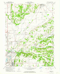
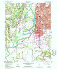
 1958 Terre Haute1960 Print · USGSTerre Haute is shown as a bustling rail and industrial hub in the late fifties, dominated by the winding Wabash River. Genealogists can locate family sites across several neighborhoods and cemeteries like Durham Cem, while historians can trace the early layout of the Indiana State Teachers College.3 unique versions available
 - 1962 Map of Indianapolis
 1962 Indianapolis1962 Print · USGSCentral Indiana and the Illinois borderlands are captured here in the early sixties, showing the region's dense rail networks and growing urban centers. Genealogists and historians can locate family-named landmarks and institutions like Crown Hill Cem, Indiana University, and the Indianapolis Motor Speedway.
 - 1962 Map of Rosedale, 1964 Print
 1962 Rosedale1964 Print · USGSThe Parke and Vigo county line was a bustling rail hub in the early sixties, centered on the convergence of major lines. Researchers can trace the development of Rosedale and North Terre Haute or locate family sites like Kennedy Cem and Sulphur Spring Ch.3 unique versions available
 - 1963 Map of New Goshen, 1965 Print
 1963 New Goshen1965 Print · USGSThe West Central Indiana borderlands come into focus in the early sixties as industrial coal mining and river transport converge. Researchers can trace the historic Erie Canal alignment or locate family roots at St Mary-of-the-Woods College and Barbour Cem.4 unique versions available
 - 1963 Map of Seelyville, 1965 Print
 1963 Seelyville1965 Print · USGSThe eastern fringes of Terre Haute in the early sixties reveal a landscape transition from city parks to coal mines and historic canal beds. Genealogists and local historians can trace the paths of the Wabash and Erie Canal and locate landmarks like the Rose Polytechnic Institute and Mt Pleasant Mine.4 unique versions available
 - 1986 Map of Paris
 1986 Paris1986 Print · USGSThe Illinois-Indiana borderlands thrive in the mid-1980s as a hub of river-side industry and fertile farmland. Genealogists and historians can trace rail-centered settlements like Chrisman and Metcalf, or locate family sites at the Quaker Cem and Bethel Ch.2 unique versions available
 - 1986 Map of Terre Haute
 1986 Terre Haute1986 Print · USGSThe Wabash River valley and the coal-rich hills of West-Central Indiana and East-Central Illinois are shown here in the mid-eighties. Genealogists and local historians can trace family-named corners like Barrick Corner, find rural churches like New Hope Ch, and locate industrial landmarks such as the Thunderbird Mine.2 unique versions available
 - 1986 Map of Terre Haute, 1989 Print
 1986 Terre Haute1989 Print · USGSTerre Haute and its riverfront neighborhoods are shown here in the mid-eighties, balancing industrial infrastructure with a dense network of local schools and colleges. Researchers can trace historic routes like the Wabash and Erie Canal or locate family landmarks such as Durham Cem and Toad Hop.
 - 2010 Map of Seelyville, 2010 Print
 2010 Seelyville2010 Print · USGSCovers Terre Haute, including Seelyville, Riley, and other nearby areas
 - 2010 Map of Rosedale, 2010 Print
 2010 Rosedale2010 Print · USGSCovers Terre Haute, including Seelyville, Rosedale, and other nearby areas
 - 2010 Map of New Goshen, 2010 Print
 2010 New Goshen2010 Print · USGSCovers Terre Haute, including Universal, Harrison, and other nearby areas
 - 2010 Map of Terre Haute, 2010 Print
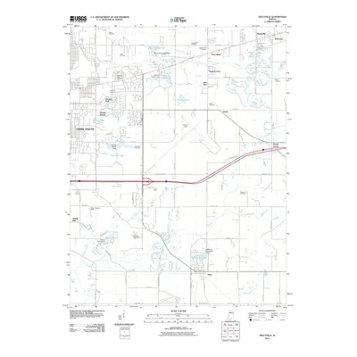
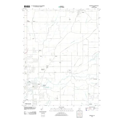
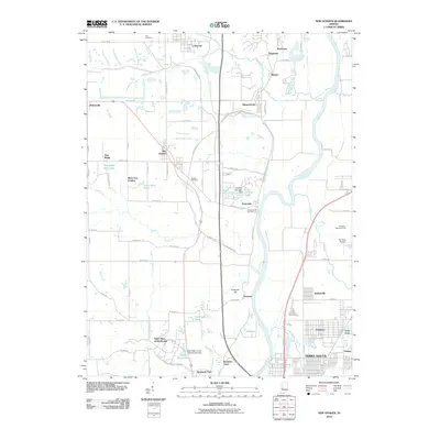
 2010 Terre Haute2010 Print · USGSCovers Terre Haute, including West Terre Haute, Duane Yards, and other nearby areas
 - 2013 Map of Terre Haute, 2013 Print
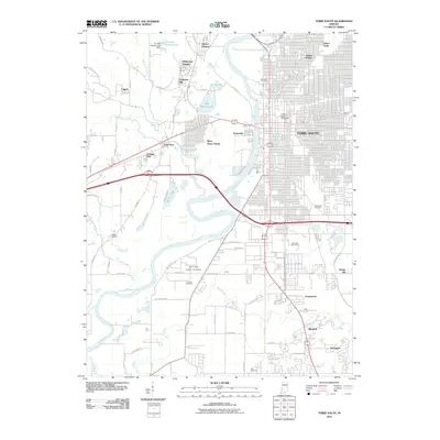
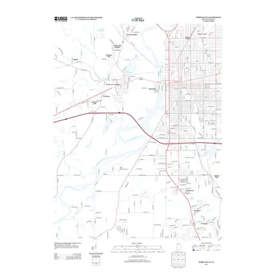 2013 Terre Haute2013 Print · USGSCovers Terre Haute, including West Terre Haute, Duane Yards, and other nearby areas
 - 2013 Map of New Goshen, 2013 Print
 2013 New Goshen2013 Print · USGSCovers Terre Haute, including Universal, Harrison, and other nearby areas
 - 2013 Map of Rosedale, 2013 Print
 2013 Rosedale2013 Print · USGSCovers Terre Haute, including Seelyville, Rosedale, and other nearby areas
 - 2013 Map of Seelyville, 2013 Print
 2013 Seelyville2013 Print · USGSCovers Terre Haute, including Seelyville, Riley, and other nearby areas
Showing maps 1-25 of 37
Top cities near Terre Haute
- Clinton historical maps
- West Terre Haute historical maps
- Fairview Park historical maps
- Prairieton historical maps
- Prairie Creek historical maps
- Farmersburg historical maps
See more
Top neighborhoods of Terre Haute
- Deming Park historical maps
- Deming Woods historical maps
- Twelve Points historical maps
- Duane Yards historical maps
- Dewey historical maps
- Preston historical maps
See more
Frequently asked questions
- What are the different types of historical maps available for Terre Haute?
- What is the oldest map of Terre Haute?
- Where can I purchase historical maps of Terre Haute for my home or office?
- Where can I download high-res historical maps of Terre Haute?
- Are there historical topographic maps available for Terre Haute?
- Is there historical aerial imagery available for Terre Haute?
- Where are historical maps of Terre Haute sourced from?