1960s Maps of Warrick County, Indiana
Explore 12 historic maps of Warrick County from the 1960s. These maps offer a rare glimpse into what life looked like during the 1960s — showing old roads, neighborhoods, homes, and landmarks that have changed or disappeared over time.
Whether you're researching your family's past, planning a metal detecting trip, or studying how Warrick County's landscape evolved across the 1960s, these high-resolution maps are a powerful tool for exploring the history of this region.
- Focus on a specific era: All maps on this page are from the 1960s, giving you a focused view of this time period.
- See what’s changed: Compare century-old streets, trails, and buildings to today's modern landscape using overlays and satellite layers.
- Research with precision: Use these maps for genealogy, historical research, land use analysis, or educational projects.
- View, download, or print: Maps are fully viewable online in high resolution, and can be downloaded or printed for your own records.
Start exploring Warrick County's history through authentic maps from the 1960s. This is your window into the past.
Warrick County, IN maps
(12)- 1960 Map of De Gonia Springs, 1962 Print
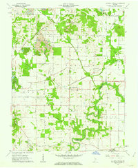 1960 De Gonia Springs1962 Print · USGSWarrick and Spencer counties are shown at the height of the mid-century mining era, as traditional farmsteads met expanding industrial footprints. Genealogists can trace family landmarks like Skelton Cems, Bethabara Ch, and the distinct settlements of De Gonia Springs and Degonia.2 unique versions available
 - 1960 Map of Chrisney, 1962 Print
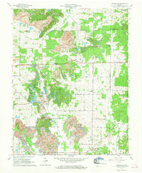
 1960 Chrisney1962 Print · USGSSpencer County at the start of the sixties reveals a transition from traditional rural townships to a landscape shaped by state parks and railroads. Researchers can trace family roots through St Martins Ch and Mt Mariah Cem, or locate landmarks like Gentryville and the Pigeon Creek Fish Hatchery.3 unique versions available
 - 1960 Map of Folsomville, 1963 Print
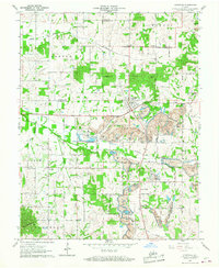
 1960 Folsomville1963 Print · USGSSouthern Indiana's coal country comes into focus in the early 1960s, showing a landscape defined by the Tecumseh Mine and widespread Strip Mines. Genealogists and historians can trace local landmarks like Dickeyville, the Old Indian Treaty Boundary, and several rural cemeteries.3 unique versions available
 - 1960 Map of Lynnville, 1968 Print
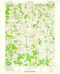
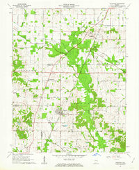
 1960 Lynnville1968 Print · USGSSouthwestern Indiana's coal country comes into sharp focus during the 1960s as industrial excavation meets rural tradition. Researchers can trace the massive Strip Mines alongside local landmarks like Barnetta Chapel, St Pauls Cem, and Graham Valley.5 unique versions available
 - 1961 Map of Evansville
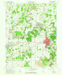
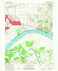
 1961 Evansville1961 Print · USGSThe Ohio River valley and its surrounding coalfields are captured here during the late fifties and early sixties. Trace the industrial rail networks of the Illinois Central RR and explore regional landmarks like Mammoth Cave National Park and Angel Mounds State Memorial.2 unique versions available
 - 1961 Map of Holland, 1962 Print
 1961 Holland1962 Print · USGSThe crossroads of Dubois, Warrick, and Spencer counties come alive in the early sixties as rural life meets emerging industry. Researchers can trace the Old Indian Treaty Boundary and locate family burial sites like St James Cem or the Strip Mine near Selvin.3 unique versions available
 - 1961 Map of Elberfeld, 1963 Print
 1961 Elberfeld1963 Print · USGSThe rural landscape around Elberfeld and Buckskin in the early sixties was a unique blend of active energy production and historical transit routes. Local historians can trace the path of the Erie and Wabash Canal and locate family sites like Nobles Cem or Zion Cem.4 unique versions available
 - 1961 Map of Boonville, 1963 Print
 1961 Boonville1963 Print · USGSWarrick County during the early sixties reveals a landscape of industrial strip mining and established small-town centers. Genealogists and local historians can trace the foundations of Boonville and Chandler alongside landmarks like St Clements Sch and Maple Grove Cem.3 unique versions available
 - 1961 Map of Daylight, 1963 Print
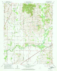 1961 Daylight1963 Print · USGSWarrick and Vanderburgh counties are shown in the early sixties as rural life centered on the rail corridors of the New York Central. Researchers can trace the legacy of the Wabash and Erie Canal or locate local landmarks like Daylight Sch and Blue Grass Cem.4 unique versions available
 - 1964 Map of Richland City, 1965 Print
 1964 Richland City1965 Print · USGSSpencer County's rural townships are captured in the mid-1960s as a landscape of managed drainage and quiet agricultural hubs. Researchers can trace ancestral sites at Hatfield Cem and Richardson Cem or locate the former Old Railroad Grade near Richland City.2 unique versions available
 - 1964 Map of Newburgh, 1966 Print
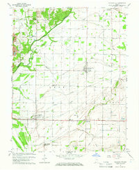
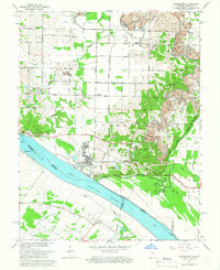
 1964 Newburgh1966 Print · USGSThe Indiana-Kentucky borderlands at the bend of the Ohio River come into focus in the mid-1960s as Evansville's suburbs meet older river towns. Researchers can locate the historic Angel Mounds State Memorial, trace the Louisville and Nashville rail line, and find family markers at Rose Hill Cem.3 unique versions available
 - 1964 Map of Yankeetown, 1966 Print
 1964 Yankeetown1966 Print · USGSThe Indiana-Kentucky borderlands along the Ohio River appear here in the mid-1960s, showing a landscape of riverfront hamlets and industrial change. Genealogists and local historians can locate Yankeetown Cem, trace the Old Railroad Grade, and find rural landmarks like St Ruperts Ch.4 unique versions available
End of results
Showing maps 1-12 of 12
Top cities of Warrick County
- Boonville historical maps
- Newburgh historical maps
- Chandler historical maps
- Lynnville historical maps
- Elberfeld historical maps
- Tennyson historical maps
Frequently asked questions
- What are the different types of historical maps available for Warrick County?
- What is the oldest map of Warrick County?
- Where can I purchase historical maps of Warrick County for my home or office?
- Where can I download high-res historical maps of Warrick County?
- Are there historical topographic maps available for Warrick County?
- Is there historical aerial imagery available for Warrick County?
- Where are historical maps of Warrick County sourced from?