1900s (20th Century) Maps of Garfield, Iowa
Explore 7 historic maps of Garfield from the 1900s (20th Century). These maps offer a rare glimpse into what life looked like during the 1900s — showing old roads, neighborhoods, homes, and landmarks that have changed or disappeared over time.
Whether you're researching your family's past, planning a metal detecting trip, or studying how Garfield's landscape evolved across the 1900s, these high-resolution maps are a powerful tool for exploring the history of this region.
- Focus on a specific era: All maps on this page are from the 1900s, giving you a focused view of this time period.
- See what’s changed: Compare century-old streets, trails, and buildings to today's modern landscape using overlays and satellite layers.
- Research with precision: Use these maps for genealogy, historical research, land use analysis, or educational projects.
- View, download, or print: Maps are fully viewable online in high resolution, and can be downloaded or printed for your own records.
Start exploring Garfield's history through authentic maps from the 1900s. This is your window into the past.
Garfield, IA maps
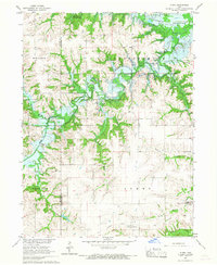
(7)- 1935 Map of Russell, 1958 Print
 1935 Russell1958 Print · USGSSouthern Iowa in the mid-thirties was a landscape of river-valley farms and rail-connected towns like Russell and Melrose. Researchers can trace old township school locations such as Brush College Sch and Rabbit Hill Sch or locate the New York Cem.2 unique versions available
 - 1938 Map of Russell
 1938 Russell1938 Print · USGSSouthern Iowa's rural school and rail network are preserved here during the mid-1930s. Genealogists can trace family footprints across dozens of local landmarks like Hilledgeville Cem, Rabbit Hill Sch, and the settlement of Confidence.2 unique versions available
 - 1954 Map of Centerville, 1967 Print
 1954 Centerville1967 Print · USGSThe Iowa-Missouri borderlands at mid-century reveal a landscape shaped by river valleys and the height of the regional rail network. Genealogists and historians can trace the paths of the Wabash railroad and locate old townsites like Mystic, Moulton, and Greentop.3 unique versions available
 - 1957 Map of Centerville
 1957 Centerville1957 Print · USGSThe Iowa-Missouri borderlands in the mid-fifties reveal a landscape of river-valley agriculture and vital rail corridors. Genealogists and historians can trace family-named landmarks and small-town growth in Centerville, Kirksville, and along the Wabash railroad line.
 - 1958 Map of Centerville
 1958 Centerville1958 Print · USGSThe Iowa-Missouri borderlands come into focus during the mid-fifties, showing a landscape defined by river valleys and intersecting rail lines. Genealogists and local historians can trace family roots through dozens of rural hubs like Bloomfield, Unionville, and Corydon.
 - 1966 Map of Plano, 1967 Print
 1966 Plano1967 Print · USGSSouthern Iowa is shown here just as the landscape was being reshaped by the rising waters of the Rathbun Reservoir. Genealogists and local historians can trace the foundations of this rural community through the Philadelphia Ch, Jones Cem, and an Old Railroad Grade.
 - 1981 Map of Leon, 1982 Print
 1981 Leon1982 Print · USGSSouthern Iowa and northern Missouri are captured here in the early eighties as the rural landscape balances traditional agriculture with large-scale water management. Researchers can trace the path of the Burlington Northern through Leon or locate early settlements like Decatur City and New Buda.
End of results
Showing maps 1-7 of 7
Top cities near Garfield
- Centerville historical maps
- Moravia historical maps
- Seymour historical maps
- Russell historical maps
- Mystic historical maps
- Cincinnati historical maps
See more
Frequently asked questions
- What are the different types of historical maps available for Garfield?
- What is the oldest map of Garfield?
- Where can I purchase historical maps of Garfield for my home or office?
- Where can I download high-res historical maps of Garfield?
- Are there historical topographic maps available for Garfield?
- Is there historical aerial imagery available for Garfield?
- Where are historical maps of Garfield sourced from?