Old Maps of Mystic, Iowa for Hiking & Exploration
Hike through history with 12 historic maps of Mystic. Explore old trails, ghost towns, and forgotten backroads — perfect for outdoor adventurers and local explorers.
- Rediscover forgotten places: Map out old mining camps, roads, and footpaths that no longer exist on modern maps.
- Layer with modern tools: Combine with LiDAR or satellite views to plan hikes through historical terrain.
- Made for exploration: Popular among hikers, overlanders, and local history lovers.
Use these maps to find adventure and explore the hidden past of Mystic.
Mystic, IA maps
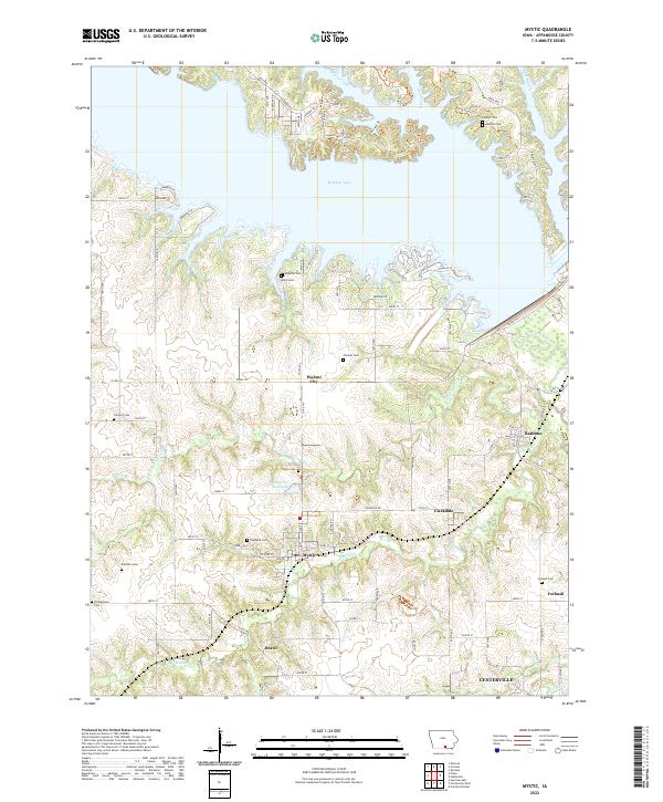
(12)- 1939 Map of Mystic, 1966 Print
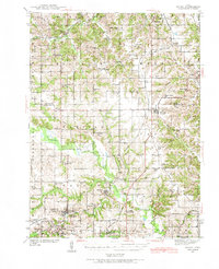 1939 Mystic1966 Print · USGSAppanoose County in the late thirties is a landscape of thriving rural townships and busy rail junctions. Genealogists and historians can trace family roots through numerous country schools like Buffalo Wallow Sch and churches such as Wesley Chapel.
 - 1942 Map of Mystic
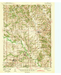 1942 Mystic1942 Print · USGSSouthern Iowa coal and rail communities are mapped here just before the mid-century, showing a landscape tied to the Chariton River. Researchers can trace rural school districts like Hedge College Sch and vanished mining-era stops including Brazil and Rathbun.
 - 1954 Map of Centerville, 1967 Print
 1954 Centerville1967 Print · USGSThe Iowa-Missouri borderlands at mid-century reveal a landscape shaped by river valleys and the height of the regional rail network. Genealogists and historians can trace the paths of the Wabash railroad and locate old townsites like Mystic, Moulton, and Greentop.3 unique versions available
 - 1957 Map of Centerville
 1957 Centerville1957 Print · USGSThe Iowa-Missouri borderlands in the mid-fifties reveal a landscape of river-valley agriculture and vital rail corridors. Genealogists and historians can trace family-named landmarks and small-town growth in Centerville, Kirksville, and along the Wabash railroad line.
 - 1958 Map of Centerville
 1958 Centerville1958 Print · USGSThe Iowa-Missouri borderlands come into focus during the mid-fifties, showing a landscape defined by river valleys and intersecting rail lines. Genealogists and local historians can trace family roots through dozens of rural hubs like Bloomfield, Unionville, and Corydon.
 - 1966 Map of Mystic, 1967 Print
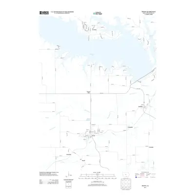
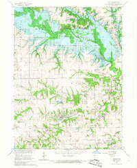 1966 Mystic1967 Print · USGSAppanoose County is captured during the mid-sixties transition as the Chariton River valley prepared for inundation. Researchers can trace the legacy of coal mining and rail travel through Mystic, Brazil, and the Rathbun Dam (under construction).
 - 1981 Map of Centerville, 1982 Print
 1981 Centerville1982 Print · USGSThe borderlands of southern Iowa and northern Missouri are captured here in the early eighties as Rathbun Lake and the Chariton River define the local geography. Researchers can trace historic rail lines like the Norfolk and Western and locate vanished hamlets such as Coal City and Glenwood Junction.
 - 2010 Map of Mystic, 2010 Print
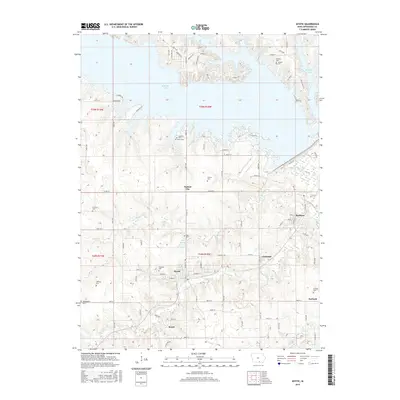
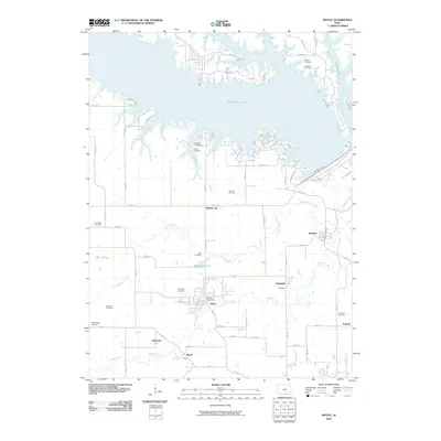 2010 Mystic2010 Print · USGSCovers Mystic, including Centerville, Rathbun, and other nearby areas
 - 2013 Map of Mystic, 2013 Print
 2013 Mystic2013 Print · USGSCovers Mystic, including Centerville, Rathbun, and other nearby areas
 - 2015 Map of Mystic, 2015 Print
 2015 Mystic2015 Print · USGSCovers Mystic, including Centerville, Rathbun, and other nearby areas
 - 2018 Map of Mystic, 2018 Print
 2018 Mystic2018 Print · USGSCovers Mystic, including Centerville, Rathbun, and other nearby areas
 - 2022 Map of Mystic, 2022 Print
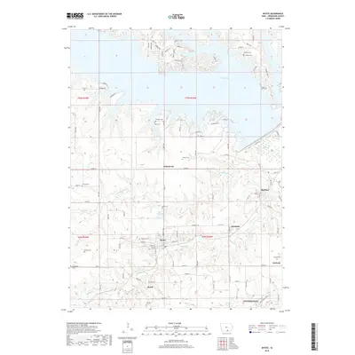
 2022 Mystic2022 Print · USGSAppanoose County settlements and the expansive shoreline of Rathbun Lake are captured here in the early 2020s. Genealogists can trace family names at Highland Cem and Shaeffer Cem, while historians can locate Mystic and Walnut City.
End of results
Showing maps 1-12 of 12
Top cities near Mystic
- Centerville historical maps
- Albia historical maps
- Moravia historical maps
- Seymour historical maps
- Cincinnati historical maps
- Exline historical maps
See more
Frequently asked questions
- What are the different types of historical maps available for Mystic?
- What is the oldest map of Mystic?
- Where can I purchase historical maps of Mystic for my home or office?
- Where can I download high-res historical maps of Mystic?
- Are there historical topographic maps available for Mystic?
- Is there historical aerial imagery available for Mystic?
- Where are historical maps of Mystic sourced from?