Old Maps of Calhoun County, Iowa
Explore 115 old maps of Calhoun County, spanning from 1954 to today. These high-resolution historic maps reveal how streets, neighborhoods, landmarks, and natural features evolved over time — perfect for genealogy, metal detecting, research, and local history exploration.
What you can do with these maps:
- See how Calhoun County changed over time: Compare historical maps to modern-day views to trace roads, homesites, rail lines & more.
- View detailed metadata: Each map includes creators, publishers, year, scale, and archive source.
- Overlay maps with satellite & LiDAR: Visualize the past alongside modern tools to explore terrain & human change.
- Trusted historical sources: Maps sourced from the USGS, Library of Congress, and other archives.
- Access maps your way: View online, download high-res files, or order prints for personal or research use.
Start exploring old maps of Calhoun County to uncover forgotten places, hidden landmarks, and the deep history beneath your feet.
Calhoun County, IA maps
(115)- 1954 Map of Fort Dodge, 1968 Print
 1954 Fort Dodge1968 Print · USGSNorthwest Iowa is shown here during a period of steady industrial and rail activity in the mid-fifties. Researchers can trace the extensive rail lines connecting Fort Dodge to mining and manufacturing sites like Gypsum and Industry Station.3 unique versions available
 - 1957 Map of Fort Dodge
 1957 Fort Dodge1957 Print · USGSWest-central Iowa thrived as a network of rail-linked agricultural hubs and river towns during the mid-fifties. Researchers can trace the development of the Des Moines River valley and locate historic landmarks in Fort Dodge, Storm Lake, and Lehigh.
 - 1958 Map of Fort Dodge
 1958 Fort Dodge1958 Print · USGSWestern Iowa in the mid-1950s reveals a productive landscape of river-valley industry and prairie agricultural hubs. Researchers can trace the development of the Des Moines River corridor through Fort Dodge and locate vanished local landmarks near Coalville or Storm Lake.
 - 1962 Map of Jefferson, 1964 Print
 1962 Jefferson1964 Print · USGSGreene County agriculture and rail commerce are at their peak in the early sixties as steam gives way entirely to diesel. Genealogists can locate family plots at Golgotha Cem, trace the rural North Sch, or explore the wetland edges of Goose Lake State Preserve.
 - 1965 Map of Farnhamville, 1966 Print
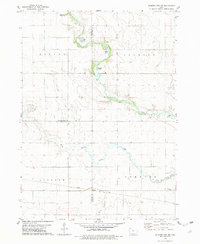
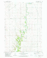
 1965 Farnhamville1966 Print · USGSCalhoun and Webster counties appear in the mid-1960s as a productive agricultural engine shaped by rail lines and drainage projects. Researchers can trace family sites near Cedar Cem, the small elevator town of Slifer, or the early Old Railroad Grade.
 - 1965 Map of Knierim, 1966 Print
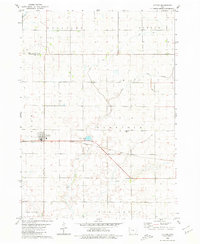
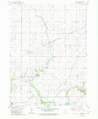
 1965 Knierim1966 Print · USGSCalhoun County was a bustling rail hub in the 1960s, where four major lines crossed paths near the grain elevators and farms. Genealogists and rail historians can trace the exact routes of the Illinois Central and find local landmarks like Township Cem and Trinity Ch.
 - 1979 Map of Fonda
 1979 Fonda1979 Print · USGSThe rail-driven landscape of northwest Iowa comes to life in this late-seventies survey of the Fonda area. Genealogists and local historians can trace the intersection of two major railroads and locate rural landmarks like Zion Cem, Knoke, and St Pauls Ch.2 unique versions available
 - 1979 Map of Gilmore City SW
 1979 Gilmore City SW1979 Print · USGSThe rural intersection of Pocahontas, Webster, and Calhoun Counties is captured here in the late seventies. Genealogists and local historians can trace family roots at Lizard Cem and St Josephs Cem, or follow the Illinois Central Gulf rail line.
 - 1979 Map of Manson
 1979 Manson1979 Print · USGSNorth-central Iowa farmland in the late seventies is defined here by the established grid of Manson and the surrounding prairie townships. Genealogists and local historians can trace family locations through numerous sites like St Paul Cem, Sherman Sch, and the Rose Hill Cem.2 unique versions available
 - 1979 Map of Pomeroy
 1979 Pomeroy1979 Print · USGSThe Pocahontas and Calhoun County line in the late 1970s reveals a prairie landscape meticulously managed by drainage ditches and heavy rail. Genealogists and local historians can locate early burial sites like St Marys Cem and rural landmarks such as Elfsborg Ch and Townhall.
 - 1979 Map of Newell East
 1979 Newell East1979 Print · USGSBuena Vista County farming and rail transport are in focus during the late seventies as the town of Newell expands. Researchers can trace land divisions across Cedar and Douglas townships or locate specific landmarks like Sunken Island Lake and the local Cem.
 - 1980 Map of Lytton
 1980 Lytton1980 Print · USGSThe border of Sac and Calhoun counties comes into focus in the 1970s, centered on the railroad town of Lytton. Genealogists and local historians can locate St John Cem, Garfield Cem, and the path of the Chicago Milwaukee St Paul and Pacific line.
 - 1980 Map of Rockwell City
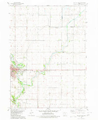
 1980 Rockwell City1980 Print · USGSRockwell City and its surrounding lake country are captured here in the late 1970s, showcasing a landscape of prairie townships and rail-side grain stops. Researchers can trace family roots at Crown Hill Cem or locate community landmarks like the Drive-in Theater and Fairground.
 - 1980 Map of Sac City East
 1980 Sac City East1980 Print · USGSSac City and the surrounding Iowa farmland are captured here in the early 1980s as the regional rail and river network remained vital. Genealogists and local historians can trace family locations near Oakland Cem, the Fairground, or along the Cedar Creek drainage.
 - 1980 Map of Carroll NE
 1980 Carroll NE1980 Print · USGSMid-century Iowa farm country unfolds across Carroll, Calhoun, and Sac counties as the eighties began. Researchers can trace the Chicago and North Western line to Lidderdale, find family plots at Cottonwood Cem, or locate the Flowing Well near the river.
 - 1980 Map of Yetter
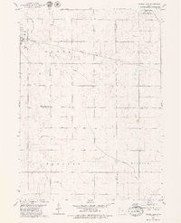
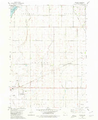
 1980 Yetter1980 Print · USGSWestern Calhoun County is shown here in the late seventies, a time when rail and river still dictated the local geography. Researchers can trace the path of the Illinois Central Gulf through Yetter or locate the historic Cottonwood Cem.
 - 1980 Map of Wightman
 1980 Wightman1980 Print · USGSCalhoun and Greene counties appear at a crossroads in the early 1980s where the Iowa rail network meets the agricultural heartland. Researchers can trace the village of Wightman, follow the Chicago and North Western tracks, and locate St Patricks Ch.
 - 1980 Map of Lanesboro
 1980 Lanesboro1980 Print · USGSLanesboro and the surrounding Carroll County farmland are captured here in the late 1970s as the rail and river networks shaped local life. Genealogists and historians can locate Lanesboro Cem, trace the Chicago and North Western rail line, or find local landmarks like Vador Bridge.
 - 1980 Map of Richard
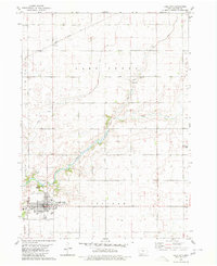
 1980 Richard1980 Print · USGSCalhoun County's agricultural landscape and the northern edge of Rockwell City are captured here in the early eighties. Local researchers can trace the routes of the Illinois Central Gulf railroad through Richard or locate Rosehill Cem and the County Home.
 - 1980 Map of Lohrville
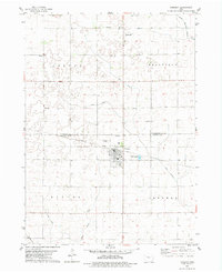
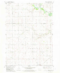
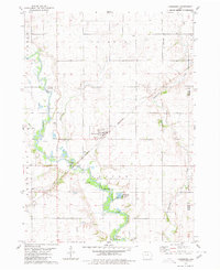
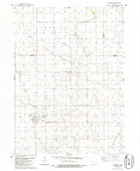
 1980 Lohrville1980 Print · USGSLohrville and the surrounding Calhoun County townships are shown here as an important agricultural rail hub during the late 1970s. Trace the intersection of two major lines, find the St Joseph Cem, and locate smaller rail outposts like Piper and Rands.
 - 1980 Map of Lake City
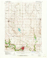
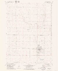
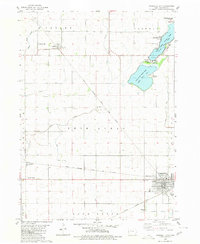
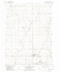
 1980 Lake City1980 Print · USGSCalhoun County's agricultural and civic heart is captured here in the late twentieth century, centered on the bustling hub of Lake City. Researchers can trace the local infrastructure from the Illinois Central Gulf railroad to the rural Lake Creek Cem and Lincoln Sch.
 - 1984 Map of Humboldt, 1985 Print
 1984 Humboldt1985 Print · USGSNorth Central Iowa in the mid-eighties shows a deeply integrated landscape of agricultural drainage and rail-connected settlements. Trace the rural layout of the era via the Chicago and North Western line, Rush Lake, and Lizard Lake County Park.2 unique versions available
 - 1985 Map of Carroll
 1985 Carroll1985 Print · USGSWest-Central Iowa in the mid-eighties shows a landscape of highly engineered farmland and river-valley conservation. Researchers can trace the drainage patterns of Purgatory Creek or locate local landmarks like Dolliver Memorial State Park and the rail-junction town of Gowrie.
 - 1985 Map of Churdan
 1985 Churdan1985 Print · USGSThis Greene County community is captured in the mid-1980s as its rail-dependent past began to shift into the modern era. Genealogists and local historians can trace the Old Railroad Grade near Adaza or locate family plots at Highland Cem.
 - 1993 Map of Carroll
 1993 Carroll1993 Print · USGSCentral Iowa's river valleys and rail corridors are captured here in the early nineties, showing a landscape shaped by the Raccoon River and Des Moines River. Genealogists can trace family connections to the many county seats, from Sac City to Jefferson, and locate rural landmarks like Pilot Mound or North Twin Lake.
Showing maps 1-25 of 115
Top cities of Calhoun County
- Rockwell City historical maps
- Lake City historical maps
- Manson historical maps
- Pomeroy historical maps
- Farnhamville historical maps
- Lohrville historical maps
See more
Frequently asked questions
- What are the different types of historical maps available for Calhoun County?
- What is the oldest map of Calhoun County?
- Where can I purchase historical maps of Calhoun County for my home or office?
- Where can I download high-res historical maps of Calhoun County?
- Are there historical topographic maps available for Calhoun County?
- Is there historical aerial imagery available for Calhoun County?
- Where are historical maps of Calhoun County sourced from?