1970s Maps of Calhoun County, Iowa
Explore 5 historic maps of Calhoun County from the 1970s. These maps offer a rare glimpse into what life looked like during the 1970s — showing old roads, neighborhoods, homes, and landmarks that have changed or disappeared over time.
Whether you're researching your family's past, planning a metal detecting trip, or studying how Calhoun County's landscape evolved across the 1970s, these high-resolution maps are a powerful tool for exploring the history of this region.
- Focus on a specific era: All maps on this page are from the 1970s, giving you a focused view of this time period.
- See what’s changed: Compare century-old streets, trails, and buildings to today's modern landscape using overlays and satellite layers.
- Research with precision: Use these maps for genealogy, historical research, land use analysis, or educational projects.
- View, download, or print: Maps are fully viewable online in high resolution, and can be downloaded or printed for your own records.
Start exploring Calhoun County's history through authentic maps from the 1970s. This is your window into the past.
Calhoun County, IA maps
(5)- 1979 Map of Fonda
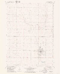
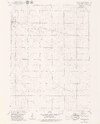
 1979 Fonda1979 Print · USGSThe rail-driven landscape of northwest Iowa comes to life in this late-seventies survey of the Fonda area. Genealogists and local historians can trace the intersection of two major railroads and locate rural landmarks like Zion Cem, Knoke, and St Pauls Ch.2 unique versions available
 - 1979 Map of Gilmore City SW
 1979 Gilmore City SW1979 Print · USGSThe rural intersection of Pocahontas, Webster, and Calhoun Counties is captured here in the late seventies. Genealogists and local historians can trace family roots at Lizard Cem and St Josephs Cem, or follow the Illinois Central Gulf rail line.
 - 1979 Map of Manson
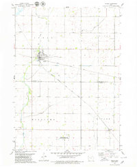
 1979 Manson1979 Print · USGSNorth-central Iowa farmland in the late seventies is defined here by the established grid of Manson and the surrounding prairie townships. Genealogists and local historians can trace family locations through numerous sites like St Paul Cem, Sherman Sch, and the Rose Hill Cem.2 unique versions available
 - 1979 Map of Pomeroy
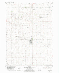 1979 Pomeroy1979 Print · USGSThe Pocahontas and Calhoun County line in the late 1970s reveals a prairie landscape meticulously managed by drainage ditches and heavy rail. Genealogists and local historians can locate early burial sites like St Marys Cem and rural landmarks such as Elfsborg Ch and Townhall.
 - 1979 Map of Newell East
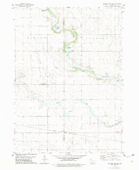
 1979 Newell East1979 Print · USGSBuena Vista County farming and rail transport are in focus during the late seventies as the town of Newell expands. Researchers can trace land divisions across Cedar and Douglas townships or locate specific landmarks like Sunken Island Lake and the local Cem.
End of results
Showing maps 1-5 of 5
Top cities of Calhoun County
- Rockwell City historical maps
- Lake City historical maps
- Manson historical maps
- Pomeroy historical maps
- Farnhamville historical maps
- Lohrville historical maps
See more
Frequently asked questions
- What are the different types of historical maps available for Calhoun County?
- What is the oldest map of Calhoun County?
- Where can I purchase historical maps of Calhoun County for my home or office?
- Where can I download high-res historical maps of Calhoun County?
- Are there historical topographic maps available for Calhoun County?
- Is there historical aerial imagery available for Calhoun County?
- Where are historical maps of Calhoun County sourced from?