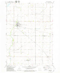
1979 Map of Fonda
USGS Topo · Published 1979About this map
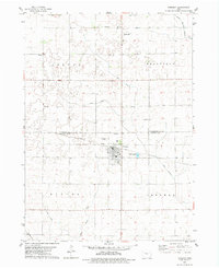
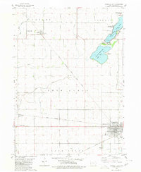
The town of Fonda serves as a central hub on the eastern plains of Iowa during the late 1970s, where two major rail lines intersect. The Illinois Central Gulf and the Chicago Milwaukee St Paul and Pacific railroads bisect the landscape, dictating the growth and layout of the settlement. To the southeast, the smaller community of Knoke sits along the rail line near St Pauls Ch.
Find a feature on this map
22 named features on this map. Tap any name to fly to it.
Don’t see what you’re looking for? This feature index may not catch every label — zoom into the map to look around manually.
Map Details
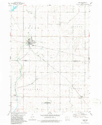
Editions of this 1979 Fonda Map
2 editions found
Other maps of this area

1954 · Fort Dodge
USGS Topo · 1:250,000

1957 · Fort Dodge
USGS Topo · 1:250,000

1958 · Fort Dodge
USGS Topo · 1:250,000
1979 · Pocahontas
USGS Topo · 1:24,000
1979 · Varina
USGS Topo · 1:24,000
1979 · Pomeroy
USGS Topo · 1:24,000
1979 · Newell East
USGS Topo · 1:24,000
1979 · Fonda NE
USGS Topo · 1:24,000
1980 · Lytton
USGS Topo · 1:24,000
1980 · Rockwell City
USGS Topo · 1:24,000