2020s Maps of Chickasaw County, Iowa
Explore 15 historic maps of Chickasaw County from the 2020s. These maps offer a rare glimpse into what life looked like during the 2020s — showing old roads, neighborhoods, homes, and landmarks that have changed or disappeared over time.
Whether you're researching your family's past, planning a metal detecting trip, or studying how Chickasaw County's landscape evolved across the 2020s, these high-resolution maps are a powerful tool for exploring the history of this region.
- Focus on a specific era: All maps on this page are from the 2020s, giving you a focused view of this time period.
- See what’s changed: Compare century-old streets, trails, and buildings to today's modern landscape using overlays and satellite layers.
- Research with precision: Use these maps for genealogy, historical research, land use analysis, or educational projects.
- View, download, or print: Maps are fully viewable online in high resolution, and can be downloaded or printed for your own records.
Start exploring Chickasaw County's history through authentic maps from the 2020s. This is your window into the past.
Chickasaw County, IA maps
(15)- 2022 Map of Waucoma, 2022 Print
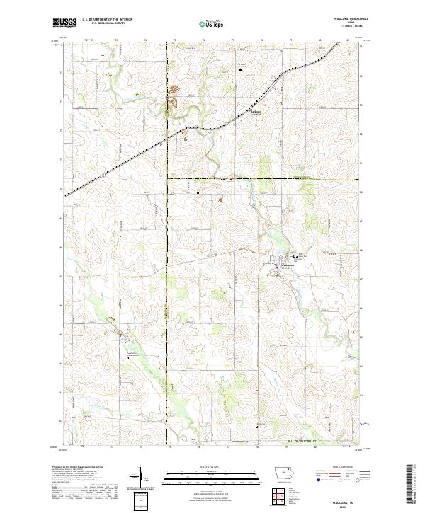 2022 Waucoma2022 Print · USGSNortheast Iowa at the start of the 2020s shows a landscape of steady agricultural roots and small-town centers. Researchers can trace family history through numerous rural sites like Saint Marys Cem, Alpha Cem, and the riverfront streets of Waucoma.
 - 2022 Map of Elma, 2022 Print
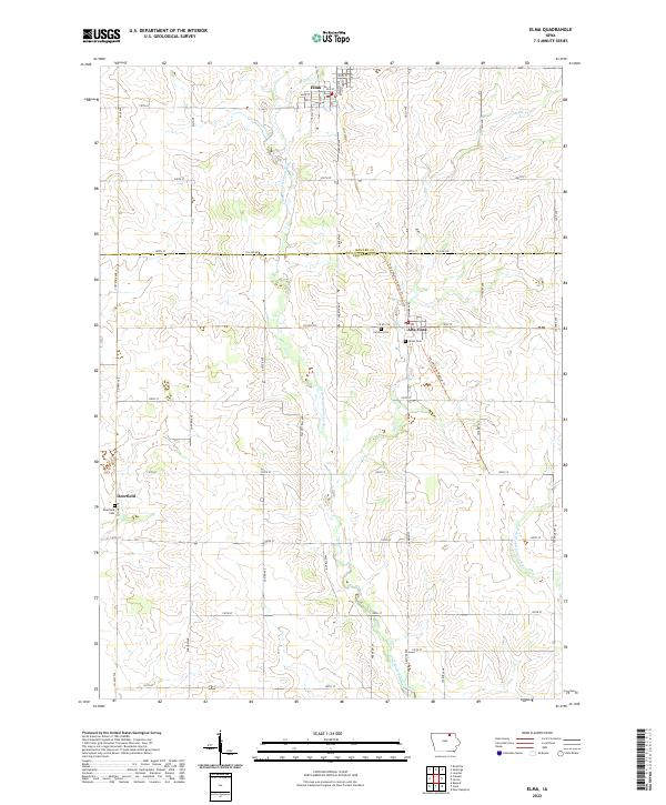 2022 Elma2022 Print · USGSThe borderlands of Howard and Chickasaw counties are captured here in the early twenty-first century, centered on the rural communities of Elma and Alta Vista. Genealogists can trace local roots at Calvary Cem or Deerfield Cem while following the valley of the Little Wapsipinicon River.
 - 2022 Map of Ionia, 2022 Print
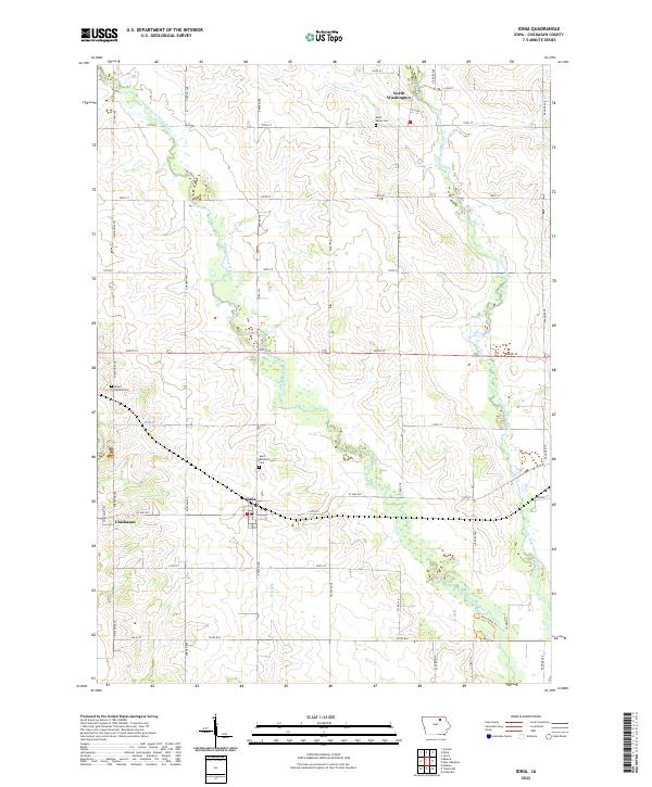 2022 Ionia2022 Print · USGSChickasaw County is revealed in the early 2020s as a quiet landscape of river valleys and rural townships. Researchers can trace family history at Saint Boniface Cem, explore the riverbanks at Chickasaw, or follow the waters of the Wapsipinicon River.
 - 2022 Map of Protivin, 2022 Print
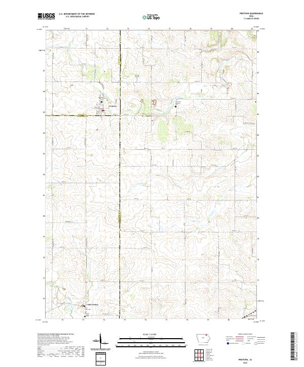 2022 Protivin2022 Print · USGSNortheast Iowa at the start of the 2020s remains a landscape of tightly-knit farming communities and quiet creek valleys. Genealogists can trace local roots through several family landmarks and burial sites, including Holy Trinity Cem in Protivin and the Bohemian National Cem.
 - 2022 Map of New Hampton, 2022 Print
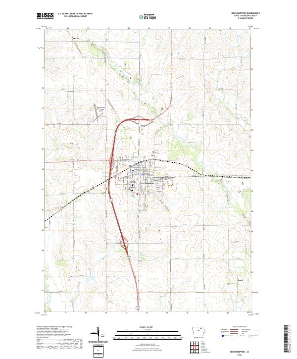 2022 New Hampton2022 Print · USGSChickasaw County's agricultural heartland is documented here in the early 2020s, centered on the civic hub of New Hampton. Researchers can trace local heritage at the Chickasaw County Courthouse or locate family sites at Saint Marys Cem and New Hampton Cem.
 - 2022 Map of Jerico, 2022 Print
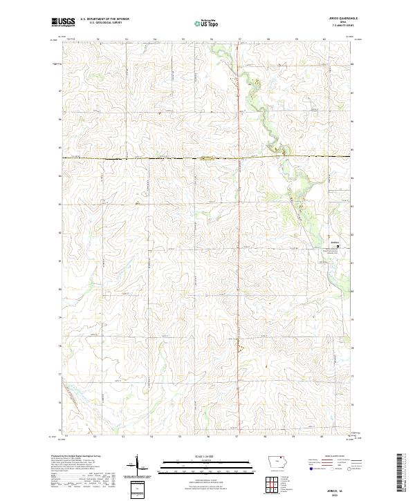 2022 Jerico2022 Print · USGSThis rural portion of Chickasaw County remains a quintessential Iowa farm landscape in the early twenty-first century. Genealogists can locate family ties at the Jerico Lutheran Church and Jerico Lutheran Cem or trace the winding E Fork Wapsipinicon River.
 - 2022 Map of Bassett, 2022 Print
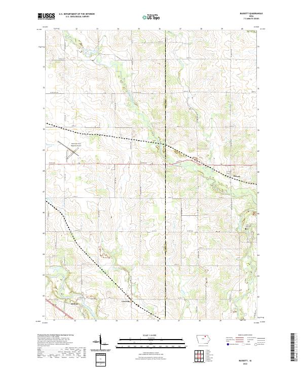 2022 Bassett2022 Print · USGSThe Floyd and Chickasaw county line comes alive in this contemporary record of Iowa's river valleys and rural townships. Trace the paths of the Little Cedar River and Cedar River to find historic sites like Carrville, Midway, and Cedar View Cem.
 - 2022 Map of Colwell, 2022 Print
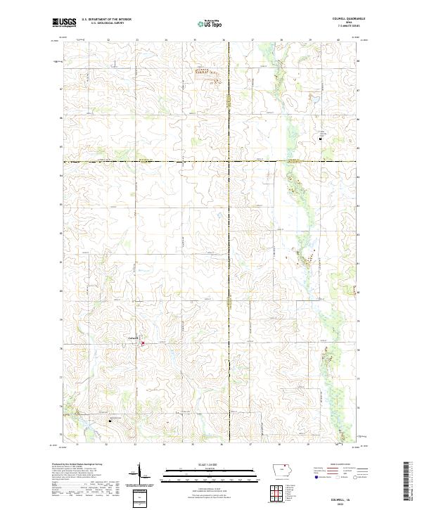 2022 Colwell2022 Print · USGSThe crossroads community of Colwell and the surrounding farmland are documented here at the convergence of four Iowa counties. Genealogists and local historians can trace family roots through the Saint Patricks Cem and Beckwith Cem or follow the banks of the Wapsipinicon River.
 - 2022 Map of Saude, 2022 Print
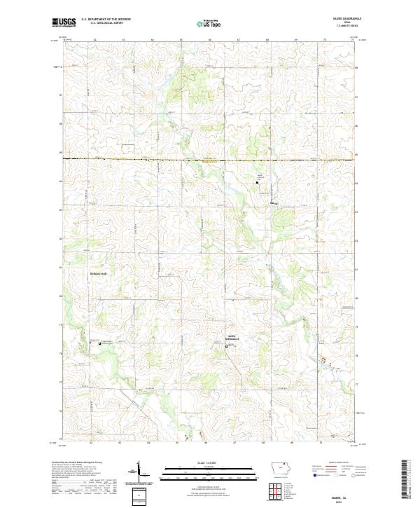 2022 Saude2022 Print · USGSNortheast Iowa’s rural landscape is captured here along the Howard and Chickasaw county line. Researchers can trace historic parish communities and burial grounds such as Reilly Settlement, Saude Lutheran Cem, and Yankee Cem.
 - 2022 Map of Lawler, 2022 Print
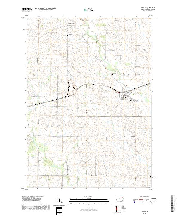 2022 Lawler2022 Print · USGSChickasaw County's agricultural heartland is documented here in the early twenty-first century, centered on the community of Lawler. Researchers can trace the heritage of local families across numerous burial grounds including Jacksonville Cem and Boyd Cem.
 - 2022 Map of Frederika, 2022 Print
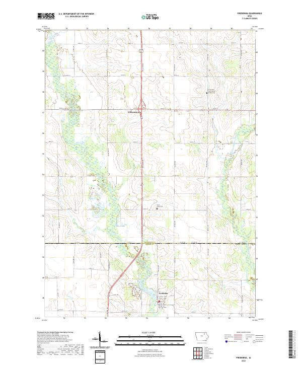 2022 Frederika2022 Print · USGSThe river valleys of southern Chickasaw County meet the Bremer County line in this modern study of eastern Iowa. Researchers can trace the grid of country roads to the settlement of Frederika, Saint Johns Cem, and the winding Wapsipinicon River.
 - 2022 Map of Fredericksburg, 2022 Print
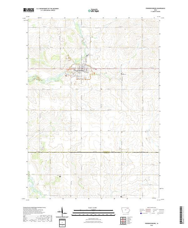 2022 Fredericksburg2022 Print · USGSFredericksburg and the surrounding Chickasaw County farmsteads are documented in this recent survey of northeastern Iowa. Researchers can locate family burial sites at Rose Hill Cem and Maple Grove Cem or trace the path of the East Fork Wapsipinicon River.
 - 2022 Map of Alpha, 2022 Print
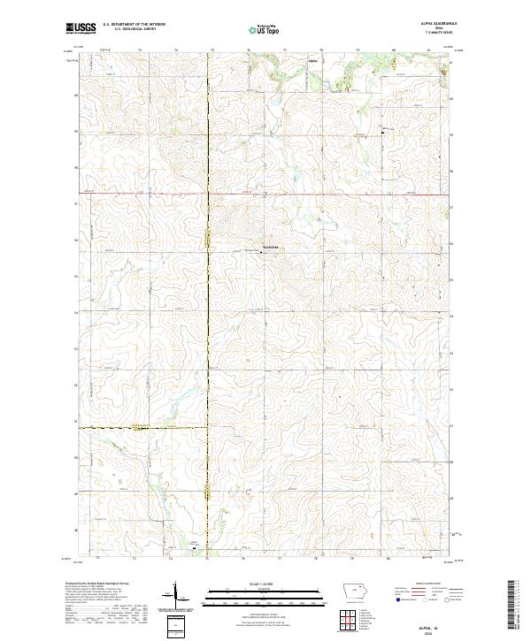 2022 Alpha2022 Print · USGSNortheastern Iowa farming country comes into focus at the meeting point of Chickasaw, Bremer, and Fayette counties. Researchers can trace family roots at Richfield Cemetery or Bethel Cemetery and follow the course of the Little Wapsipinicon River.
 - 2022 Map of Nashua, 2022 Print
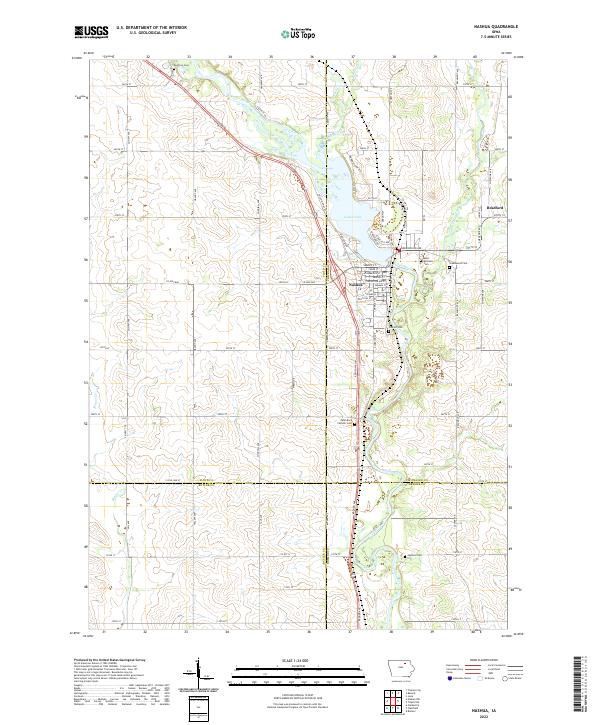 2022 Nashua2022 Print · USGSIn the river valley of northern Iowa, this recent survey shows the convergence of the Cedar River and Little Cedar River at Nashua. Researchers can locate numerous family burial sites such as Pearl Rock Catholic Cem and Oak Hill Cem.
 - 2022 Map of Tripoli NW, 2022 Print
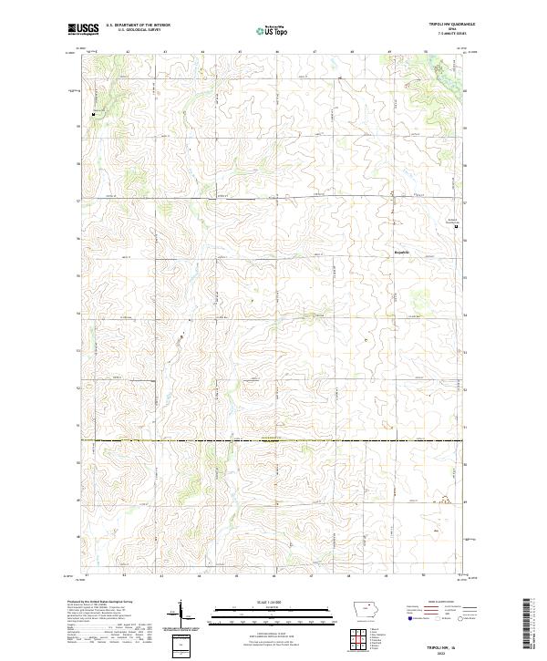 2022 Tripoli NW2022 Print · USGSChickasaw and Bremer Counties are seen here in recent years, showing a landscape deeply rooted in its nineteenth-century township divisions. Genealogists and local historians can trace family ties at Cagley Cemetery and Richland Township Cemetery near the settlement of Republic.
End of results
Showing maps 1-15 of 15
Top cities of Chickasaw County
- New Hampton historical maps
- Nashua historical maps
- Fredericksburg historical maps
- Lawler historical maps
- Alta Vista historical maps
- Ionia historical maps
See more
Frequently asked questions
- What are the different types of historical maps available for Chickasaw County?
- What is the oldest map of Chickasaw County?
- Where can I purchase historical maps of Chickasaw County for my home or office?
- Where can I download high-res historical maps of Chickasaw County?
- Are there historical topographic maps available for Chickasaw County?
- Is there historical aerial imagery available for Chickasaw County?
- Where are historical maps of Chickasaw County sourced from?