2020s Maps of Arnolds Park, Iowa
Explore 4 historic maps of Arnolds Park from the 2020s. These maps offer a rare glimpse into what life looked like during the 2020s — showing old roads, neighborhoods, homes, and landmarks that have changed or disappeared over time.
Whether you're researching your family's past, planning a metal detecting trip, or studying how Arnolds Park's landscape evolved across the 2020s, these high-resolution maps are a powerful tool for exploring the history of this region.
- Focus on a specific era: All maps on this page are from the 2020s, giving you a focused view of this time period.
- See what’s changed: Compare century-old streets, trails, and buildings to today's modern landscape using overlays and satellite layers.
- Research with precision: Use these maps for genealogy, historical research, land use analysis, or educational projects.
- View, download, or print: Maps are fully viewable online in high resolution, and can be downloaded or printed for your own records.
Start exploring Arnolds Park's history through authentic maps from the 2020s. This is your window into the past.
Arnolds Park, IA maps
(4)- 2022 Map of Okoboji, 2022 Print
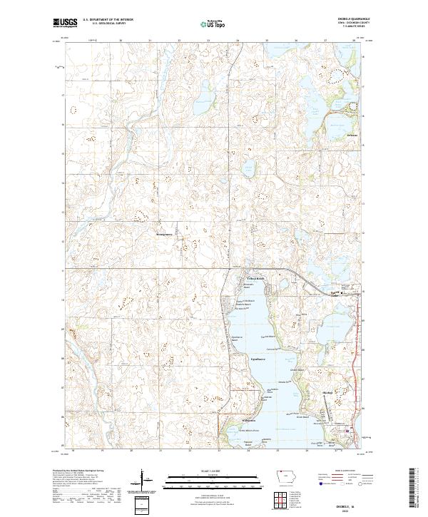 2022 Okoboji2022 Print · USGSThe Iowa Great Lakes region is shown in contemporary detail, tracing the shoreline of West Okoboji Lake and its surrounding communities. Local historians can locate landmarks like Wahpeton, Spirit Lake Municipal Airport, and the Iowa Great Lakes Recreational Trl.
 - 2022 Map of Spirit Lake SE, 2022 Print
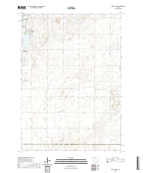 2022 Spirit Lake SE2022 Print · USGSThe southern reach of the Iowa Great Lakes comes into focus during this modern era of rural growth. Genealogists and local historians can trace the lakeside settlements of Arnolds Park and Milford or locate family land near Little Muddy Cr and Kruses Beach.
 - 2022 Map of Milford, 2022 Print
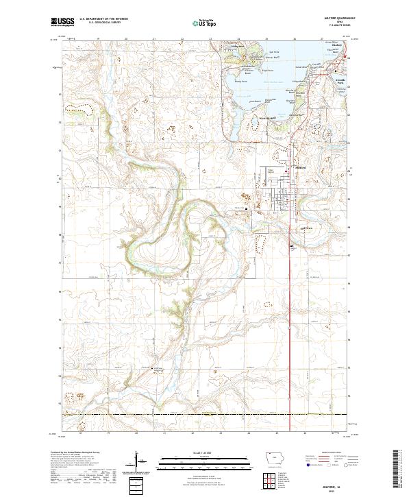 2022 Milford2022 Print · USGSIn the heart of the Iowa Great Lakes during the 2020s, this area showcases the dense settlement of the lakefront alongside the rural Little Sioux River valley. Genealogists and local historians can trace family locations near Milford Cem or explore landmarks like Fuller Airport and Garlock Slough.
 - 2022 Map of Spirit Lake, 2022 Print
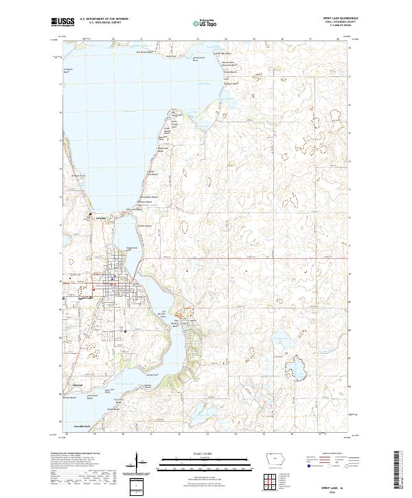 2022 Spirit Lake2022 Print · USGSThe Iowa Great Lakes region is captured here in detail, showcasing the established resort communities and residential growth surrounding the state's largest natural lake. Researchers can trace local genealogy and land use through landmarks like Lakeview Cem, the Dickinson County Courthouse, and named shorelines such as Miniwaukon Beach.
End of results
Showing maps 1-4 of 4
Top cities near Arnolds Park
- Spencer historical maps
- Spirit Lake historical maps
- Milford historical maps
- Lake Park historical maps
- Okoboji historical maps
- Ruthven historical maps
See more
Top neighborhoods of Arnolds Park
Frequently asked questions
- What are the different types of historical maps available for Arnolds Park?
- What is the oldest map of Arnolds Park?
- Where can I purchase historical maps of Arnolds Park for my home or office?
- Where can I download high-res historical maps of Arnolds Park?
- Are there historical topographic maps available for Arnolds Park?
- Is there historical aerial imagery available for Arnolds Park?
- Where are historical maps of Arnolds Park sourced from?