Old Maps of Dubuque County, Iowa for Academic Research
Study the evolution of Dubuque County with 152 high-resolution historic maps. Whether you're teaching, researching, or modeling changes in land use, these maps provide essential visual documentation of urban, environmental, and geographic change.
- Analyze long-term change: Track patterns in development, transportation, and natural features.
- Ideal for environmental or urban studies: Support academic projects with primary historical map data.
- Use in the classroom or lab: Educators and researchers rely on these maps to bring historical context to life.
These maps are a powerful tool for teaching, research, and visualizing how Dubuque County has changed over the decades.
Dubuque County, IA maps
(152)- 1900 Map of Anamosa
 1900 Anamosa1900 Print · USGSEastern Iowa is shown here during the peak of its rail-driven development at the end of the century. Genealogists and historians can trace the early layouts of Anamosa and Monticello or locate smaller settlements like Sand Spring and Rockville.4 unique versions available
 - 1900 Map of Lancaster
 1900 Lancaster1900 Print · USGSGrant County and the Mississippi River bluffs are captured at the close of the nineteenth century, showing a landscape of river towns and ridge-top farms. Researchers can trace the early rail corridors and vanished river landings from Cassville and Potosi to the county seat at Lancaster.
 - 1901 Map of Peosta
 1901 Peosta1901 Print · USGSDubuque and Jackson counties were a hub of river commerce and early rail expansion at the turn of the century. Genealogists and historians can trace the foundations of communities like Peosta, St.Donatus, and the mill sites at Washington Mills.4 unique versions available
 - 1902 Map of Elkader
 1902 Elkader1902 Print · USGSNortheast Iowa at the turn of the century is defined by the deep river valleys of the Mississippi, Turkey, and Volga. Genealogists and historians can trace rail lines and early settlements like Elkader, Guttenberg, and Elkport as they appeared in 1898.4 unique versions available
 - 1904 Map of Lancaster, 1953 Print
 1904 Lancaster1953 Print · USGSSouthwest Wisconsin and its neighboring river lands are shown at the turn of the century as railroads began to dominate the ridge tops. Researchers can trace the development of the river-and-rail economy through sites like Spechts Ferry, Sinsinawa Mound, and Lancaster.
 - 1908 Map of Lancaster
 1908 Lancaster1908 Print · USGSGrant County and the Mississippi River border appear in the first decade of the twentieth century, when river crossings and new rail lines defined local commerce. Researchers can trace the landings at Spechts Ferry and Mc Cartney or locate early settlements like British Hollow and Beetown.5 unique versions available
 - 1911 Map of Galena, 1953 Print
 1911 Galena1953 Print · USGSBefore the decline of the local lead industry, this area was a hub of mining and river commerce. Genealogists can trace family names through dozens of rural schools and mines like Blackjack Mine, or locate long-lost river crossings like Gears Ferry.3 unique versions available
 - 1913 Map of Galena
 1913 Galena1913 Print · USGSThe mining and river districts of Jo Daviess County are captured here just before the First World War. Genealogists and researchers can locate family-named landmarks like Horseshoe Mound, local schools such as Miners School, and industrial sites like the Hoskin Mine.3 unique versions available
 - 1935 Map of East Dubuque, 1957 Print
 1935 East Dubuque1957 Print · USGSThe riverfront and rail lines of Jo Daviess County come alive in this mid-1930s survey of the tri-state border region. Researchers can trace the old tracks of the Chicago Illinois Burlington and Quincy and locate vanished rural schoolhouses like Miller Sch and Sand Ridge Sch.
 - 1940 Map of East Dubuque
 1940 East Dubuque1940 Print · USGSThe Mississippi River borderlands of Jo Daviess County appear here in the mid-1930s, showing the vital rail and river connections at East Dubuque. Genealogists and local historians can trace rural school districts like Sand Ridge Sch or the riverside community of Menominee Sta.3 unique versions available
 - 1955 Map of Menominee, 1956 Print
 1955 Menominee1956 Print · USGSThe tri-state border region along the Mississippi River appears here in the mid-fifties, showing a landscape of river-bottom refuges and blufftop farms. Genealogists can locate several schools and rural settlements like Menominee and Shawondasse, or trace the tracks of the Illinois Central railroad.3 unique versions available
 - 1955 Map of Cassville, 1957 Print
 1955 Cassville1957 Print · USGSMid-century life along the Mississippi River bluffs is captured here as the transition from one-room schools to larger districts begins. Genealogists can trace family roots at St Charles Cem and Advent Ch or locate discontinued sites like Hefel Sch.2 unique versions available
 - 1955 Map of Dubuque South, 1957 Print
 1955 Dubuque South1957 Print · USGSMid-century Dubuque and its Illinois neighbor across the river are shown at a time of significant transition and growth. Genealogists can trace family roots through numerous local landmarks, including Mount Olivet Cemetery, Ballyclough, and several rural schoolhouses like Smith Sch.3 unique versions available
 - 1955 Map of Balltown, 1957 Print
 1955 Balltown1957 Print · USGSThe Upper Mississippi River corridor at the Iowa-Wisconsin border is shown here in the mid-1950s, split by the winding Grant River and heavy rail traffic. Genealogists can trace family footprints in Balltown or find local landmarks like Sinners Creek Sch and Burton.2 unique versions available
 - 1956 Map of Dubuque North, 1958 Print
 1956 Dubuque North1958 Print · USGSThe tri-state border region around Dubuque comes alive in the mid-1950s, revealing a landscape defined by river industry and deep-rooted community institutions. Researchers can trace the heritage of Loras College, find the old Eagle Point Bridge (Toll), and locate family sites near Linwood Cemetery.5 unique versions available
 - 1956 Map of Sherrill, 1958 Print
 1956 Sherrill1958 Print · USGSDubuque County in the mid-fifties remains a landscape of tightly-knit rural communities and family-named hollows. Researchers can trace the legacy of local education and faith at St Johns Ch, Bloody Run Sch, and the riverside crossing at Redford Bridge.2 unique versions available
 - 1957 Map of Turkey River, 1959 Print
 1957 Turkey River1959 Print · USGSNortheast Iowa at the confluence of the Turkey and Mississippi Rivers shows a landscape of deep hollows and river-bottom railroads in the late fifties. Genealogists can locate family landmarks like St Johns Cem, the settlement of Millville, and the Goshen Ch.3 unique versions available
 - 1957 Map of Colesburg, 1959 Print
 1957 Colesburg1959 Print · USGSThe tri-county border area of Northeast Iowa is captured here during the late 1950s, showing the rural landscape around Colesburg. Family historians can locate several burial sites and country churches, including Oak Hill Cem, Zion Ch, and the remote Hanna Cem.2 unique versions available
 - 1957 Map of Holy Cross, 1959 Print
 1957 Holy Cross1959 Print · USGSDubuque County is shown here in the mid-1950s, during a period of significant change for its rural school districts. Researchers can trace the exact locations of several former landmarks like the Flanagan Sch, Cottage Hill, and Rickardsville.
 - 1957 Map of Potosi, 1967 Print
 1957 Potosi1967 Print · USGSThe bluffs of Grant County meet the Mississippi River in the mid-1950s, revealing a landscape shaped by lead mining and river commerce. Genealogists can locate family landmarks like St Thomas Cem, Spechts Ferry, and the old Rigsby Sch.2 unique versions available
 - 1959 Map of Dubuque, 1982 Print
 1959 Dubuque1982 Print · USGSThe Tri-State region comes alive in the mid-twentieth century as a hub of river commerce and rail transit. Genealogists and historians can trace the paths of the Illinois Central Gulf through Dubuque or locate the Savanna Ordnance Depot and Lock and Dam No 11.
 - 1961 Map of Dubuque
 1961 Dubuque1961 Print · USGSThe Tri-State region's river-and-rail landscape is captured here during the early sixties, showing the convergence of Iowa, Illinois, and Wisconsin. Trace mid-century rail lines like the Chicago Great Western Ry and explore sites like the Savanna Ordnance Depot and Backbone State Park.
 - 1962 Map of Dubuque
 1962 Dubuque1962 Print · USGSThe Tri-State region's river-and-rail economy is captured here in the early sixties, centered on the Mississippi River bluffs. Genealogists and historians can locate Numerous lead and zinc mines, the New Melleray Abbey Monastery, and rural hubs like Saint Olaf.2 unique versions available
 - 1962 Map of New Vienna, 1963 Print
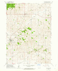 1962 New Vienna1963 Print · USGSDubuque County’s agricultural and woodland landscape is captured here in the early sixties, showing a region defined by its German-Catholic heritage and winding river valleys. Genealogists and local historians can trace the early layouts of New Vienna, Luxemburg, and the wooded depths of White Pine Hollow State Park.
 - 1962 Map of Petersburg, 1964 Print
 1962 Petersburg1964 Print · USGSEastern Iowa's farming heartland is captured here in the early sixties, centered on the village of Petersburg and its rail connections. Genealogists can locate family sites such as St Patrick Cem or trace the Chicago Great Western rail line.
Showing maps 1-25 of 152
Top cities of Dubuque County
- Dubuque historical maps
- Asbury historical maps
- Cascade historical maps
- Epworth historical maps
- Peosta historical maps
- Farley historical maps
See more
Frequently asked questions
- What are the different types of historical maps available for Dubuque County?
- What is the oldest map of Dubuque County?
- Where can I purchase historical maps of Dubuque County for my home or office?
- Where can I download high-res historical maps of Dubuque County?
- Are there historical topographic maps available for Dubuque County?
- Is there historical aerial imagery available for Dubuque County?
- Where are historical maps of Dubuque County sourced from?