2020s Maps of Emmet County, Iowa
Explore 15 historic maps of Emmet County from the 2020s. These maps offer a rare glimpse into what life looked like during the 2020s — showing old roads, neighborhoods, homes, and landmarks that have changed or disappeared over time.
Whether you're researching your family's past, planning a metal detecting trip, or studying how Emmet County's landscape evolved across the 2020s, these high-resolution maps are a powerful tool for exploring the history of this region.
- Focus on a specific era: All maps on this page are from the 2020s, giving you a focused view of this time period.
- See what’s changed: Compare century-old streets, trails, and buildings to today's modern landscape using overlays and satellite layers.
- Research with precision: Use these maps for genealogy, historical research, land use analysis, or educational projects.
- View, download, or print: Maps are fully viewable online in high resolution, and can be downloaded or printed for your own records.
Start exploring Emmet County's history through authentic maps from the 2020s. This is your window into the past.
Emmet County, IA maps
(15)- 2022 Map of Ceylon, 2022 Print
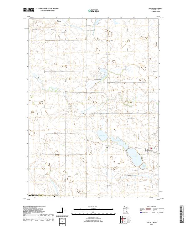 2022 Ceylon2022 Print · USGSThe Minnesota-Iowa border comes into focus in the early 2020s, revealing a landscape of managed wetlands and prairie lakebeds. Researchers can trace rural lineages at Lone Cedar Cem or Lake Belt Cem and explore the historic hydrology of Smith Lakebed.
 - 2022 Map of Dunnell, 2022 Print
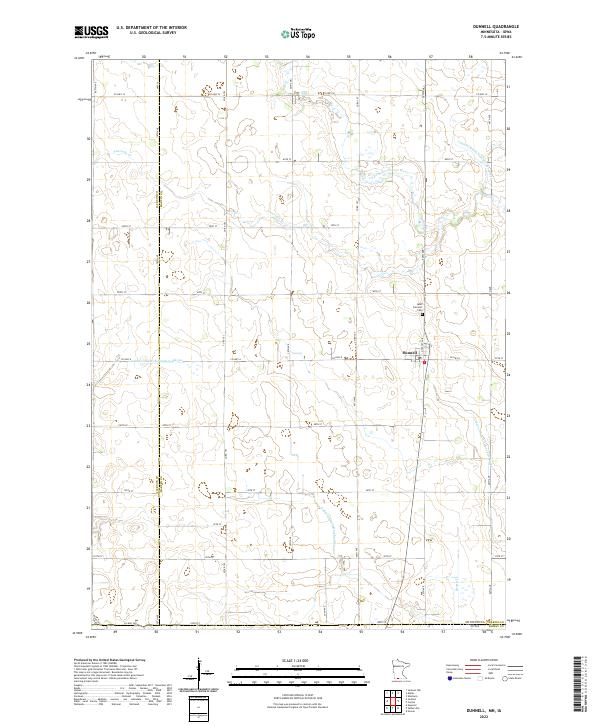 2022 Dunnell2022 Print · USGSMartin County agriculture and the borderlands of southern Minnesota are captured here in the early 2020s. Researchers can trace the section-line roads surrounding Dunnell and locate local landmarks like the Lake Fremont Cem and the E Fork Des Moines River.
 - 2022 Map of Willmert Lake, 2022 Print
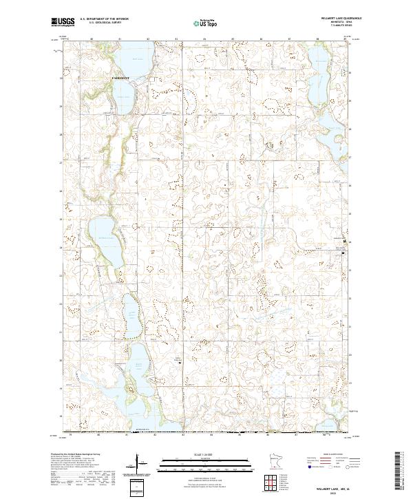 2022 Willmert Lake2022 Print · USGSThe lakeside community of Fairmont and the surrounding Minnesota-Iowa borderlands are captured here in the early twenty-first century. Researchers can trace rural lineages at Center Chain Cem or explore the shorelines of Amber Lake and North Silver Lake.
 - 2022 Map of Wilbert, 2022 Print
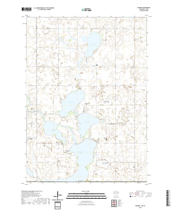 2022 Wilbert2022 Print · USGSThe rural borderlands of Martin County are captured in this study of the lake country around the Iowa line. Genealogists can locate family burial sites such as Saint Paul's Lutheran Cem and Teitje Farm Cem or trace the drainage of Okamanpeedan Lake.
 - 2022 Map of Jackson, 2022 Print
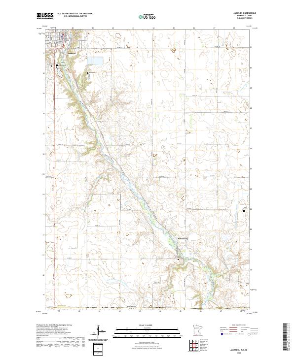 2022 Jackson2022 Print · USGSThe river valley and prairie township of Jackson are captured here in the early 2020s, showing the intersection of local government and rural life. Researchers can locate numerous family and community landmarks, including Riverside Cem, the Jackson County Courthouse, and the settlement of Petersburg.
 - 2022 Map of Gruver, 2022 Print
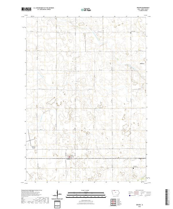 2022 Gruver2022 Print · USGSEmmet County's prairie-turned-farmland is captured here in the early twenty-first century, showcasing the region's intense drainage network. Genealogists and local historians can locate Gruver, Dolliver, and the Palestine Cem amidst the section-line roads.
 - 2022 Map of Seneca, 2022 Print
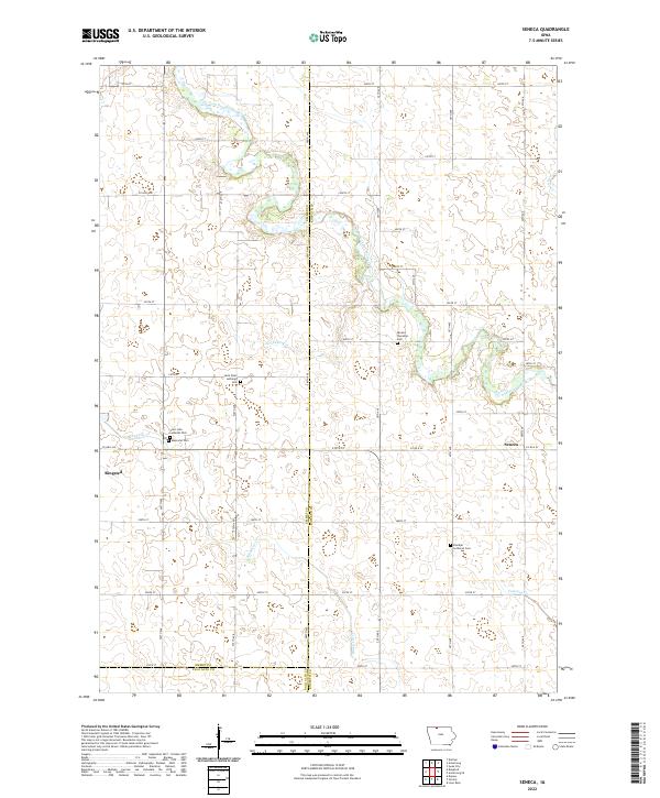 2022 Seneca2022 Print · USGSNorthern Iowa farmland at the start of the 2020s shows a landscape of long-held family ties and river drainage. Genealogists can trace local history through sites like Saint Pauls Lutheran Cem and Memorial Cem near Ringsted.
 - 2022 Map of Ringsted, 2022 Print
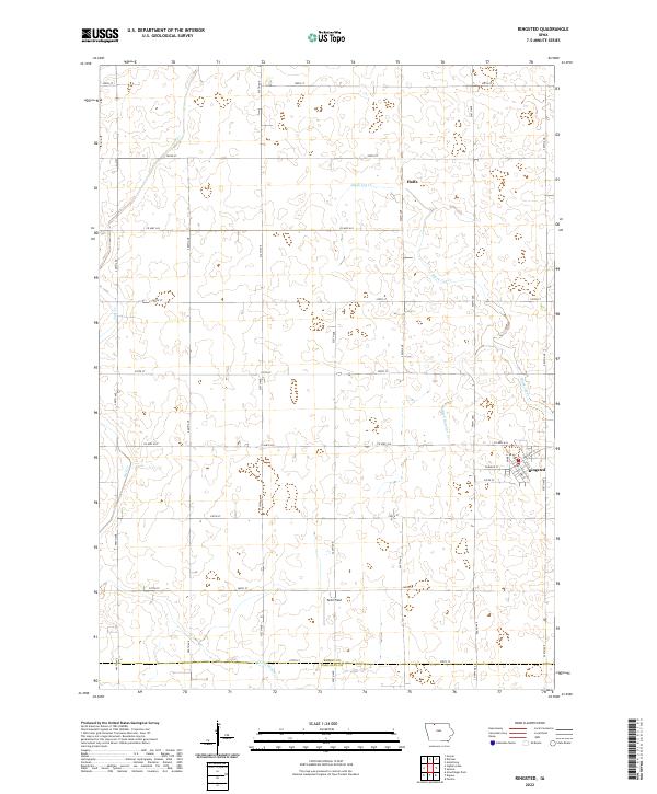 2022 Ringsted2022 Print · USGSEmmet County at the start of the 2020s shows a landscape defined by industrial-scale agriculture and critical water management. Researchers can trace the layout of Ringsted, find the rural cluster at Halfa, and follow drainage networks like Black Cat Cr.
 - 2022 Map of Armstrong, 2022 Print
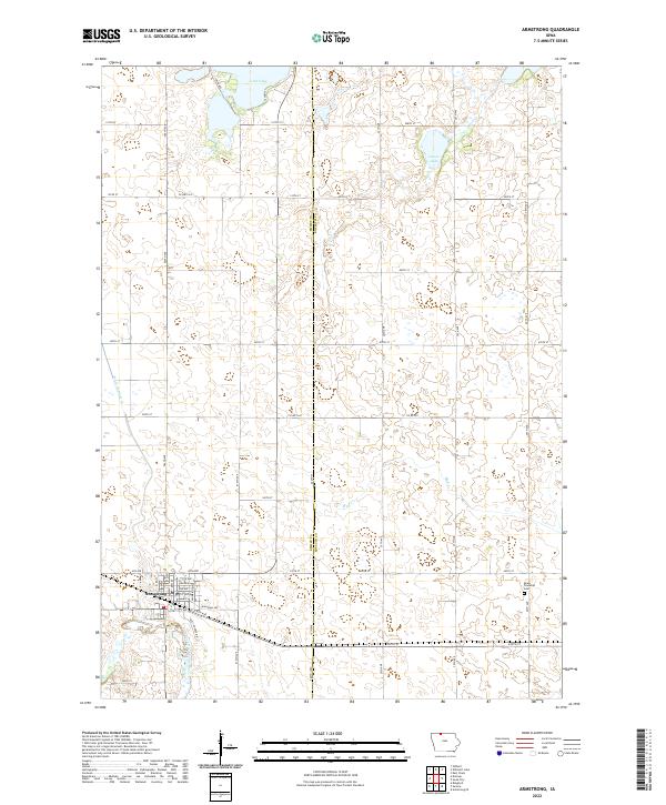 2022 Armstrong2022 Print · USGSNorthwestern Iowa's agricultural heartland is documented here in the early twenty-first century, centered on the community of Armstrong. Researchers can trace local landmarks and property boundaries near the Swea Township Cem and the waters of Iowa Lake.
 - 2022 Map of Superior, 2022 Print
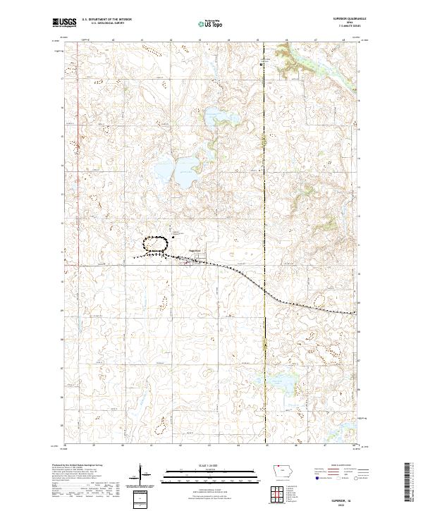 2022 Superior2022 Print · USGSSuperior and the surrounding prairies of the Iowa-Minnesota borderlands are captured here in the early twenty-first century. Genealogists and local historians can trace family locations near the Superior Township Cem, Swan Lake, or along the Des Moines River.
 - 2022 Map of Estherville, 2022 Print
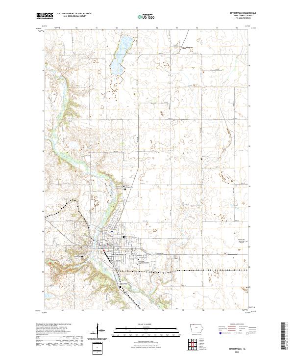 2022 Estherville2022 Print · USGSEstherville and the surrounding Emmet County prairie are captured here in the early twenty-first century as the Des Moines River winds through the valley. Researchers can pinpoint several local burial grounds like Oak Hill Cem and Prosser Cem or locate the Emmet County Courthouse and the Iowa Lakes Community College Estherville Campus.
 - 2022 Map of Terril, 2022 Print
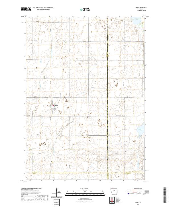 2022 Terril2022 Print · USGSThe community of Terril and the surrounding Iowa prairie are captured in the early 2020s, showing a landscape defined by industrial agriculture and natural basins. Genealogists and local historians can locate Fairview Cem and trace the paths of Big Muddy Cr and Pickerel Run.
 - 2022 Map of Wallingford, 2022 Print
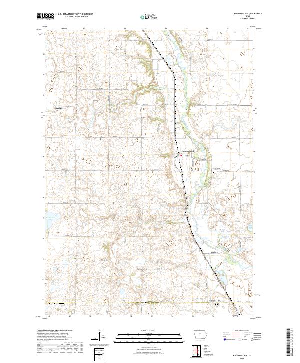 2022 Wallingford2022 Print · USGSSettlement and agriculture converge along the Des Moines River in this modern survey of the Iowa prairie. Genealogists can locate family sites near Wallingford Lutheran Cem, Raleigh, and the banks of Twelvemile Lake.
 - 2022 Map of Ingham Lake, 2022 Print
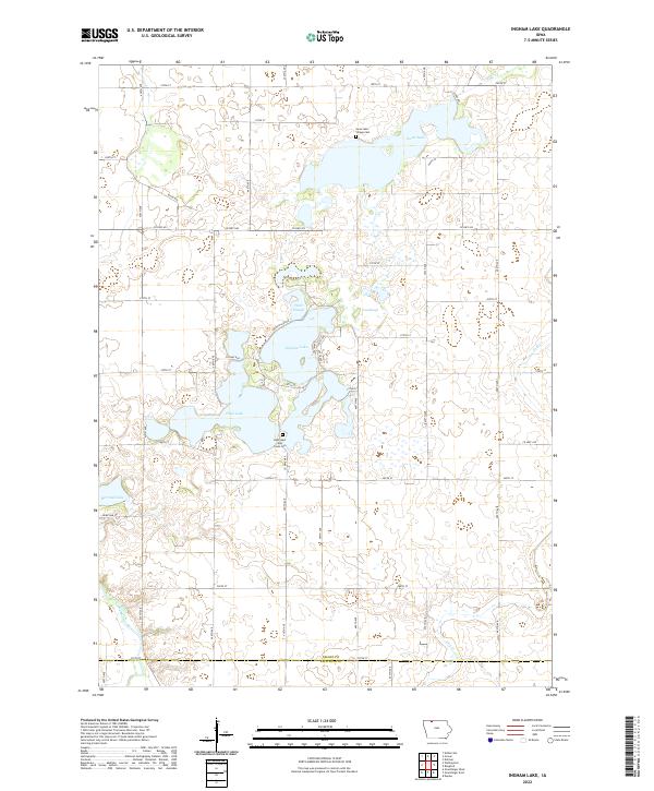 2022 Ingham Lake2022 Print · USGSEmmet County's prairie-pothole landscape is captured here in the early 2020s, showing a region defined by its glacial lakes and rural road networks. Genealogists and local researchers can locate established burial grounds like Swan Lake Village Cem and High Lake Jack Creek Cem near High Lake.
 - 2022 Map of Dolliver, 2022 Print
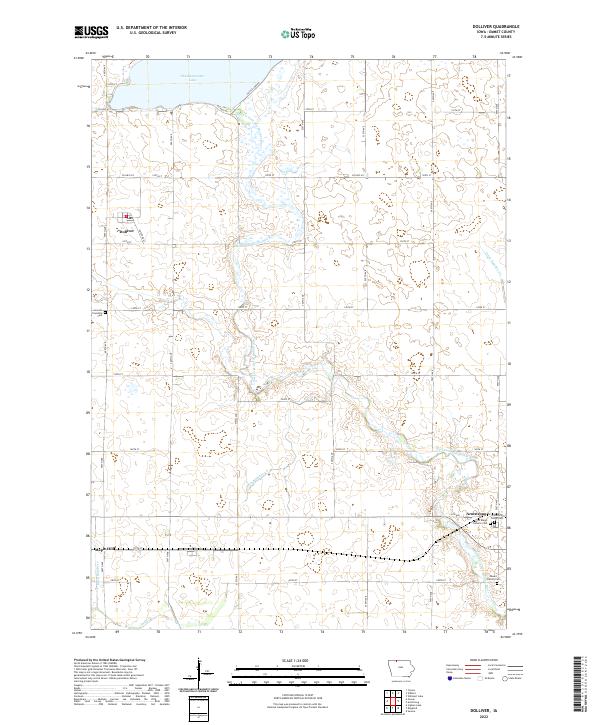 2022 Dolliver2022 Print · USGSEmmet County prairie life is centered on the river and rail in this recent survey. Local historians can trace the foundations of Dolliver, Maple Hill, and Armstrong alongside sites like Lincoln Township Cem.
End of results
Showing maps 1-15 of 15
Top cities of Emmet County
- Estherville historical maps
- Armstrong historical maps
- Ringsted historical maps
- Wallingford historical maps
- Dolliver historical maps
- Gruver historical maps
Frequently asked questions
- What are the different types of historical maps available for Emmet County?
- What is the oldest map of Emmet County?
- Where can I purchase historical maps of Emmet County for my home or office?
- Where can I download high-res historical maps of Emmet County?
- Are there historical topographic maps available for Emmet County?
- Is there historical aerial imagery available for Emmet County?
- Where are historical maps of Emmet County sourced from?