2020s Maps of Franklin County, Iowa
Explore 16 historic maps of Franklin County from the 2020s. These maps offer a rare glimpse into what life looked like during the 2020s — showing old roads, neighborhoods, homes, and landmarks that have changed or disappeared over time.
Whether you're researching your family's past, planning a metal detecting trip, or studying how Franklin County's landscape evolved across the 2020s, these high-resolution maps are a powerful tool for exploring the history of this region.
- Focus on a specific era: All maps on this page are from the 2020s, giving you a focused view of this time period.
- See what’s changed: Compare century-old streets, trails, and buildings to today's modern landscape using overlays and satellite layers.
- Research with precision: Use these maps for genealogy, historical research, land use analysis, or educational projects.
- View, download, or print: Maps are fully viewable online in high resolution, and can be downloaded or printed for your own records.
Start exploring Franklin County's history through authentic maps from the 2020s. This is your window into the past.
Franklin County, IA maps
(16)- 2022 Map of Alexander, 2022 Print
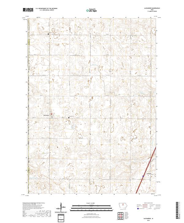 2022 Alexander2022 Print · USGSFranklin County's agricultural heartland is captured here in the early twenty-first century, showcasing the tight-knit grid of the Iowa prairie. Genealogists and local historians can trace the areas around Alexander and Latimer, including the Holland Cem and Buffalo Cr.
 - 2022 Map of Sheffield, 2022 Print
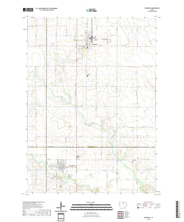 2022 Sheffield2022 Print · USGSSettled across the Cerro Gordo and Franklin county line, this area shows its agricultural and small-town roots in the early 2020s. Genealogists can locate family sites at Rockwell Cem or Saint John Zion Cem while tracing the West Fork Cedar River.
 - 2022 Map of Iowa Falls West, 2022 Print
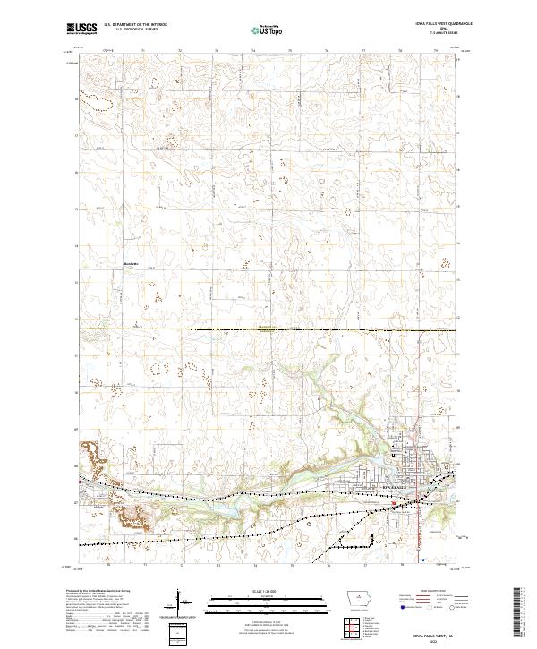 2022 Iowa Falls West2022 Print · USGSCrossing the border of Franklin and Hardin counties, this Iowa landscape centers on the river-fed growth of the early 2020s. Genealogists and local researchers can trace sites like Union Cem and Saint Mark's Cem near the banks of the Iowa River.
 - 2022 Map of Popejoy, 2022 Print
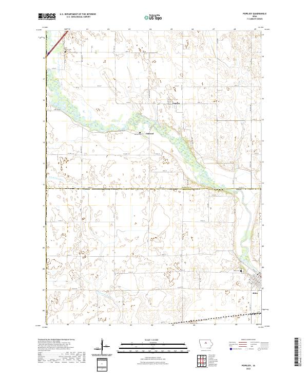 2022 Popejoy2022 Print · USGSFranklin and Hardin counties are seen here in the early twenty-first century, centered on the river-fed agricultural plains of Iowa. Researchers can trace family history through local burial sites like Oak Hill Cem and the riverfront street grid of Alden.
 - 2022 Map of Hansell, 2022 Print
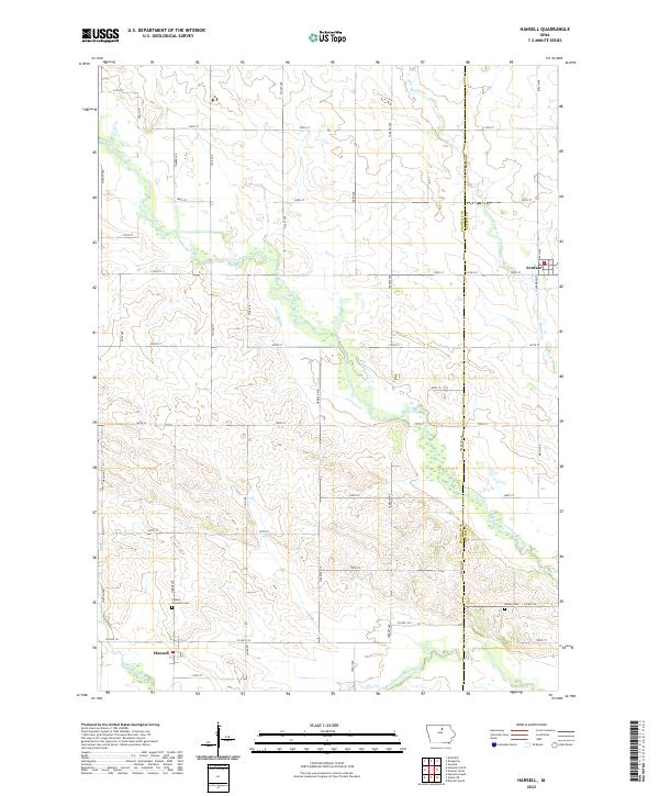 2022 Hansell2022 Print · USGSHansell and Aredale are captured in the early twenty-first century amidst the fertile plains of Franklin and Butler counties. Researchers can locate burial sites at Ingham Township Cem or trace the meandering course of the West Fork Cedar River.
 - 2022 Map of Dows East, 2022 Print
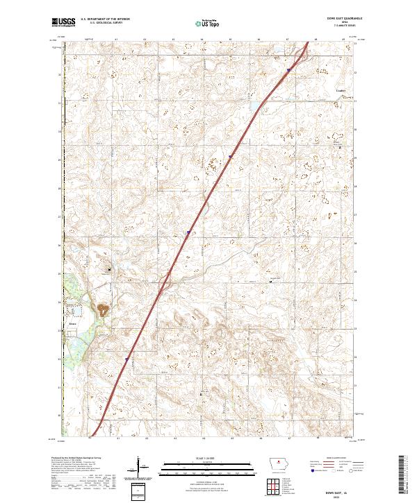 2022 Dows East2022 Print · USGSFranklin County's agricultural heartland is documented here in the early twenty-first century, centered on the communities of Dows and Coulter. Local historians can locate ancestral sites at Saint Peters Cemetery, Morgan Cemetery, and along the banks of the Iowa River.
 - 2022 Map of Iowa Falls East, 2022 Print
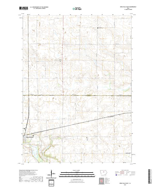 2022 Iowa Falls East2022 Print · USGSCentral Iowa in the early 2020s remains a landscape of historic farmsteads and rural cemeteries defined by the Iowa River and the border of Franklin and Hardin counties. Genealogists can trace family roots at Saint Peters Evangelical Cem, Pleasant Hill Cem, or the small settlement of Robertson.
 - 2022 Map of Ackley, 2022 Print
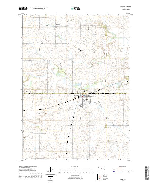 2022 Ackley2022 Print · USGSThe crossroads of four Iowa counties come together at the town of Ackley in this modern-era topographic study. Genealogists can trace family landmarks and burial sites like Oak Wood Cem and Pleasant Hill Cem along the banks of Beaver Cr.
 - 2022 Map of Dougherty, 2022 Print
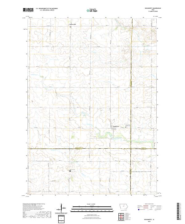 2022 Dougherty2022 Print · USGSThis northern Iowa landscape at the meeting of three counties highlights the enduring rural character of the region. Genealogists and local historians can locate Saint Patricks Catholic Cem and West Fork Cem while tracing the winding paths of Coldwater Creek.
 - 2022 Map of Thornton, 2022 Print
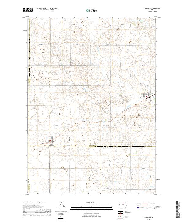 2022 Thornton2022 Print · USGSThe agricultural plains of Cerro Gordo County are captured here in the early twenty-first century. Researchers can trace the legacy of the rails along the Railroad R.O.W. Corridor Trl or locate family roots at Pleasant View Cem and Meservey Cem.
 - 2022 Map of Latimer, 2022 Print
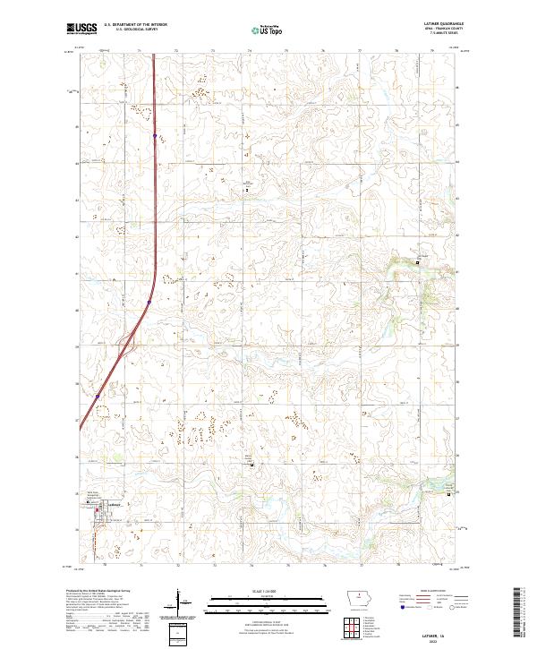 2022 Latimer2022 Print · USGSFranklin County's agricultural heartland is documented here in the early twenty-first century, centered on the community of Latimer. Genealogists and local historians can locate specific family burial sites such as Old Chapin Cem and Marion Center Cem.
 - 2022 Map of Swaledale, 2022 Print
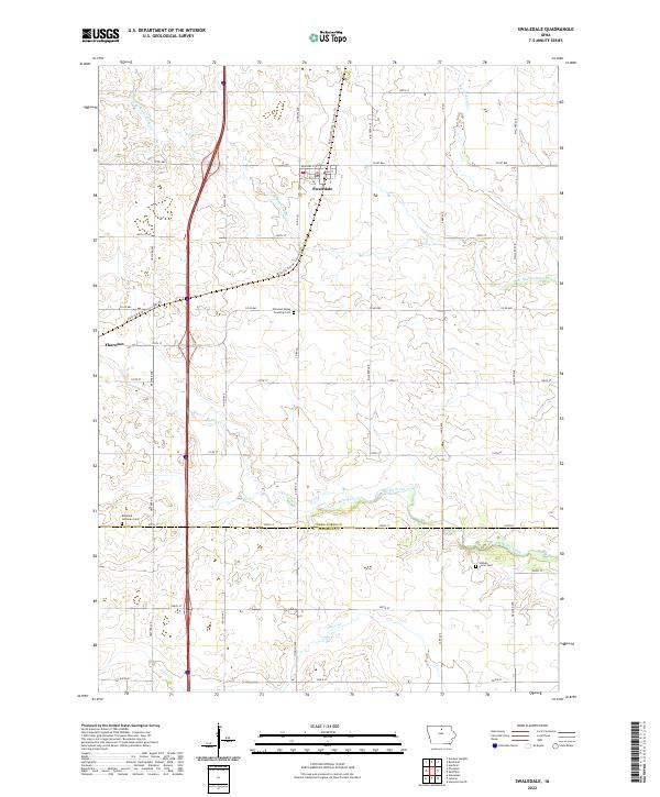 2022 Swaledale2022 Print · USGSThe agricultural plains of Cerro Gordo and Franklin Counties are captured here in the early twenty-first century. Genealogists and local historians can trace family plots at Richland Lutheran Cem and Shobes Grove Cem or follow the path of the Railroad R.O.W. Corridor Trl.
 - 2023 Map of Coulter, 2023 Print
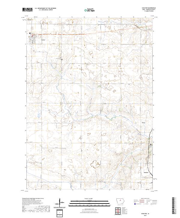 2023 Coulter2023 Print · USGSFranklin County's rural landscape is captured here in the early twenty-first century, centered on the historic town of Coulter. Researchers can trace local heritage through sites like Saint Johns Lutheran Cem, the settlement at Reeve, and the winding course of Maynes Creek.
 - 2023 Map of Hampton South, 2023 Print
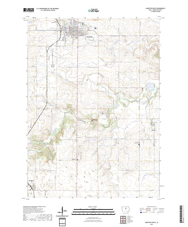 2023 Hampton South2023 Print · USGSFranklin County's agricultural heartland is documented here in the early twenty-first century, centered on the county seat of Hampton. Researchers can trace family history at Maysville Cem, locate the Franklin County Courthouse, and follow the former rail path of the Rolling Prairie Trl.
 - 2023 Map of Hampton North, 2023 Print
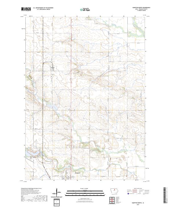 2023 Hampton North2023 Print · USGSFranklin County farmland and the community of Chapin are captured in this recent survey. You can trace the rural landscape from the banks of Beeds Lake to local landmarks like the Way Side Cem and the small Lake Airport.
 - 2023 Map of Ackley NE, 2023 Print
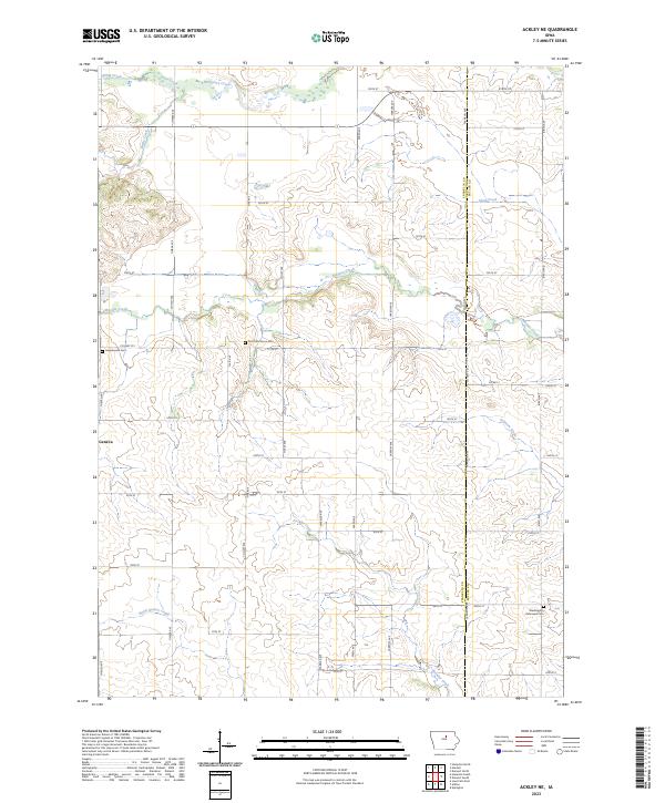 2023 Ackley NE2023 Print · USGSFranklin County's rural townships are captured here during the 2020s, showing a landscape defined by agricultural grids and wandering creeks. Researchers can trace family history at Lindenwood Cem, Four Mile Grove Cem, and the community of Geneva.
End of results
Showing maps 1-16 of 16
Top cities of Franklin County
- Hampton historical maps
- Sheffield historical maps
- Latimer historical maps
- Coulter historical maps
- Alexander historical maps
- Geneva historical maps
See more
Frequently asked questions
- What are the different types of historical maps available for Franklin County?
- What is the oldest map of Franklin County?
- Where can I purchase historical maps of Franklin County for my home or office?
- Where can I download high-res historical maps of Franklin County?
- Are there historical topographic maps available for Franklin County?
- Is there historical aerial imagery available for Franklin County?
- Where are historical maps of Franklin County sourced from?