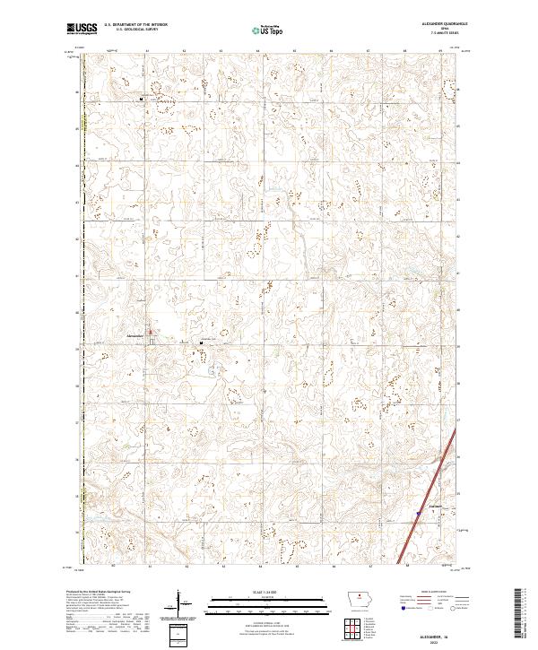
2022 Map of Alexander
USGS Topo · Published 2022About this map
Alexander and Latimer anchor this Franklin County landscape, reflecting the organized township and range system of north-central Iowa. The terrain is defined by a dense grid of agricultural roads, including Wright Ave and Balsam Ave, which delineate the fertile farmland between Buffalo Cr and Spring Cr. Local history is anchored by the Alexander Cem and Holland Cem, while the regional drainage infrastructure is highlighted by Ditch Number 146. The map captures the intersection of rural life and transit, where secondary highways like Co Rd S25 and Co Rd C31 connect these small farming communities. This survey provides a clear look at the enduring geometry of Iowa's prairie-turned-farmland, showing how the natural hydrology of the creeks has been integrated into the modern agricultural landscape.
Find a feature on this map
32 named features on this map. Tap any name to fly to it.
Don’t see what you’re looking for? This feature index may not catch every label — zoom into the map to look around manually.
Map Details
Editions of this 2022 Alexander Map
This is the sole edition of this map. No revisions or reprints were ever made.
Other maps of this area

1954 · Waterloo
USGS Topo · 1:250,000

1955 · Waterloo
USGS Topo · 1:250,000

1972 · Alexander
USGS Topo · 1:24,000

1972 · Thornton
USGS Topo · 1:24,000

1972 · Swaledale
USGS Topo · 1:24,000

1972 · Belmond
USGS Topo · 1:24,000

1972 · Latimer
USGS Topo · 1:24,000
1972 · Goodell
USGS Topo · 1:24,000

1978 · Dows West
USGS Topo · 1:24,000

1979 · Dows East
USGS Topo · 1:24,000