
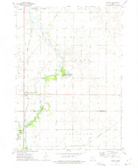
1972 Map of Belmond
USGS Topo · Published 1975About this map
The East Branch Iowa River defines the western edge of this agricultural landscape in Wright County, where the city of Belmond serves as a critical rail and transit hub. The town is marked by its position at the intersection of two major lines, the Chicago and North Western and the Chicago Rock Island and Pacific railroads. These transit corridors frame the community's residential and industrial core, which includes local landmarks like the High Sch and several neighborhood Gravel Pits.
Find a feature on this map
20 named features on this map. Tap any name to fly to it.
Don’t see what you’re looking for? This feature index may not catch every label — zoom into the map to look around manually.
Map Details
Editions of this 1972 Belmond Map
This is the sole edition of this map. No revisions or reprints were ever made.
Other maps of this area

1954 · Waterloo
USGS Topo · 1:250,000

1955 · Waterloo
USGS Topo · 1:250,000

1972 · Cornelia
USGS Topo · 1:24,000

1972 · Alexander
USGS Topo · 1:24,000

1972 · Thornton
USGS Topo · 1:24,000

1972 · Olaf
USGS Topo · 1:24,000
1972 · Goodell
USGS Topo · 1:24,000

1978 · Clarion
USGS Topo · 1:24,000

1978 · Dows West
USGS Topo · 1:24,000

1979 · Dows East
USGS Topo · 1:24,000