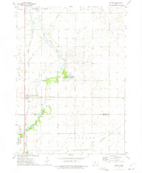
1972 Map of Goodell
USGS Topo · Published 1975About this map
The East Branch Iowa River meanders southward through this rural landscape on the border of Hancock and Wright counties. The town of Goodell serves as the primary settlement, situated along the Chicago Rock Island and Pacific railroad line. This 1970s survey captures the area during a period of established agricultural and recreational land use, evidenced by the presence of the Goodell State Game Management Area and Eldred Sherwood Park along the riverbanks. Local history is grounded at the Amsterdam Cem, while the industrial character of the era is represented by several Gravel Pits and the Chicago and North Western railway cutting through the southeastern corner. The landscape is further marked by modern infrastructure like pipelines and a prominent Radio Tower, reflecting the utility-focused development of mid-century Iowa.
Find a feature on this map
21 named features on this map. Tap any name to fly to it.
Don’t see what you’re looking for? This feature index may not catch every label — zoom into the map to look around manually.
Map Details
Editions of this 1972 Goodell Map
This is the sole edition of this map. No revisions or reprints were ever made.
Other maps of this area

1954 · Mason City
USGS Topo · 1:250,000

1954 · Waterloo
USGS Topo · 1:250,000

1955 · Waterloo
USGS Topo · 1:250,000

1957 · Mason City
USGS Topo · 1:250,000

1958 · Mason City
USGS Topo · 1:250,000

1972 · Cornelia
USGS Topo · 1:24,000

1972 · Alexander
USGS Topo · 1:24,000

1972 · Thornton
USGS Topo · 1:24,000

1972 · Olaf
USGS Topo · 1:24,000

1972 · Belmond
USGS Topo · 1:24,000