
1972 Map of Latimer
USGS Topo · Published 1975About this map
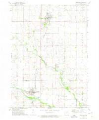
Latimer sits in the southwestern corner of this survey, surrounded by the agricultural grids of Richland and Marion townships. The landscape is defined by the drainage patterns of Otter Creek, Buffalo Creek, and Spring Creek, supplemented by engineering efforts like Ditch No 55. Significant recreational and community spaces are concentrated in the south, including the Beeds Lake State Park and a local Golf Course.
Find a feature on this map
20 named features on this map. Tap any name to fly to it.
Don’t see what you’re looking for? This feature index may not catch every label — zoom into the map to look around manually.
Map Details
Editions of this 1972 Latimer Map
This is the sole edition of this map. No revisions or reprints were ever made.
Other maps of this area

1954 · Waterloo
USGS Topo · 1:250,000

1955 · Waterloo
USGS Topo · 1:250,000

1972 · Alexander
USGS Topo · 1:24,000

1972 · Thornton
USGS Topo · 1:24,000

1972 · Swaledale
USGS Topo · 1:24,000
1972 · Sheffield
USGS Topo · 1:24,000

1972 · Hampton North
USGS Topo · 1:24,000

1979 · Dows East
USGS Topo · 1:24,000

1979 · Coulter
USGS Topo · 1:24,000
1979 · Hampton South
USGS Topo · 1:24,000