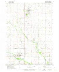
1972 Map of Sheffield
USGS Topo · Published 1975About this map
The agricultural landscape of north-central Iowa is anchored by the rail corridor of the Chicago and North Western as it passes through the towns of Rockwell and Sheffield in the early 1970s. The terrain is defined by the winding course of the West Fork Cedar River and its tributaries, including Beaverdam Creek and Lillibridge Creek. Local industry and community infrastructure are clearly marked, from the industrial Claypit and several Gravel Pits near Sheffield to civic spaces like Linn Grove County Park and Galvin Memorial Park. Genealogists will find several rural burial sites, including Hillside Cem, Sacred Heart Cem, and St John Zion Cem, providing a detailed look at the settlement patterns between Cerro Gordo and Franklin counties.
Find a feature on this map
31 named features on this map. Tap any name to fly to it.
Don’t see what you’re looking for? This feature index may not catch every label — zoom into the map to look around manually.
Map Details
Editions of this 1972 Sheffield Map
This is the sole edition of this map. No revisions or reprints were ever made.
Other maps of this area

1954 · Mason City
USGS Topo · 1:250,000

1954 · Waterloo
USGS Topo · 1:250,000

1955 · Waterloo
USGS Topo · 1:250,000

1957 · Mason City
USGS Topo · 1:250,000

1958 · Mason City
USGS Topo · 1:250,000

1959 · Mason City
USGS Topo · 1:62,500

1959 · Mason City SE
USGS Topo · 1:24,000

1959 · Hanford
USGS Topo · 1:24,000

1972 · Hansell
USGS Topo · 1:24,000
1972 · Dougherty
USGS Topo · 1:24,000