
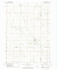
1959 Map of Hanford
USGS Topo · Published 1966About this map
The northern periphery of Mason City meets the rural townships of Bath, Mason, Portland, and Owen in this late 1950s survey of Cerro Gordo County. This landscape is defined by the heavy presence of mid-century rail infrastructure, where the Chicago Great Western, the Chicago and North Western, and the Chicago Rock Island and Pacific railroads crisscross the prairie. These lines provided the essential link between smaller agricultural sidings like Hanford and Hurley and the industrial hub of the city.
Find a feature on this map
20 named features on this map. Tap any name to fly to it.
Don’t see what you’re looking for? This feature index may not catch every label — zoom into the map to look around manually.
Map Details
Editions of this 1959 Hanford Map
This is the sole edition of this map. No revisions or reprints were ever made.
Other maps of this area

1954 · Mason City
USGS Topo · 1:250,000

1954 · Waterloo
USGS Topo · 1:250,000

1955 · Waterloo
USGS Topo · 1:250,000

1957 · Mason City
USGS Topo · 1:250,000

1958 · Mason City
USGS Topo · 1:250,000

1959 · Mason City
USGS Topo · 1:24,000

1959 · Mason City
USGS Topo · 1:62,500

1959 · Nora Springs
USGS Topo · 1:24,000

1959 · Mason City SE
USGS Topo · 1:24,000
1972 · Dougherty
USGS Topo · 1:24,000