1900s (20th Century) Maps of Iowa County, Iowa
Explore 25 historic maps of Iowa County from the 1900s (20th Century). These maps offer a rare glimpse into what life looked like during the 1900s — showing old roads, neighborhoods, homes, and landmarks that have changed or disappeared over time.
Whether you're researching your family's past, planning a metal detecting trip, or studying how Iowa County's landscape evolved across the 1900s, these high-resolution maps are a powerful tool for exploring the history of this region.
- Focus on a specific era: All maps on this page are from the 1900s, giving you a focused view of this time period.
- See what’s changed: Compare century-old streets, trails, and buildings to today's modern landscape using overlays and satellite layers.
- Research with precision: Use these maps for genealogy, historical research, land use analysis, or educational projects.
- View, download, or print: Maps are fully viewable online in high resolution, and can be downloaded or printed for your own records.
Start exploring Iowa County's history through authentic maps from the 1900s. This is your window into the past.
Iowa County, IA maps
(25)- 1903 Map of Fairfax
 1903 Fairfax1903 Print · USGSEastern Iowa's rail-and-river corridor is captured here at the start of the twentieth century, showing the region's transition into an agricultural powerhouse. Genealogists can locate the seven original communal villages of the Amana colonies and old educational sites like Western College.2 unique versions available
 - 1954 Map of Des Moines, 1973 Print
 1954 Des Moines1973 Print · USGSCentral Iowa's evolving landscape is captured here in the early seventies, just as major reservoirs were reshaping the river valleys. Genealogists and historians can trace the rail corridors of the Burlington Northern or locate family roots near Pella, Indianola, and Knoxville.2 unique versions available
 - 1956 Map of Des Moines
 1956 Des Moines1956 Print · USGSCentral Iowa in the mid-fifties shows a landscape defined by bustling rail hubs and deep-rooted agricultural research. Genealogists and researchers can trace the growth of Des Moines and Ames, locate the Sac and Fox Indian Reservation, or study the paths of the Skunk River and South Skunk River.
 - 1957 Map of Des Moines
 1957 Des Moines1957 Print · USGSCentral Iowa's post-war landscape is defined here by the converging rail lines and river valleys that shaped its earliest settlements. Genealogists and historians can trace the paths of the Rock Island Railroad and locate community landmarks in Des Moines, Ames, and Newton.
 - 1958 Map of Davenport, 1968 Print
 1958 Davenport1968 Print · USGSEastern Iowa and western Illinois thrive along the river during the late fifties, defined by the industrial Quad Cities and a robust rail network. Genealogists can trace family roots through settlements like Oasis and Stanwood or along the Cedar River.2 unique versions available
 - 1961 Map of Davenport
 1961 Davenport1961 Print · USGSThe Quad Cities and the eastern Iowa riverlands are captured here in the early sixties, showing the region's transition into a modern industrial and transit hub. Genealogists and historians can trace the paths of major railroads and find river landmarks like Rock Island Arsenal, Huron Island, and the Coralville Reservoir.
 - 1962 Map of Davenport
 1962 Davenport1962 Print · USGSThe Quad Cities and the Mississippi River corridor are shown at their industrial peak just before the interstate era fully transformed the region. Researchers can trace the sprawling rail networks of the Chicago Rock Island and Pacific and find landmarks like the Rock Island Arsenal and Wild Cat Den State Park.
 - 1965 Map of Ladora, 1966 Print
 1965 Ladora1966 Print · USGSIowa County is captured here in the mid-1960s, showing the agricultural heartland between the Iowa River and the local rail corridor. You can trace family history at Koszta Cem and Dayton Cem or locate the old Chicago Rock Island and Pacific line near Ladora.
 - 1965 Map of Marengo, 1966 Print
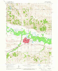 1965 Marengo1966 Print · USGSMarengo and the surrounding Iowa County townships are captured in the mid-1960s as a thriving rail and river hub. Genealogists can locate family sites at Titus Cem, St Martins Ch, and Iowa Valley Sch along the river valley.
 - 1968 Map of Deep River, 1970 Print
 1968 Deep River1970 Print · USGSEastern Iowa farmland in the late sixties reveals a network of small townships and river valleys. Researchers can trace the path of the Old Railroad Grade or locate family sites at Dresden Cem and the town of Deep River.
 - 1968 Map of North English, 1970 Print
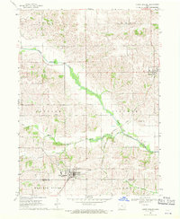 1968 North English1970 Print · USGSNorth English and the surrounding Iowa countryside are captured here in the late sixties, showing a landscape defined by river valleys and rail lines. Genealogists and local historians can trace rural landmarks like Pleasant Grove Ch, Campbell Cem, and the Chicago Milwaukee St Paul and Pacific railroad.
 - 1968 Map of Williamsburg, 1970 Print
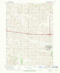 1968 Williamsburg1970 Print · USGSIowa County at the end of the sixties shows a landscape of steady agricultural growth and established rail corridors. Genealogists and local historians can locate early landmarks such as the Pilot Grove Union Cem, North Pilot Sch, and the village of Conroy.
 - 1968 Map of Victor, 1970 Print
 1968 Victor1970 Print · USGSIowa farm country in the late sixties shows a landscape balancing its rail history with new highway development. Researchers can trace family roots at Wilson Cem and Guernsey Cem or follow the Old Railroad Grade near Guernsey.
 - 1968 Map of Williamsburg NW, 1970 Print
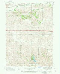 1968 Williamsburg NW1970 Print · USGSIowa County at the end of the sixties reveals a landscape of traditional family farms intersecting with modern transit. Genealogists and historians can locate the Genoa Bluff settlement, the Smith Cem, and the path of the Chicago Rock Island and Pacific railroad.
 - 1968 Map of Hartwick, 1970 Print
 1968 Hartwick1970 Print · USGSThe rural landscape around Hartwick is shown in the late sixties, where the Iowa River meets the borders of several counties. Genealogists and local historians can trace family plots at Union Cem or Holan Cem and locate an Old Railroad Grade through the northern hills.
 - 1968 Map of Millersburg, 1971 Print
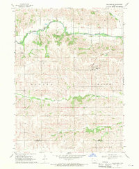 1968 Millersburg1971 Print · USGSIowa and Keokuk counties appear here in the late sixties as a landscape of structured townships and winding river valleys. Researchers can locate family landmarks such as St Bernards Cath Ch, Mt Zion Cem, and the rural crossing at Armah Ch.
 - 1968 Map of Middle Amana, 1971 Print
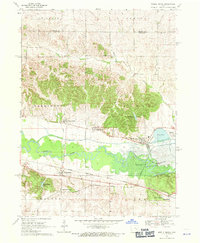 1968 Middle Amana1971 Print · USGSThe Amana Colonies are captured here in the late sixties as they sit along the winding Iowa River and major rail lines. Researchers can trace the layout of traditional settlements like High Amana and Homestead alongside landmarks such as Maas Cem and Lily Pond.
 - 1968 Map of Amana, 1971 Print
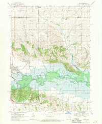 1968 Amana1971 Print · USGSThe Amana Colonies and the Iowa River valley are captured here in the late sixties as the Coralville Reservoir defines the local landscape. Genealogists and historians can trace family landmarks like Hala Cem or explore rail hubs in Amana and Homestead.2 unique versions available
 - 1969 Map of Des Moines
 1969 Des Moines1969 Print · USGSCentral Iowa's fertile plains and growing capital are captured here during the late sixties, a time of major highway expansion and reservoir construction. Genealogists and researchers can trace rural township boundaries, local cemeteries, and rail lines serving towns like Pella, Grinnell, and Oskaloosa.
 - 1973 Map of Oxford, 1975 Print
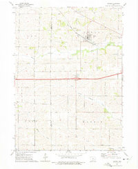 1973 Oxford1975 Print · USGSOxford and its surrounding Iowa townships are caught here in the early 1970s, as the landscape balanced rail-era roots with modern highway expansion. Trace local family history at Oxford Cem or follow the path of the CHICAGO ROCK ISLAND AND PACIFIC railroad.
 - 1973 Map of Amish, 1975 Print
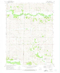 1973 Amish1975 Print · USGSIowa's rural heritage is preserved in this mid-1970s survey of the Johnson and Washington county borders. Genealogists and local historians can trace the foundations of this community through the Mennonite Sch, Windham cemetery, and Amish settlement.
 - 1973 Map of Conroy, 1975 Print
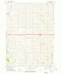 1973 Conroy1975 Print · USGSIowa County at the start of the 1970s shows a landscape of established farmsteads and rural parish life. Genealogists and local historians can trace family roots through numerous sites like Trinity Cem, Dane Cem, and the village of Williamsburg.
 - 1973 Map of Holbrook, 1975 Print
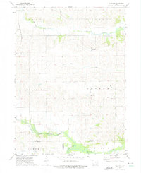 1973 Holbrook1975 Print · USGSIowa County farmland in the early 1970s reveals a quiet landscape shaped by the North English River and the legacy of local settlements. Genealogists can trace family roots through several rural burial grounds, including St Josephs Cem, Piersol Cem, and the community of Holbrook.
 - 1984 Map of Iowa City, 1985 Print
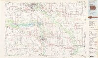 1984 Iowa City1985 Print · USGSEastern Iowa in the mid-eighties shows a landscape of expanding university towns and river-fed conservation lands. Genealogists and local historians can trace the rural networks connecting Iowa City to smaller outposts like West Branch, Solon, and Atalissa.2 unique versions available
 - 1984 Map of Grinnell, 1985 Print
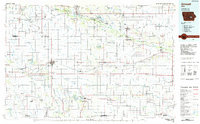 1984 Grinnell1985 Print · USGSCentral Iowa's prairie towns and rail corridors are captured in the mid-1980s, showcasing the agricultural grid and protected marshlands. Researchers can trace historic routes along the Chicago and North Western or locate family roots near the Sac and Fox Indian Reservation and Lake Ponderosa.2 unique versions available
End of results
Showing maps 1-25 of 25
Top cities of Iowa County
- Williamsburg historical maps
- Marengo historical maps
- North English historical maps
- Victor historical maps
- Middle Amana historical maps
- Amana historical maps
See more
Frequently asked questions
- What are the different types of historical maps available for Iowa County?
- What is the oldest map of Iowa County?
- Where can I purchase historical maps of Iowa County for my home or office?
- Where can I download high-res historical maps of Iowa County?
- Are there historical topographic maps available for Iowa County?
- Is there historical aerial imagery available for Iowa County?
- Where are historical maps of Iowa County sourced from?