2020s Maps of Kellogg Township, Iowa
Explore 5 historic maps of Kellogg Township from the 2020s. These maps offer a rare glimpse into what life looked like during the 2020s — showing old roads, neighborhoods, homes, and landmarks that have changed or disappeared over time.
Whether you're researching your family's past, planning a metal detecting trip, or studying how Kellogg Township's landscape evolved across the 2020s, these high-resolution maps are a powerful tool for exploring the history of this region.
- Focus on a specific era: All maps on this page are from the 2020s, giving you a focused view of this time period.
- See what’s changed: Compare century-old streets, trails, and buildings to today's modern landscape using overlays and satellite layers.
- Research with precision: Use these maps for genealogy, historical research, land use analysis, or educational projects.
- View, download, or print: Maps are fully viewable online in high resolution, and can be downloaded or printed for your own records.
Start exploring Kellogg Township's history through authentic maps from the 2020s. This is your window into the past.
Kellogg Township, IA maps
(5)- 2022 Map of Kellogg, 2022 Print
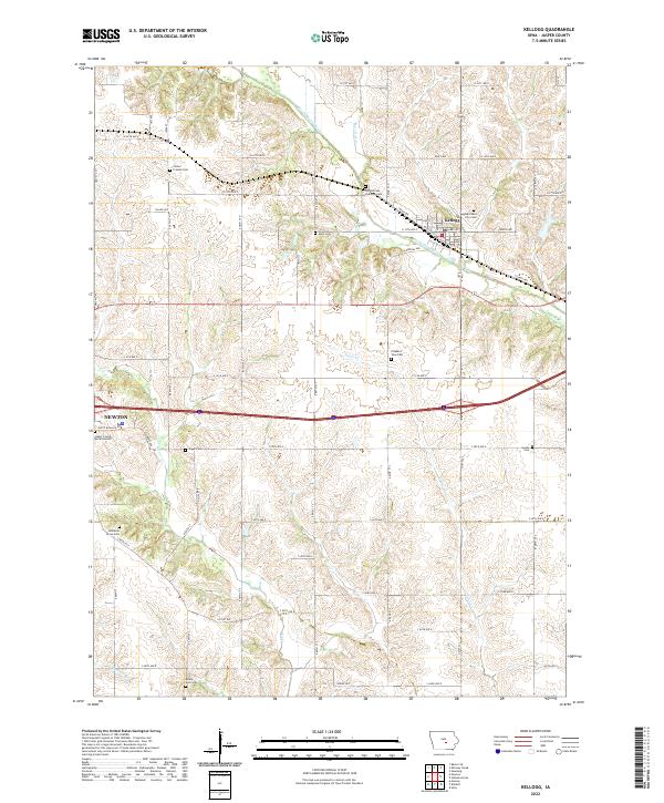 2022 Kellogg2022 Print · USGSJasper County at the start of the 2020s shows a landscape of deep-rooted rural communities and enduring family landmarks. Genealogists and local historians can map out numerous burial sites across the prairie, from Our Silent City Cem to Adamson Grove Cem.
 - 2022 Map of Newton, 2022 Print
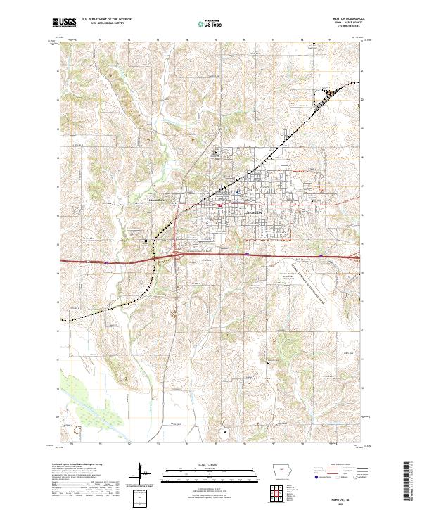 2022 Newton2022 Print · USGSJasper County's seat and the surrounding prairie come into sharp focus in this recent survey of central Iowa. Researchers can trace family history at Newton Union Cem and Sacred Heart Cem or locate civil landmarks like the Jasper County Courthouse.
 - 2022 Map of Alloway Creek, 2022 Print
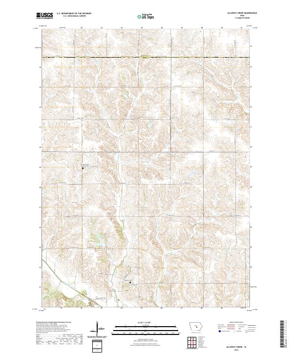 2022 Alloway Creek2022 Print · USGSJasper County and the Marshall County line are shown here in recent years, where a intricate network of prairie streams feeds the Skunk River system. Local historians can locate the German Society Methodist Cem, Rushville Cem, and Ken Wolfe Lake among the section lines.
 - 2022 Map of Baxter SE, 2022 Print
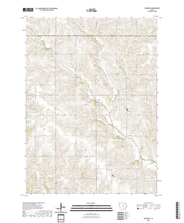 2022 Baxter SE2022 Print · USGSJasper County farmland at the border of Marshall County is mapped here in the early 2020s. Genealogists can locate several local burial sites including Wittemberg Cem, Saint Johns Cem, and Linder Cem along the North Skunk River drainage.
 - 2022 Map of Oakland Acres, 2022 Print
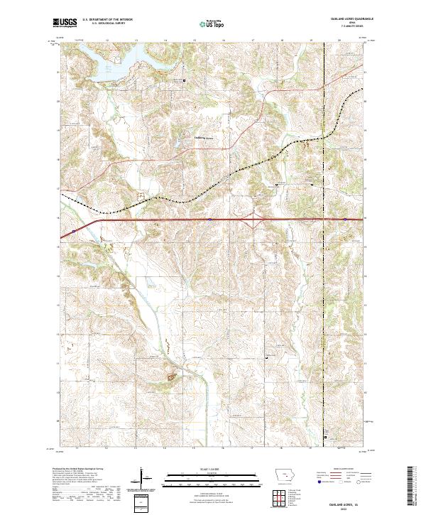 2022 Oakland Acres2022 Print · USGSJasper and Poweshiek counties meet in this agricultural landscape as it appeared in recent years, centered on the Oakland Acres community. Genealogists can trace several historical burial sites including Mormon Grave, Rock Creek Liberty Cem, and Bethel Cem.
End of results
Showing maps 1-5 of 5
Top cities near Kellogg Township
- Newton historical maps
- Grinnell historical maps
- Monroe historical maps
- Baxter historical maps
- Sully historical maps
- Melbourne historical maps
See more
Top neighborhoods of Kellogg Township
Frequently asked questions
- What are the different types of historical maps available for Kellogg Township?
- What is the oldest map of Kellogg Township?
- Where can I purchase historical maps of Kellogg Township for my home or office?
- Where can I download high-res historical maps of Kellogg Township?
- Are there historical topographic maps available for Kellogg Township?
- Is there historical aerial imagery available for Kellogg Township?
- Where are historical maps of Kellogg Township sourced from?