1900s (20th Century) Maps of Maharishi Vedic City, Iowa
Explore 11 historic maps of Maharishi Vedic City from the 1900s (20th Century). These maps offer a rare glimpse into what life looked like during the 1900s — showing old roads, neighborhoods, homes, and landmarks that have changed or disappeared over time.
Whether you're researching your family's past, planning a metal detecting trip, or studying how Maharishi Vedic City's landscape evolved across the 1900s, these high-resolution maps are a powerful tool for exploring the history of this region.
- Focus on a specific era: All maps on this page are from the 1900s, giving you a focused view of this time period.
- See what’s changed: Compare century-old streets, trails, and buildings to today's modern landscape using overlays and satellite layers.
- Research with precision: Use these maps for genealogy, historical research, land use analysis, or educational projects.
- View, download, or print: Maps are fully viewable online in high resolution, and can be downloaded or printed for your own records.
Start exploring Maharishi Vedic City's history through authentic maps from the 1900s. This is your window into the past.
Maharishi Vedic City, IA maps
(11)- 1954 Map of Des Moines, 1973 Print
 1954 Des Moines1973 Print · USGSCentral Iowa's evolving landscape is captured here in the early seventies, just as major reservoirs were reshaping the river valleys. Genealogists and historians can trace the rail corridors of the Burlington Northern or locate family roots near Pella, Indianola, and Knoxville.2 unique versions available
 - 1956 Map of Des Moines
 1956 Des Moines1956 Print · USGSCentral Iowa in the mid-fifties shows a landscape defined by bustling rail hubs and deep-rooted agricultural research. Genealogists and researchers can trace the growth of Des Moines and Ames, locate the Sac and Fox Indian Reservation, or study the paths of the Skunk River and South Skunk River.
 - 1957 Map of Des Moines
 1957 Des Moines1957 Print · USGSCentral Iowa's post-war landscape is defined here by the converging rail lines and river valleys that shaped its earliest settlements. Genealogists and historians can trace the paths of the Rock Island Railroad and locate community landmarks in Des Moines, Ames, and Newton.
 - 1958 Map of Davenport, 1968 Print
 1958 Davenport1968 Print · USGSEastern Iowa and western Illinois thrive along the river during the late fifties, defined by the industrial Quad Cities and a robust rail network. Genealogists can trace family roots through settlements like Oasis and Stanwood or along the Cedar River.2 unique versions available
 - 1961 Map of Davenport
 1961 Davenport1961 Print · USGSThe Quad Cities and the eastern Iowa riverlands are captured here in the early sixties, showing the region's transition into a modern industrial and transit hub. Genealogists and historians can trace the paths of major railroads and find river landmarks like Rock Island Arsenal, Huron Island, and the Coralville Reservoir.
 - 1962 Map of Davenport
 1962 Davenport1962 Print · USGSThe Quad Cities and the Mississippi River corridor are shown at their industrial peak just before the interstate era fully transformed the region. Researchers can trace the sprawling rail networks of the Chicago Rock Island and Pacific and find landmarks like the Rock Island Arsenal and Wild Cat Den State Park.
 - 1969 Map of Des Moines
 1969 Des Moines1969 Print · USGSCentral Iowa's fertile plains and growing capital are captured here during the late sixties, a time of major highway expansion and reservoir construction. Genealogists and researchers can trace rural township boundaries, local cemeteries, and rail lines serving towns like Pella, Grinnell, and Oskaloosa.
 - 1980 Map of Fairfield North, 1981 Print
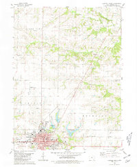 1980 Fairfield North1981 Print · USGSJefferson County in the early eighties reveals the growth of Fairfield alongside its academic and agricultural roots. Genealogists and historians can locate Evergreen Cem, trace the Old Railroad Grade, and explore the rural community of Perlee.
 - 1980 Map of Brookville, 1981 Print
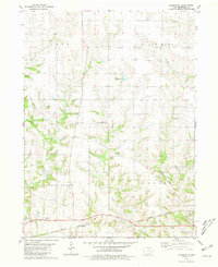 1980 Brookville1981 Print · USGSJefferson County farming communities and family legacies are preserved here in the early eighties. Genealogists can locate several burial grounds like Brooks Cem and Gantz Cem while tracing the Burlington Northern rail line.
 - 1982 Map of Oskaloosa
 1982 Oskaloosa1982 Print · USGSSoutheast Iowa's river valleys and rail hubs are meticulously detailed in the early eighties, showing a landscape of productive farmland and growing municipal centers. Researchers can trace the legacy of small-town life and local industry through features like Union Mills, What Cheer, and the extensive Burlington Northern rail network.
 - 1984 Map of Muscatine, 1985 Print
 1984 Muscatine1985 Print · USGSThe Mississippi River corridor and Iowa prairie meet in the 1980s, showcasing a landscape of river navigation and agricultural heartland. Genealogists and researchers can locate old schools and landmarks like Maharishi International University, Elm Grove Cem, and Lock & Dam No 16.2 unique versions available
End of results
Showing maps 1-11 of 11
Top cities near Maharishi Vedic City
- Fairfield historical maps
- Eldon historical maps
- Brighton historical maps
- Richland historical maps
- Batavia historical maps
- Birmingham historical maps
See more
Frequently asked questions
- What are the different types of historical maps available for Maharishi Vedic City?
- What is the oldest map of Maharishi Vedic City?
- Where can I purchase historical maps of Maharishi Vedic City for my home or office?
- Where can I download high-res historical maps of Maharishi Vedic City?
- Are there historical topographic maps available for Maharishi Vedic City?
- Is there historical aerial imagery available for Maharishi Vedic City?
- Where are historical maps of Maharishi Vedic City sourced from?