1970s Maps of Kossuth County, Iowa
Explore 15 historic maps of Kossuth County from the 1970s. These maps offer a rare glimpse into what life looked like during the 1970s — showing old roads, neighborhoods, homes, and landmarks that have changed or disappeared over time.
Whether you're researching your family's past, planning a metal detecting trip, or studying how Kossuth County's landscape evolved across the 1970s, these high-resolution maps are a powerful tool for exploring the history of this region.
- Focus on a specific era: All maps on this page are from the 1970s, giving you a focused view of this time period.
- See what’s changed: Compare century-old streets, trails, and buildings to today's modern landscape using overlays and satellite layers.
- Research with precision: Use these maps for genealogy, historical research, land use analysis, or educational projects.
- View, download, or print: Maps are fully viewable online in high resolution, and can be downloaded or printed for your own records.
Start exploring Kossuth County's history through authentic maps from the 1970s. This is your window into the past.
Kossuth County, IA maps
(15)- 1972 Map of German Valley
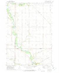
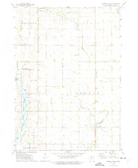 1972 German Valley1972 Print · USGSKossuth County farmland meets the wetlands of the Union Slough in the early seventies, showing a landscape defined by drainage and conservation. Trace local family history through sites like Ramsey Ch, German Valley, and the Lutheran Cem.
 - 1972 Map of Buffalo Center, 1975 Print
 1972 Buffalo Center1975 Print · USGSWinnebago County agriculture and small-town life are centered around Buffalo Center and Rake during the early seventies. Genealogists can locate several local burial grounds, including Olena Mound Cem and Township Cem, while following the path of the Chicago Rock Island and Pacific railroad.
 - 1972 Map of Buffalo Center SW, 1975 Print
 1972 Buffalo Center SW1975 Print · USGSNorth-central Iowa farmland is captured here in the early seventies, centered on the community of Woden. Researchers can trace rural property lines and drainage networks or locate local landmarks like Immanuel Ch, Township Cem, and two private landing strips.
 - 1972 Map of Corwith, 1975 Print
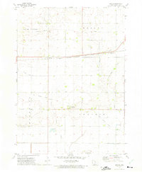
 1972 Corwith1975 Print · USGSCorwith and the surrounding Iowa prairie townships are captured here in the early 1970s, showcasing the intersection of four counties. Researchers can trace family roots at St Marys Cem, follow the Chicago and North Western rail line, or locate Township Cem.
 - 1972 Map of Algona, 1975 Print
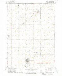
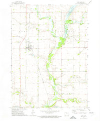
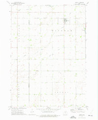
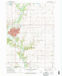 1972 Algona1975 Print · USGSAlgona and the surrounding Kossuth County townships are captured here in the early seventies during a period of steady Midwestern growth. Genealogists and local historians can trace family locations through numerous sites like River View Cemetery, St Cecelias Academy, and the southern village of Irvington.2 unique versions available
 - 1972 Map of Bancroft, 1975 Print
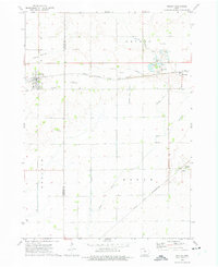
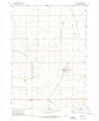
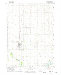 1972 Bancroft1975 Print · USGSBancroft and the surrounding Kossuth County prairies are captured here in the early 1970s as a landscape of precision agriculture and wetland conservation. Researchers can locate family plots at Greenwood Cem or trace the Chicago and North Western rail line as it bypasses the Union Slough National Wildlife Refuge.
 - 1972 Map of St. Joseph, 1975 Print
 1972 St. Joseph1975 Print · USGSNorth-central Iowa farmland meets the winding East Fork Des Moines River in the early seventies. Researchers can trace rural life and transport through the Chicago and North Western railroad and landmarks like St Joseph and Union Cem.
 - 1972 Map of Titonka, 1975 Print
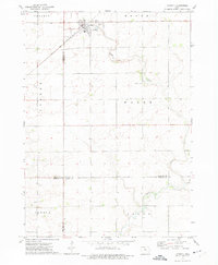
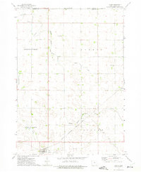
 1972 Titonka1975 Print · USGSThe Titonka region of Kossuth County appears here in the early 1970s, showcasing a landscape of steady rail transport and rural township life. Researchers can trace the path of the Chicago Rock Island and Pacific railroad or locate the Doan Ch and Good Hope Cem.
 - 1972 Map of Burt, 1975 Print
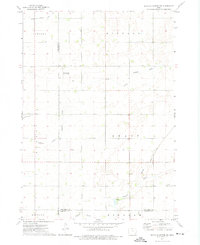
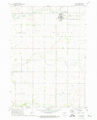
 1972 Burt1975 Print · USGSBurt and the surrounding Kossuth County prairie are documented here during the early 1970s, as the railroad still anchored this agricultural landscape. Researchers can trace family roots at Township Cem and Plum Creek Cem or locate old civic markers like the Townhall.
 - 1972 Map of Sexton, 1975 Print
 1972 Sexton1975 Print · USGSAgricultural life in Kossuth County during the early seventies centers on the rail-side village of Sexton. Researchers can trace the legacy of rural Iowa through the Old Railroad Grade, the Wesley Evergreen Cem, and the small community of St Benedict.
 - 1972 Map of Lu Verne, 1975 Print
 1972 Lu Verne1975 Print · USGSLu Verne and the surrounding prairie townships are captured here in the early seventies as the rail lines still dictated the local geography. Genealogists can trace family farmsteads near Hanna, Hefty, and the local Cem, or follow the Chicago and North Western corridor.
 - 1972 Map of Wesley, 1975 Print
 1972 Wesley1975 Print · USGSThe North-Central Iowa prairie is documented here in the early 1970s, showcasing a landscape defined by heavy rail and extensive drainage engineering. Researchers can locate the small communities of Hutchins and Stilson, or trace family roots at St Joseph Cem and Township Cem.
 - 1972 Map of Woden, 1975 Print
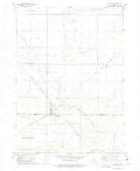
 1972 Woden1975 Print · USGSWoden and the surrounding Iowa townships are shown here in the early seventies, caught in a moment of quiet rural stability. Genealogists and local historians can trace the Chicago Rock Island and Pacific rail line and locate landmarks like Woden Ch or the Township Cem.
 - 1972 Map of Ledyard, 1975 Print
 1972 Ledyard1975 Print · USGSLedyard and the surrounding Kossuth County farm country are shown in the early seventies as a highly engineered prairie landscape. Trace the local rail history along the Chicago and North Western or find family sites at Highland Home Cem and Gerled.
 - 1972 Map of Lakota, 1975 Print
 1972 Lakota1975 Print · USGSThe northern Kossuth County borderlands come to life in the early seventies, showing a landscape of precise township lines and agricultural engineering. Genealogists and local historians can trace family-named sites like Boehm and Stevens or the grounds of St Matthews Cem.
End of results
Showing maps 1-15 of 15
Top cities of Kossuth County
- Algona historical maps
- Bancroft historical maps
- Swea City historical maps
- Titonka historical maps
- Whittemore historical maps
- Burt historical maps
See more
Frequently asked questions
- What are the different types of historical maps available for Kossuth County?
- What is the oldest map of Kossuth County?
- Where can I purchase historical maps of Kossuth County for my home or office?
- Where can I download high-res historical maps of Kossuth County?
- Are there historical topographic maps available for Kossuth County?
- Is there historical aerial imagery available for Kossuth County?
- Where are historical maps of Kossuth County sourced from?