1980s Maps of Kossuth County, Iowa
Explore 15 historic maps of Kossuth County from the 1980s. These maps offer a rare glimpse into what life looked like during the 1980s — showing old roads, neighborhoods, homes, and landmarks that have changed or disappeared over time.
Whether you're researching your family's past, planning a metal detecting trip, or studying how Kossuth County's landscape evolved across the 1980s, these high-resolution maps are a powerful tool for exploring the history of this region.
- Focus on a specific era: All maps on this page are from the 1980s, giving you a focused view of this time period.
- See what’s changed: Compare century-old streets, trails, and buildings to today's modern landscape using overlays and satellite layers.
- Research with precision: Use these maps for genealogy, historical research, land use analysis, or educational projects.
- View, download, or print: Maps are fully viewable online in high resolution, and can be downloaded or printed for your own records.
Start exploring Kossuth County's history through authentic maps from the 1980s. This is your window into the past.
Kossuth County, IA maps
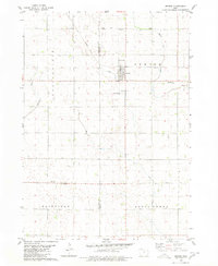
(15)- 1980 Map of Lone Rock
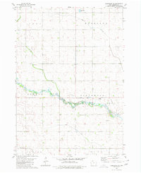
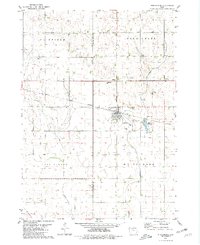
 1980 Lone Rock1980 Print · USGSKossuth County farming country is documented here in the late twentieth century, showing a landscape defined by prairie streams and drainage projects. Genealogy researchers can locate Lone Rock and rural landmarks like Immanuel Ch or the Township Cem.
 - 1980 Map of Fenton
 1980 Fenton1980 Print · USGSKossuth and Palo Alto counties are captured here in the late seventies, showing a landscape of productive Iowa prairie and evolving small towns. Trace rural community roots at St Johns Cem, St Lukes Ch, and the settlement of Fairville.
 - 1980 Map of Seneca
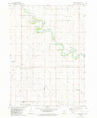 1980 Seneca1980 Print · USGSThe rural landscape of northern Iowa is captured here in the late twentieth century, showing the farmsteads and resource extraction sites along the East Fork Des Moines River. Genealogists and local historians can trace legacy sites like St Pauls Cem and Blakjer Ch.
 - 1980 Map of Armstrong
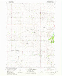
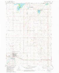 1980 Armstrong1980 Print · USGSArmstrong and the surrounding northern Iowa prairie are captured here in the late twentieth century, showing a landscape defined by conservation and rail. Researchers can trace local history at Township Cemetery and the Chicago and North Western line.
 - 1980 Map of Swea City
 1980 Swea City1980 Print · USGSSwea City and the surrounding Iowa-Minnesota borderlands are captured here in the 1980s, showcasing a landscape defined by industrial rail and intensive agriculture. Genealogists can locate Lutheran Cemetery and Township Cemetery or trace the Chicago Rock Island and Pacific rail line.
 - 1980 Map of Armstrong SE
 1980 Armstrong SE1980 Print · USGSKossuth County farmland is captured here in the mid-1970s, showing the intersection of several rural townships. Genealogists can locate family-named sites like Johannesen and the Buaer Landing Strip along the East Fork Des Moines River.
 - 1980 Map of Hobarton
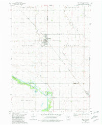
 1980 Hobarton1980 Print · USGSKossuth County agriculture and infrastructure are captured here in the late twentieth century. Genealogists and local researchers can trace family lands near the Chicago Milwaukee St Paul and Pacific rail line, the County Home, and Hobarton.
 - 1980 Map of West Bend, 1981 Print
 1980 West Bend1981 Print · USGSWest Bend and its surrounding farmsteads are shown during the early 1980s at the junction of four Iowa counties. Researchers can trace the Chicago Rock Island and Pacific rail line between West Bend and Ottosen or locate family sites near McKnights Point and Union Cem.
 - 1980 Map of West Bend NE, 1981 Print
 1980 West Bend NE1981 Print · USGSNorth-central Iowa farmland is captured here in the early eighties, showing the transition between Kossuth and Humboldt counties. Genealogists and rail historians can trace the Chicago Rock Island and Pacific line through Ottosen and find local landmarks like the Townhall in Riverdale.
 - 1980 Map of Whittemore, 1981 Print
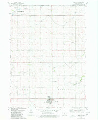
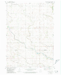
 1980 Whittemore1981 Print · USGSWhittemore and its surrounding townships show a settled agricultural landscape in the early 1980s. Researchers can locate family roots at St Michaels Cem or St Pauls Cem and follow the old Chicago Milwaukee and Pacific rail corridor through town.
 - 1984 Map of Humboldt, 1985 Print
 1984 Humboldt1985 Print · USGSNorth Central Iowa in the mid-eighties shows a deeply integrated landscape of agricultural drainage and rail-connected settlements. Trace the rural layout of the era via the Chicago and North Western line, Rush Lake, and Lizard Lake County Park.2 unique versions available
 - 1984 Map of Iowa Falls, 1985 Print
 1984 Iowa Falls1985 Print · USGSNorth-central Iowa is documented here during the mid-eighties, showing a landscape of traditional rail towns and extensive wildlife management areas. Researchers can trace family history through settlements like Belmond, Dows, and Ackley, or locate landmarks like Beeds Lake State Park.2 unique versions available
 - 1985 Map of Mason City
 1985 Mason City1985 Print · USGSThe Northern Iowa and Southern Minnesota borderlands are captured here in the mid-eighties, showing a region defined by agricultural drainage and rail heritage. Genealogists and historians can trace the grid of rural townships and find local landmarks like Pilot Knob State Park, Nora Springs, and Clear Lake State Park.2 unique versions available
 - 1985 Map of Estherville
 1985 Estherville1985 Print · USGSNorthern Iowa in the mid-eighties was a landscape of grid-patterned agriculture and vast marshland conservation. Genealogists can locate rural landmarks like Oak Hill Cemetery and Fourmile Lake School, or trace the rail lines of the Chicago and North Western.2 unique versions available
 - 1985 Map of Fairmont, 1991 Print
 1985 Fairmont1991 Print · USGSSouthern Minnesota in the mid-eighties shows a robust network of prairie towns and rail-connected agricultural hubs. Genealogists can trace family footprints across Rolling Green and Manyaska or locate old homesteads near Fox Lake and the Chicago & North Western line.
End of results
Showing maps 1-15 of 15
Top cities of Kossuth County
- Algona historical maps
- Bancroft historical maps
- Swea City historical maps
- Titonka historical maps
- Whittemore historical maps
- Burt historical maps
See more
Frequently asked questions
- What are the different types of historical maps available for Kossuth County?
- What is the oldest map of Kossuth County?
- Where can I purchase historical maps of Kossuth County for my home or office?
- Where can I download high-res historical maps of Kossuth County?
- Are there historical topographic maps available for Kossuth County?
- Is there historical aerial imagery available for Kossuth County?
- Where are historical maps of Kossuth County sourced from?