Old Maps of Lyon County, Iowa for Hiking & Exploration
Hike through history with 136 historic maps of Lyon County. Explore old trails, ghost towns, and forgotten backroads — perfect for outdoor adventurers and local explorers.
- Rediscover forgotten places: Map out old mining camps, roads, and footpaths that no longer exist on modern maps.
- Layer with modern tools: Combine with LiDAR or satellite views to plan hikes through historical terrain.
- Made for exploration: Popular among hikers, overlanders, and local history lovers.
Use these maps to find adventure and explore the hidden past of Lyon County.
Lyon County, IA maps
(136)- 1897 Map of Canton, 1954 Print
 1897 Canton1954 Print · USGSSoutheastern South Dakota and the Iowa borderlands were undergoing a railway-driven expansion during the 1890s. Genealogists and historians can trace early settlements like Beloit, Centerville, and Lennox as they grew along the Big Sioux River.
 - 1900 Map of Canton
 1900 Canton1900 Print · USGSSoutheastern South Dakota and the Iowa borderlands are captured here at a peak of late-nineteenth-century rail expansion. Genealogists can trace the early foundations of towns like Canton, Centerville, and Beresford along the Big Sioux River.2 unique versions available
 - 1954 Map of Fairmont, 1967 Print
 1954 Fairmont1967 Print · USGSThe prairie landscape of southern Minnesota and northern Iowa comes alive in this mid-century survey of the Coteau des Prairies. Genealogists and historians can trace the rail-connected growth of Fairmont and Blue Earth or locate family roots near St Kilian Ch and Union Slough National Wildlife Refuge.3 unique versions available
 - 1955 Map of Sioux Falls, 1967 Print
 1955 Sioux Falls1967 Print · USGSThe eastern South Dakota and western Minnesota borderlands come alive in the mid-fifties, showing the vital rail-to-river connections of the era. Genealogists can trace family footprints across townships like Madison and Pipestone, while following the paths of the Big Sioux River and the Chicago and North Western line.3 unique versions available
 - 1958 Map of Sioux Falls
 1958 Sioux Falls1958 Print · USGSThe tri-state borderlands of South Dakota, Minnesota, and Iowa are captured here during the mid-century peak of the regional rail network. Genealogists and historians can trace local landmarks like Augustana Academy, the St Marys Cem, and the path of the Illinois Central through Rock Rapids.
 - 1958 Map of Fairmont
 1958 Fairmont1958 Print · USGSThe borderlands of southern Minnesota and northern Iowa come alive in the mid-1950s, showing a landscape defined by glacial lakes and rail-line commerce. Researchers can trace historic landmarks like Lakeside Laboratory, Gridley Station, and the Bancroft Wildlife Refuge across the prairie.
 - 1962 Map of Klondike, 1964 Print
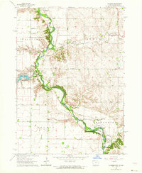 1962 Klondike1964 Print · USGSThe Big Sioux River valley comes alive in the early sixties, showing the rural landscape where Iowa meets South Dakota. Trace family roots at Springdale Cem or locate old rail sidings in Granite and Klondike.
 - 1962 Map of Canton, 1964 Print
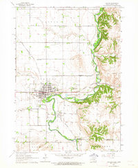 1962 Canton1964 Print · USGSThe South Dakota and Iowa border comes alive in the early sixties as the Big Sioux River winds past bustling prairie towns. Genealogists can locate several rural schools and cemeteries, including Augustana Academy, Beloit Cem, and York Sch.2 unique versions available
 - 1962 Map of Brandon, 1964 Print
 1962 Brandon1964 Print · USGSThe South Dakota and Iowa borderlands come to life in this early sixties survey of the Big Sioux River valley. Genealogists and historians can trace the early layouts of Brandon and Rowena, or locate family sites at Beaver Valley Ch and local Quarries.2 unique versions available
 - 1967 Map of Valley Springs, 1968 Print
 1967 Valley Springs1968 Print · USGSThe tri-state border region of the Upper Midwest is captured in the late sixties, showcasing the intersection of rail and road. Trace family roots and vanished landmarks near Valley Springs, Benclare, and the Nerison Cem.2 unique versions available
 - 1967 Map of Rushmore, 1968 Print
 1967 Rushmore1968 Print · USGSNobles County is shown in the late sixties as a thriving agricultural and rail corridor along the Minnesota-Iowa border. Genealogists can locate family-named landmarks and rural centers like Sunset Rest Cem, Emmanuel Ch, and the Townhall near the Rock River.2 unique versions available
 - 1967 Map of Hills, 1968 Print
 1967 Hills1968 Print · USGSSouthwestern Rock County is shown here in the late sixties, a landscape where the Illinois Central and Chicago and North Western railroads defined the local economy. Researchers can trace historic property boundaries and locate community landmarks like Beaver Valley Cem and School No 1851.2 unique versions available
 - 1967 Map of Adrian SW, 1968 Print
 1967 Adrian SW1968 Print · USGSThe rural borderlands between Minnesota and Iowa are captured here in the late sixties, showcasing a landscape of high-prairie agriculture. Genealogists and historians can trace the Chicago Rock Island and Pacific rail line and family farmsteads near Kanaranzi Creek.2 unique versions available
 - 1967 Map of Ellsworth, 1969 Print
 1967 Ellsworth1969 Print · USGSThe Minnesota-Iowa borderlands near Ellsworth and Kanaranzi are captured here in the late sixties, showing a landscape defined by rail and agriculture. Genealogists and local historians can trace the Chicago Rock Island and Pacific line and family burial sites like Ashwood and St Marys Cem.
 - 1967 Map of Ash Creek, 1969 Print
 1967 Ash Creek1969 Print · USGSSouthwestern Minnesota and northwestern Iowa meet here in the late sixties along the winding Rock River. Genealogists and local historians can trace family farmsteads and rural infrastructure, including School No 1839, Ebenezer Ch, and the tiny settlement of Ash Creek.2 unique versions available
 - 1971 Map of Edna, 1973 Print
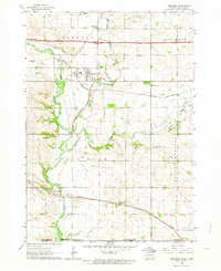
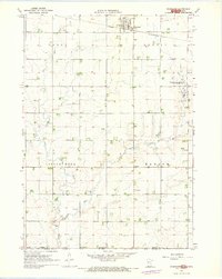
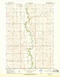
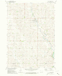
 1971 Edna1973 Print · USGSLyon County, Iowa, is captured in the early seventies at a crossroads of the regional rail system. Genealogists and rail historians can trace the intersecting lines of the Illinois Central and Chicago Rock Island and Pacific near Edna.
 - 1971 Map of Lester, 1973 Print
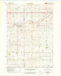
 1971 Lester1973 Print · USGSLester and the surrounding northwest Iowa townships are captured here in the early 1970s, as the railroad still dictated the local economy. Genealogists and researchers can locate family sites near Hillside Cem or trace the Burlington Northern line and Mud Creek.
 - 1971 Map of Inwood, 1973 Print
 1971 Inwood1973 Print · USGSInwood and its surrounding townships are captured in the early 1970s, as the railroad still dictated the rhythm of this agricultural region. Genealogists can trace family footprints across Richland and Centennial townships, locating Bethlehem Cem and Our Saviors Ch.
 - 1971 Map of Larchwood, 1973 Print
 1971 Larchwood1973 Print · USGSThe northern edge of Iowa meets the plains of South Dakota and Minnesota in the early 1970s, centered on the community of Larchwood. Genealogists and local historians can trace the town's layout and its rural surroundings, including St Marys Cem, West Lyon Sch, and the small Zangger Airport.
 - 1971 Map of George West, 1973 Print
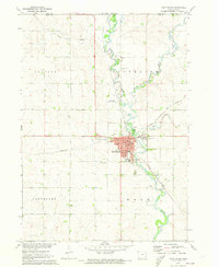
 1971 George West1973 Print · USGSNorthwest Iowa's agricultural prairie is captured in the early seventies, centered on the railroad town of George. Genealogists and local historians can trace the Illinois Central rail line, find Evergreen Cem, and locate Hope Ch near the Little Rock River.2 unique versions available
 - 1971 Map of Rock Rapids, 1973 Print
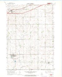
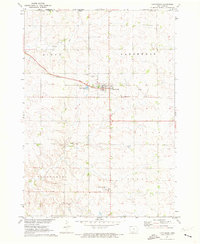
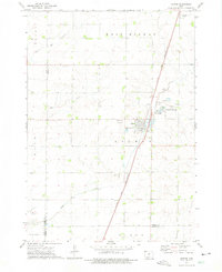
 1971 Rock Rapids1973 Print · USGSNorthwest Iowa near the Minnesota border appears here as a thriving rail and river hub in the early seventies. You can trace the path of the Chicago Rock Island and Pacific railroad through Rock Rapids and locate family landmarks like Holy Name Cem or the Christian Sch.
 - 1971 Map of Doon, 1973 Print
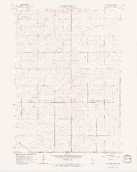
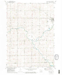
 1971 Doon1973 Print · USGSDoon and its surrounding river valleys are captured here in the early seventies during a period of steady agricultural and rail activity. Researchers can trace the Burlington Northern line through town or locate family sites near Township Cem and Lakewood Corner.
 - 1971 Map of Alvord, 1973 Print
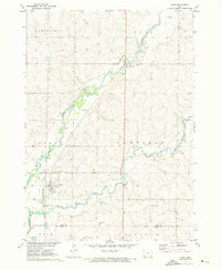
 1971 Alvord1973 Print · USGSThe town of Alvord and the surrounding prairie townships are captured here in the early 1970s. Genealogists and local historians can trace family burial sites at St Marys Cem and Hillside Cem or follow the Burlington Northern rail corridor.
 - 1972 Map of Ashton, 1975 Print
 1972 Ashton1975 Print · USGSOsceola County and the town of Ashton are captured in the early seventies, showcasing a landscape of rail-connected commerce and prairie agriculture. Genealogists and local historians can trace family plots at St Marys Cem or locate the site of Willemssen along the county line.
 - 1972 Map of Little Rock, 1975 Print
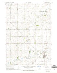
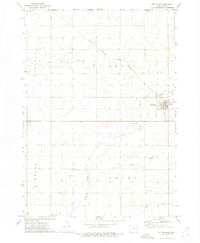 1972 Little Rock1975 Print · USGSThe Lyon County prairie meets the Minnesota state line in the early 1970s, centered on the railroad crossing at Little Rock. Local researchers can trace family landmarks like Zion Cem, Bethel Ch, and the old Rock Island and Pacific rail line.
Showing maps 1-25 of 136
Top cities of Lyon County
- Rock Rapids historical maps
- George historical maps
- Inwood historical maps
- Doon historical maps
- Little Rock historical maps
- Lester historical maps
See more
Frequently asked questions
- What are the different types of historical maps available for Lyon County?
- What is the oldest map of Lyon County?
- Where can I purchase historical maps of Lyon County for my home or office?
- Where can I download high-res historical maps of Lyon County?
- Are there historical topographic maps available for Lyon County?
- Is there historical aerial imagery available for Lyon County?
- Where are historical maps of Lyon County sourced from?