
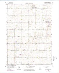
1967 Map of Rushmore
USGS Topo · Published 1968About this map
The town of Rushmore serves as the primary hub in this late-1960s landscape, situated along the Chicago and North Western railroad line. The surrounding terrain is organized into civil townships including Olney, Dewald, Little Rock, and Ransom, reflecting a dense grid of rural sections. This survey captures a moment when the regional economy was tied to both the railway and the numerous Gravel Pits scattered across the landscape.
Find a feature on this map
34 named features on this map. Tap any name to fly to it.
Don’t see what you’re looking for? This feature index may not catch every label — zoom into the map to look around manually.
Map Details
Editions of this 1967 Rushmore Map
2 editions found
Other maps of this area

1954 · Fairmont
USGS Topo · 1:250,000

1958 · Fairmont
USGS Topo · 1:250,000

1960 · Reading
USGS Topo · 1:24,000

1960 · Bigelow
USGS Topo · 1:24,000

1967 · Adrian SW
USGS Topo · 1:24,000

1967 · Adrian NE
USGS Topo · 1:24,000

1967 · Adrian
USGS Topo · 1:24,000
1972 · Little Rock
USGS Topo · 1:24,000

1972 · Sibley West
USGS Topo · 1:24,000
1972 · Sibley East
USGS Topo · 1:24,000