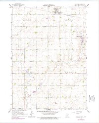
1967 Map of Rushmore
USGS Topo · Published 1977About this map
Rushmore serves as the primary settlement hub in this southwestern Minnesota landscape, situated at the intersection of local roads and the Chicago and North Western railroad line. The surrounding terrain is defined by the winding course of the Little Rock River and its tributary, Little Rock Creek, which carve through the agricultural landscape. Religious and civic life are anchored by features like Emmanuel Ch and the rural Townhall, while the Sunset Rest Cem provides a genealogical point of interest just north of the rail line. Small infrastructure markers, including a prominent Water Tank, underscore the town's role as a support center for the surrounding farmsteads. The mapping reveals a well-organized grid of sections, typical of the Midwestern plains, where water sources dictated the early placement of buildings and bridges.
Find a feature on this map
8 named features on this map. Tap any name to fly to it.
Don’t see what you’re looking for? This feature index may not catch every label — zoom into the map to look around manually.
Map Details
Editions of this 1967 Rushmore Map
2 editions found
Other maps of this area

1954 · Fairmont
USGS Topo · 1:250,000

1958 · Fairmont
USGS Topo · 1:250,000

1960 · Reading
USGS Topo · 1:24,000

1960 · Bigelow
USGS Topo · 1:24,000

1967 · Rushmore
USGS Topo · 1:24,000

1967 · Adrian SW
USGS Topo · 1:24,000

1967 · Adrian NE
USGS Topo · 1:24,000

1967 · Adrian
USGS Topo · 1:24,000
1972 · Little Rock
USGS Topo · 1:24,000

1972 · Sibley West
USGS Topo · 1:24,000