Old Maps of Nobles County, Minnesota
Explore 139 old maps of Nobles County, spanning from 1954 to today. These high-resolution historic maps reveal how streets, neighborhoods, landmarks, and natural features evolved over time — perfect for genealogy, metal detecting, research, and local history exploration.
What you can do with these maps:
- See how Nobles County changed over time: Compare historical maps to modern-day views to trace roads, homesites, rail lines & more.
- View detailed metadata: Each map includes creators, publishers, year, scale, and archive source.
- Overlay maps with satellite & LiDAR: Visualize the past alongside modern tools to explore terrain & human change.
- Trusted historical sources: Maps sourced from the USGS, Library of Congress, and other archives.
- Access maps your way: View online, download high-res files, or order prints for personal or research use.
Start exploring old maps of Nobles County to uncover forgotten places, hidden landmarks, and the deep history beneath your feet.
Nobles County, MN maps
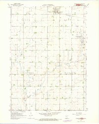
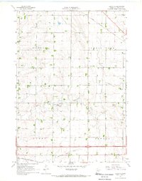
(139)- 1954 Map of Fairmont, 1967 Print
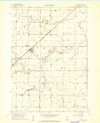
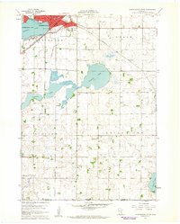
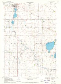
 1954 Fairmont1967 Print · USGSThe prairie landscape of southern Minnesota and northern Iowa comes alive in this mid-century survey of the Coteau des Prairies. Genealogists and historians can trace the rail-connected growth of Fairmont and Blue Earth or locate family roots near St Kilian Ch and Union Slough National Wildlife Refuge.3 unique versions available
 - 1955 Map of Sioux Falls, 1967 Print
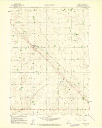
 1955 Sioux Falls1967 Print · USGSThe eastern South Dakota and western Minnesota borderlands come alive in the mid-fifties, showing the vital rail-to-river connections of the era. Genealogists can trace family footprints across townships like Madison and Pipestone, while following the paths of the Big Sioux River and the Chicago and North Western line.3 unique versions available
 - 1958 Map of Sioux Falls
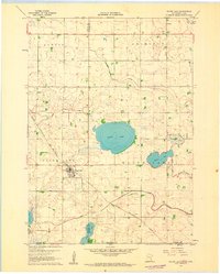
 1958 Sioux Falls1958 Print · USGSThe tri-state borderlands of South Dakota, Minnesota, and Iowa are captured here during the mid-century peak of the regional rail network. Genealogists and historians can trace local landmarks like Augustana Academy, the St Marys Cem, and the path of the Illinois Central through Rock Rapids.
 - 1958 Map of Fairmont
 1958 Fairmont1958 Print · USGSThe borderlands of southern Minnesota and northern Iowa come alive in the mid-1950s, showing a landscape defined by glacial lakes and rail-line commerce. Researchers can trace historic landmarks like Lakeside Laboratory, Gridley Station, and the Bancroft Wildlife Refuge across the prairie.
 - 1960 Map of Brewster, 1961 Print
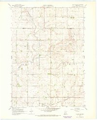
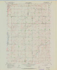
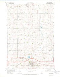
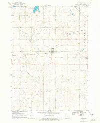
 1960 Brewster1961 Print · USGSThe town of Brewster and its surrounding townships are shown here during the early 1960s as a thriving agricultural and rail corridor. Genealogists can locate Trinity Cem and Hersey Cem, or trace the path of the Chicago and North Western line.2 unique versions available
 - 1960 Map of Reading, 1961 Print
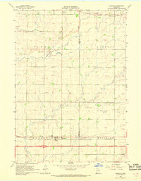
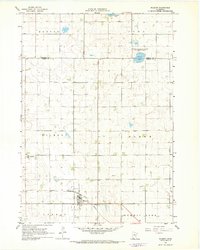
 1960 Reading1961 Print · USGSNobles County farming communities and rail lines are captured here in the early sixties. Researchers can trace family sites near Reading and locate landmarks like Summit Lake Cem or the Brethren Ch along the prairie roads.2 unique versions available
 - 1960 Map of Bigelow, 1961 Print
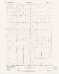
 1960 Bigelow1961 Print · USGSNobles County's southern border at the turn of the 1960s reveals a landscape of prairie farms and vital rail links. Genealogists can locate Ransom Cem and the settlement of Org near the Chicago and North Western railroad.2 unique versions available
 - 1960 Map of Worthington North, 1962 Print
 1960 Worthington North1962 Print · USGSThe northern reaches of Worthington come into focus in the early sixties, showing the town's expansion toward the municipal airport. Genealogists can locate family landmarks such as the Townhall, Christian Sch, and the County Fairground.3 unique versions available
 - 1960 Map of Worthington South, 1962 Print
 1960 Worthington South1962 Print · USGSWorthington and the surrounding prairie townships are captured here at the start of the sixties, where rail lines and lakefront parks met rural farmsteads. Researchers can trace the legacy of local congregations and commerce at Indian Lake Ch, St Marys Cem, and the old Drive-in Theater.2 unique versions available
 - 1960 Map of Round Lake, 1962 Print
 1960 Round Lake1962 Print · USGSNear the Minnesota and Iowa border in the early sixties, this prairie landscape shows a mix of rail-side commerce and engineered wetlands. Trace the path of the Chicago Rock Island and Pacific through the village of Round Lake or locate rural landmarks like Grace Ch and Townhall.
 - 1967 Map of Slayton SW, 1968 Print
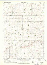
 1967 Slayton SW1968 Print · USGSThe rural prairie of Nobles County is captured in the late sixties, showing the vital rail corridor of the Chicago Rock Island and Pacific as it served Lismore. Researchers can trace the drainage patterns of Champepadan Creek and locate several early Gravel Pits and the local Gaging Station.
 - 1967 Map of Magnolia, 1968 Print
 1967 Magnolia1968 Print · USGSSouthwestern Minnesota's prairie borderlands are captured in the late sixties as the modern interstate era arrived. Researchers can trace the legacy of early settlements via Kenneth, School No 60, and the older Chicago and North Western rail line.
 - 1967 Map of Rushmore, 1968 Print
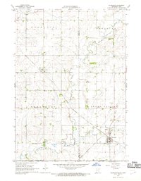
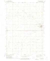
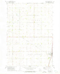
 1967 Rushmore1968 Print · USGSNobles County is shown in the late sixties as a thriving agricultural and rail corridor along the Minnesota-Iowa border. Genealogists can locate family-named landmarks and rural centers like Sunset Rest Cem, Emmanuel Ch, and the Townhall near the Rock River.2 unique versions available
 - 1967 Map of Kenneth, 1968 Print
 1967 Kenneth1968 Print · USGSAcross the prairie townships of southwest Minnesota in the 1960s, this survey shows the rail-and-road network connecting Kenneth and Leota. Genealogists and researchers can trace the Chicago Rock Island and Pacific rail line and locate the Leota Cem.
 - 1967 Map of Wilmont, 1968 Print
 1967 Wilmont1968 Print · USGSThe agricultural heart of Nobles County is captured here in the late sixties as the Chicago Rock Island and Pacific railroad still serves Wilmont. Researchers can trace old property lines across Bloom and Larkin townships or locate the St Kilian settlement and Wilmont Cem.
 - 1967 Map of Adrian SW, 1968 Print
 1967 Adrian SW1968 Print · USGSThe rural borderlands between Minnesota and Iowa are captured here in the late sixties, showcasing a landscape of high-prairie agriculture. Genealogists and historians can trace the Chicago Rock Island and Pacific rail line and family farmsteads near Kanaranzi Creek.2 unique versions available
 - 1967 Map of Adrian NE, 1969 Print
 1967 Adrian NE1969 Print · USGSNobles County's agricultural heartland is documented here during the late 1960s, showing the intersection of four key townships. Genealogists and local historians can trace property lines between Larkin and Dewald along the Chicago Rock Island and Pacific railroad.
 - 1967 Map of Adrian, 1969 Print
 1967 Adrian1969 Print · USGSNobles County's agricultural and rail heartland is captured here in the late 1960s as a vital crossroads. Researchers can trace the dual rail lines of the Chicago and North Western and locate family plots at St Adrian Cem and Lismore Cem.
 - 1967 Map of Ellsworth, 1969 Print
 1967 Ellsworth1969 Print · USGSThe Minnesota-Iowa borderlands near Ellsworth and Kanaranzi are captured here in the late sixties, showing a landscape defined by rail and agriculture. Genealogists and local historians can trace the Chicago Rock Island and Pacific line and family burial sites like Ashwood and St Marys Cem.
 - 1970 Map of Dundee, 1972 Print
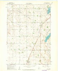
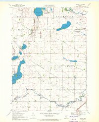 1970 Dundee1972 Print · USGSDundee and Kinbrae thrive at the junction of two major rail lines in this early 1970s landscape of the Minnesota prairie. Genealogists and local historians can trace family ties at St Marys Cemetery or Kinbrae Cemetery and explore the early wildlife management areas surrounding Talcot Lake and Graham Lake.2 unique versions available
 - 1970 Map of Fulda, 1972 Print
 1970 Fulda1972 Print · USGSIn the early 1970s, the prairie town of Fulda remained a vital rail crossroads where the Chicago and North Western met the Milwaukee Road. Local historians can trace the development of the High School and the recreational lands surrounding West Graham Lake and Fulda Second Lake.
 - 1970 Map of Fulda SW, 1972 Print
 1970 Fulda SW1972 Print · USGSNobles and Murray Counties appear here in the early 1970s, showcasing a landscape of prairie townships and agricultural drainage. Researchers can locate the Seward Cem, the rural settlement at Pfingsten, and the path of the Chicago Milwaukee St Paul and Pacific railroad.
 - 1970 Map of Harris, 1972 Print
 1970 Harris1972 Print · USGSOsceola County farmland is captured here in the early 1970s, centered on the railroad town of Harris. Genealogists and local historians can trace the paths of the Chicago Rock Island and Pacific or locate rural burials at Fairview Cem and Union Cem.
 - 1972 Map of Little Rock, 1975 Print
 1972 Little Rock1975 Print · USGSThe Lyon County prairie meets the Minnesota state line in the early 1970s, centered on the railroad crossing at Little Rock. Local researchers can trace family landmarks like Zion Cem, Bethel Ch, and the old Rock Island and Pacific rail line.
 - 1972 Map of Sibley West, 1975 Print
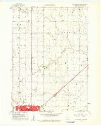
 1972 Sibley West1975 Print · USGSOsceola County at the start of the seventies shows a landscape defined by the intersection of major rail lines and a thriving agricultural grid. Genealogists can locate family sites near Holman Cem, Argo, and the Sibley town site.
Showing maps 1-25 of 139
Top cities of Nobles County
- Worthington historical maps
- Adrian historical maps
- Ellsworth historical maps
- Brewster historical maps
- Leota historical maps
- Round Lake historical maps
See more
Frequently asked questions
- What are the different types of historical maps available for Nobles County?
- What is the oldest map of Nobles County?
- Where can I purchase historical maps of Nobles County for my home or office?
- Where can I download high-res historical maps of Nobles County?
- Are there historical topographic maps available for Nobles County?
- Is there historical aerial imagery available for Nobles County?
- Where are historical maps of Nobles County sourced from?