2020s Maps of Nobles County, Minnesota
Explore 22 historic maps of Nobles County from the 2020s. These maps offer a rare glimpse into what life looked like during the 2020s — showing old roads, neighborhoods, homes, and landmarks that have changed or disappeared over time.
Whether you're researching your family's past, planning a metal detecting trip, or studying how Nobles County's landscape evolved across the 2020s, these high-resolution maps are a powerful tool for exploring the history of this region.
- Focus on a specific era: All maps on this page are from the 2020s, giving you a focused view of this time period.
- See what’s changed: Compare century-old streets, trails, and buildings to today's modern landscape using overlays and satellite layers.
- Research with precision: Use these maps for genealogy, historical research, land use analysis, or educational projects.
- View, download, or print: Maps are fully viewable online in high resolution, and can be downloaded or printed for your own records.
Start exploring Nobles County's history through authentic maps from the 2020s. This is your window into the past.
Nobles County, MN maps
(22)- 2022 Map of Kenneth, 2022 Print
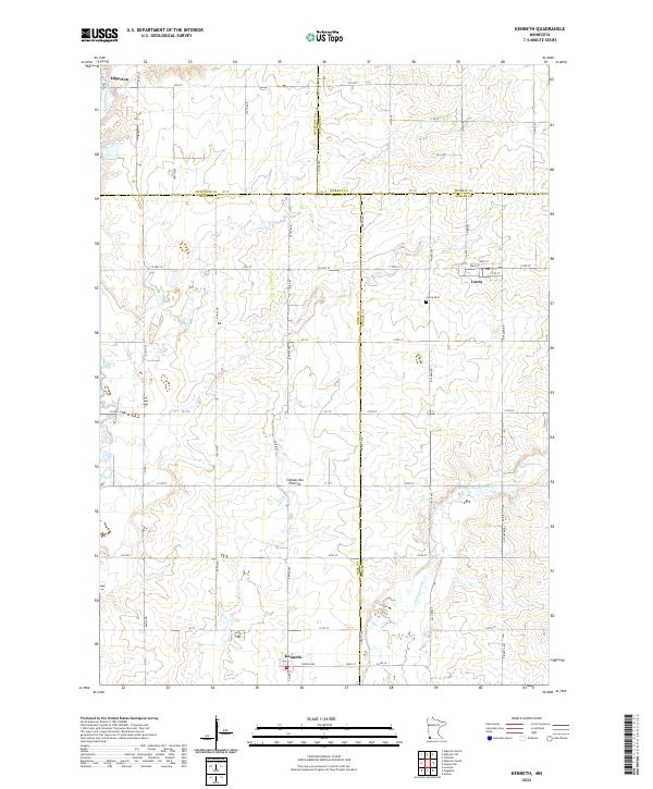 2022 Kenneth2022 Print · USGSSouthwestern Minnesota prairie life is captured here in the early 2020s, showing the intersection of four counties atop the Coteau des Prairies. Genealogists and local historians can trace the rural layouts of Kenneth and Leota, including the location of the Leota Cem.
 - 2022 Map of Wilmont, 2022 Print
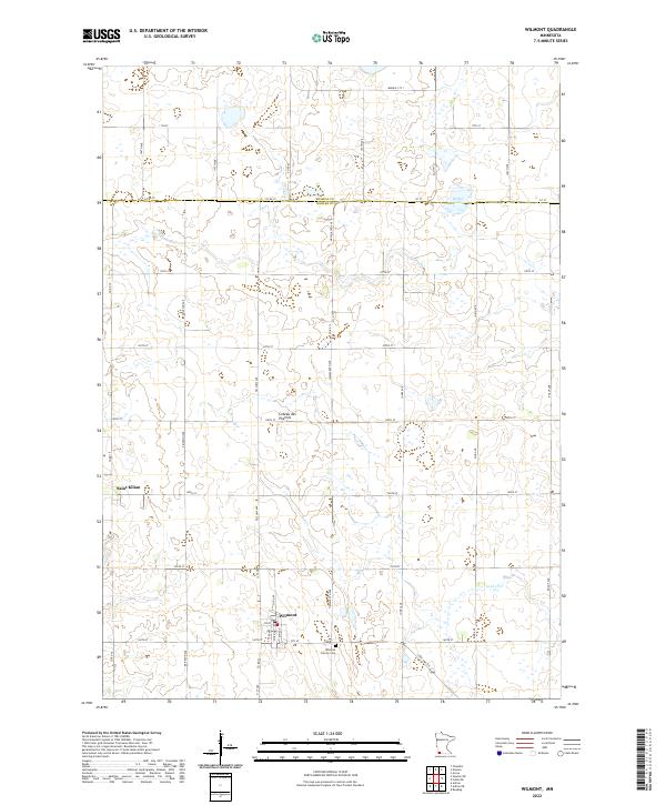 2022 Wilmont2022 Print · USGSSouthwestern Minnesota's prairie highlands come into focus in this recent survey of Nobles County. Genealogists and local historians can trace the streets of Wilmont and Saint Kilian or locate family plots at Wilmont Calvary Cem along the rise of the Coteau des Prairies.
 - 2022 Map of Adrian, 2022 Print
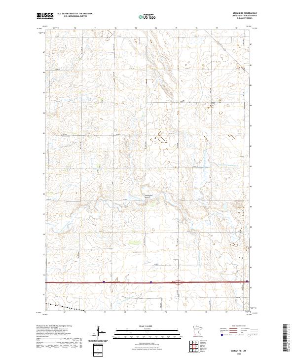
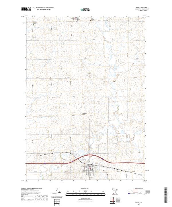 2022 Adrian2022 Print · USGSNobles County in the early twenty-first century remains a quintessential prairie landscape governed by the grid. Genealogists can locate several local burial grounds, including Saint Anthonys Cem, Lismore Cem, and the Norwegian Lutheran Cem.
 - 2022 Map of Fulda, 2022 Print
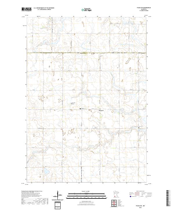
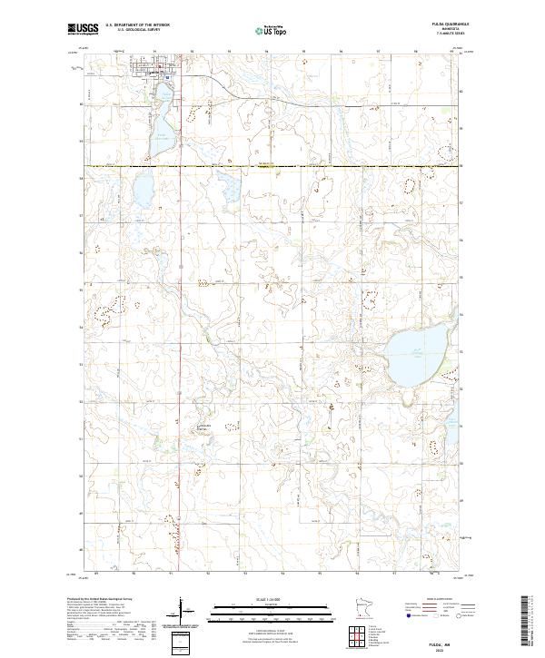 2022 Fulda2022 Print · USGSThe southwestern Minnesota prairie around Fulda is captured here in the early twenty-first century, showing a landscape defined by its lakes and agricultural grid. Researchers can trace land tracts near West Graham Lake or follow the path of Jack Cr across the Coteau des Prairies.
 - 2022 Map of Slayton SW, 2022 Print
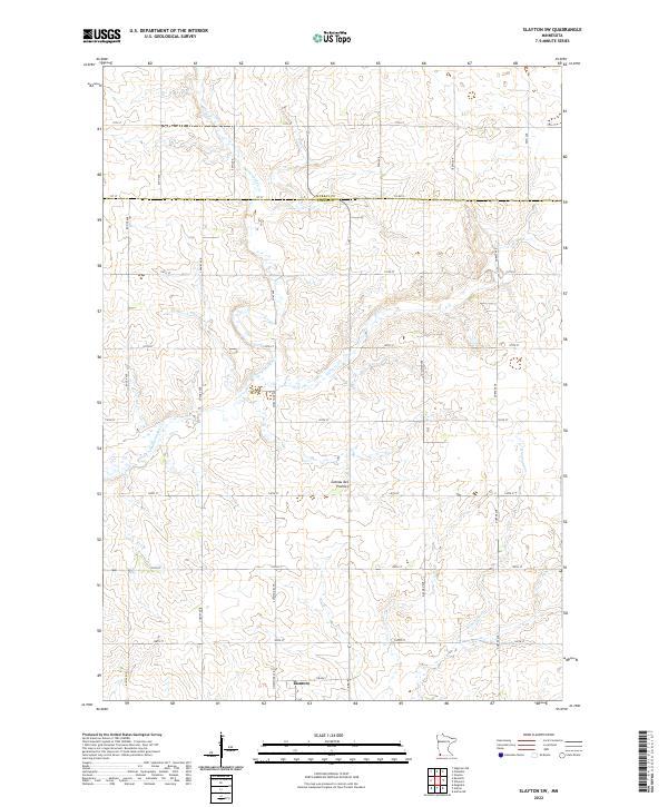 2022 Slayton SW2022 Print · USGSNobles County agriculture and the town of Lismore take center stage in this early twenty-first-century survey of the Minnesota prairie. Researchers can trace the drainage of the Coteau des Prairies through local waterways like Champepadan Cr and Kanaranzi Cr.
 - 2022 Map of Magnolia, 2022 Print
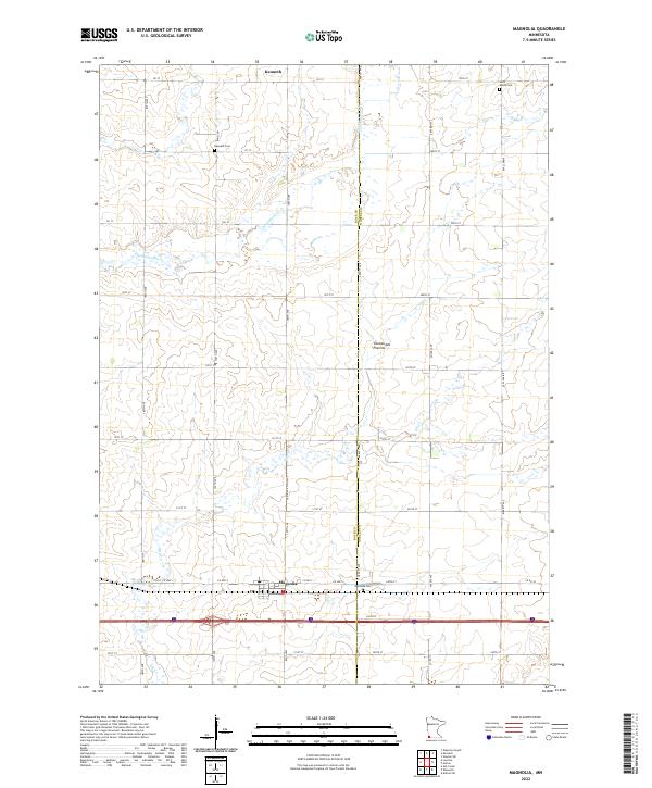 2022 Magnolia2022 Print · USGSSouthwestern Minnesota's prairie highlands are captured here in the early 2020s, showing the agricultural gridding of the Coteau des Prairies. Genealogists and local historians can trace the town sites of Magnolia and Kenneth, as well as Saint Marys Cem and Westside Cem.
 - 2022 Map of Rushmore, 2022 Print
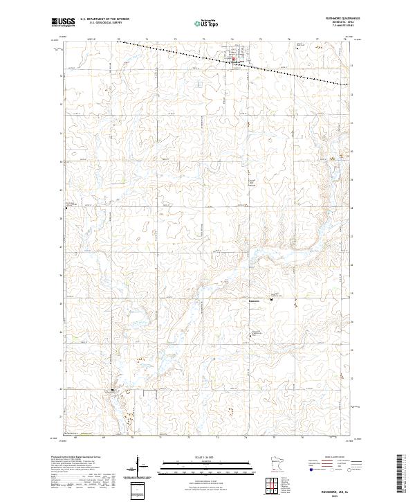 2022 Rushmore2022 Print · USGSNobles County's agricultural heartland is captured here in the early twenty-first century, centered on the upland heights of the Coteau des Prairies. Researchers can map out early family holdings near Rushmore and Ransom, or locate rural burial grounds such as Sunset Rest Cem.
 - 2022 Map of Reading, 2022 Print
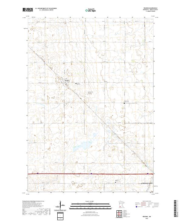 2022 Reading2022 Print · USGSNobles County at the start of the 2020s shows a well-preserved agricultural landscape defined by the Coteau des Prairies. Genealogists and historians can trace local family lineages at Summit Lake Cem, Garden of Memories, and the Church of the Brethren Cem.
 - 2022 Map of Adrian NE, 2022 Print
 2022 Adrian NE2022 Print · USGSIn the high prairie of Nobles County during the early 2020s, the land is a study in precise agricultural engineering and natural drainage. Researchers can trace the intersection of modern infrastructure and local geography along State Hwy 266 and the winding E Br Kanaranzi Cr.
 - 2022 Map of Fulda SW, 2022 Print
 2022 Fulda SW2022 Print · USGSSouthwest Minnesota's agricultural landscape is detailed here in the early twenty-first century, showing the intersection of Murray and Nobles counties. Genealogists and local researchers can locate American Lutheran Cem and Seward Cem or trace the drainage of Jack Cr.
 - 2022 Map of Brewster, 2022 Print
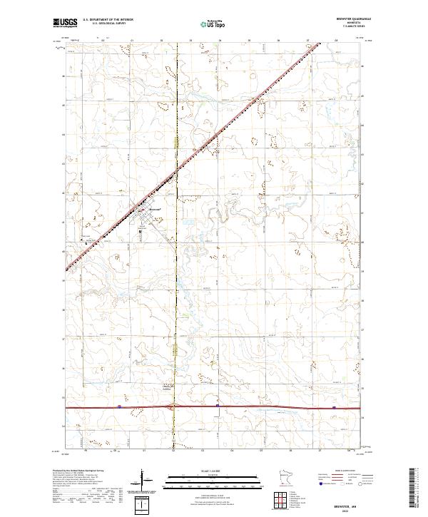 2022 Brewster2022 Print · USGSPrairie agriculture and town life intersect at the Nobles and Jackson county line during the early twenty-first century. Genealogists and local historians can locate family sites near Brewster, Sacred Heart Cem, and Trinity Cem.
 - 2022 Map of Adrian SW, 2022 Print
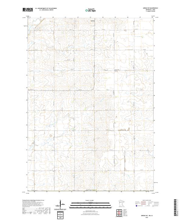 2022 Adrian SW2022 Print · USGSAgricultural land in Nobles County is mapped in detail during this recent survey of the prairie landscape near the Iowa border. Genealogists and local historians can trace the rural section lines and watercourses like Norwegian Cr and Tom Cr south of Adrian.
 - 2022 Map of Round Lake, 2022 Print
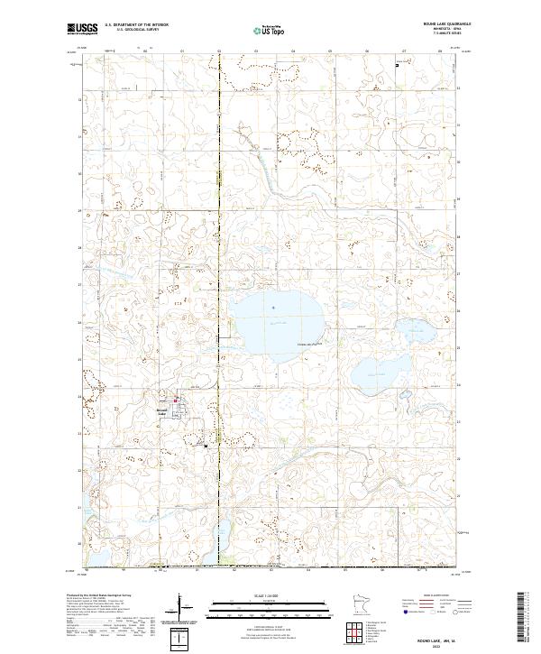 2022 Round Lake2022 Print · USGSThe town of Round Lake and the surrounding Minnesota prairie are captured here in a 2022 survey of the Coteau des Prairies landscape. Researchers can trace family history at Round Lake Cem and Grace Cem or explore the intricate network of Judicial Ditch Number Thirteen and local lakes.
 - 2022 Map of Dundee, 2022 Print
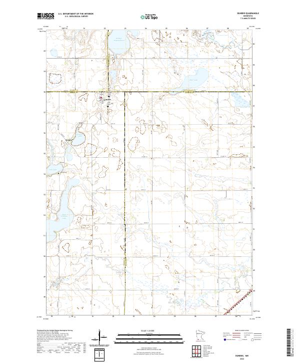 2022 Dundee2022 Print · USGSDundee and its surrounding prairie lakes are shown here in the early 2020s, highlighting a landscape defined by water and townships. Genealogists and researchers can locate family sites at the Lutheran Cem, Saint Marys Cem, and Kinbrae Cem near Kinbrae Lake.
 - 2022 Map of Ellsworth, 2022 Print
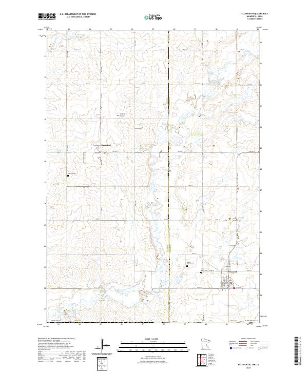 2022 Ellsworth2022 Print · USGSThe borderlands of Nobles and Rock County come into focus in this contemporary survey of the Coteau des Prairies highlands. Local historians can trace the town layouts of Ellsworth and Kanaranzi alongside local landmarks like Ashwood Cem.
 - 2022 Map of Worthington North, 2022 Print
 2022 Worthington North2022 Print · USGSWorthington and the surrounding Nobles County prairie are documented here in the early twenty-first century. Researchers can trace the modern footprint of Worthington and locate key landmarks like the Worthington Municipal Airport and Okabena Cr.
 - 2022 Map of Worthington South, 2022 Print
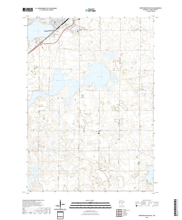 2022 Worthington South2022 Print · USGSThe southern outskirts of Worthington and the surrounding prairie wetlands come into focus in this contemporary survey of Nobles County. Genealogists and local researchers can trace cemetery locations like Saint Marys Cem and follow the path of the Ocheyedan River across the Coteau des Prairies.
 - 2022 Map of Bigelow, 2022 Print
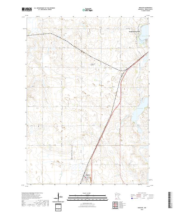 2022 Bigelow2022 Print · USGSNobles County's glacial landscape is documented here in the early 2020s, showing the intersection of prairie hydrology and rural settlement. Genealogists and local historians can locate the historic Ransom Cem and trace the paths of the Ocheyedan River and the town of Bigelow.
 - 2022 Map of Little Rock, 2022 Print
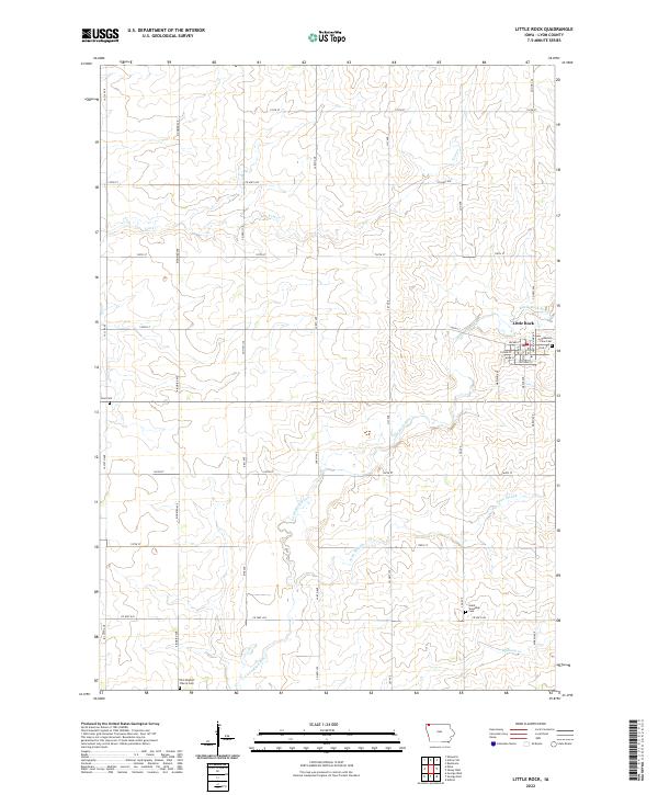 2022 Little Rock2022 Print · USGSThe town of Little Rock and the surrounding Lyon County prairie are shown here in the early twenty-first century. Genealogists and local historians can locate several burial grounds, including Pleasant View Cem, Zion Cem, and Grant Township Cem.
 - 2022 Map of Harris, 2022 Print
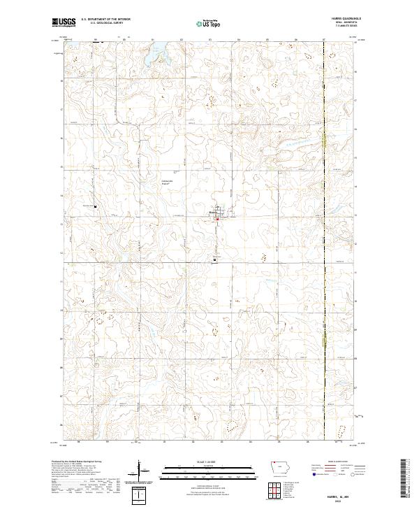 2022 Harris2022 Print · USGSThe town of Harris and the surrounding Osceola County farmland are shown here in the early twenty-first century. Genealogists and local historians can trace rural cemetery sites like Union Cem and Fairview Cem or locate the shoreline of Iowa Lake.
 - 2022 Map of Sibley West, 2022 Print
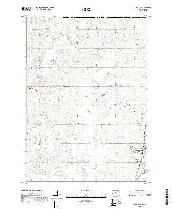 2022 Sibley West2022 Print · USGSOsceola County farmland and the rising Coteau des Prairies define this portion of northwest Iowa in the early twenty-first century. Researchers can trace local genealogy at Hope Church Cem or map the drainage of the Little Rock River and Argo Slough.
 - 2022 Map of Sibley East, 2022 Print
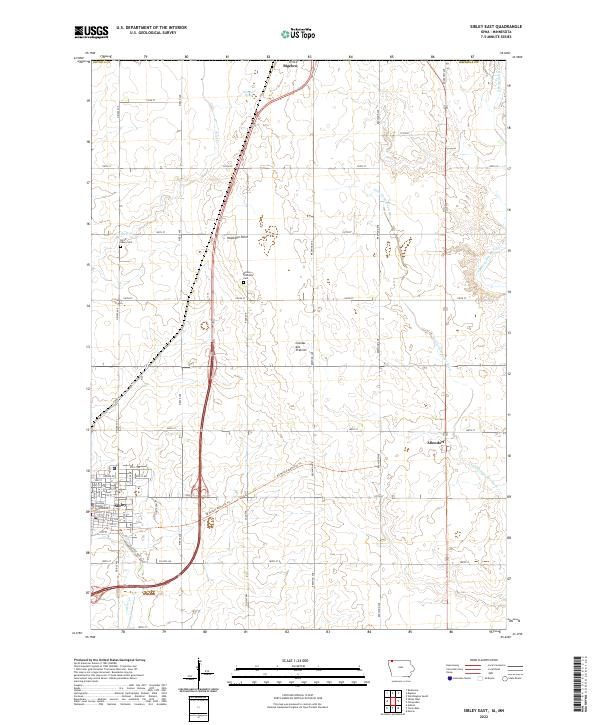 2022 Sibley East2022 Print · USGSOsceola County at the turn of the 21st century features the highest natural elevation in Iowa and the regional hub of Sibley. Genealogists and local historians can trace the town grid around the Osceola County Courthouse and locate the North Sibley Cem and Wilson Township Cem.
End of results
Showing maps 1-22 of 22
Top cities of Nobles County
- Worthington historical maps
- Adrian historical maps
- Ellsworth historical maps
- Brewster historical maps
- Leota historical maps
- Round Lake historical maps
See more
Frequently asked questions
- What are the different types of historical maps available for Nobles County?
- What is the oldest map of Nobles County?
- Where can I purchase historical maps of Nobles County for my home or office?
- Where can I download high-res historical maps of Nobles County?
- Are there historical topographic maps available for Nobles County?
- Is there historical aerial imagery available for Nobles County?
- Where are historical maps of Nobles County sourced from?