2020s Maps of Mahaska County, Iowa
Explore 16 historic maps of Mahaska County from the 2020s. These maps offer a rare glimpse into what life looked like during the 2020s — showing old roads, neighborhoods, homes, and landmarks that have changed or disappeared over time.
Whether you're researching your family's past, planning a metal detecting trip, or studying how Mahaska County's landscape evolved across the 2020s, these high-resolution maps are a powerful tool for exploring the history of this region.
- Focus on a specific era: All maps on this page are from the 2020s, giving you a focused view of this time period.
- See what’s changed: Compare century-old streets, trails, and buildings to today's modern landscape using overlays and satellite layers.
- Research with precision: Use these maps for genealogy, historical research, land use analysis, or educational projects.
- View, download, or print: Maps are fully viewable online in high resolution, and can be downloaded or printed for your own records.
Start exploring Mahaska County's history through authentic maps from the 2020s. This is your window into the past.
Mahaska County, IA maps
(16)- 2022 Map of Barnes City, 2022 Print
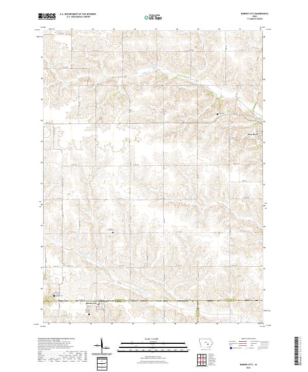 2022 Barnes City2022 Print · USGSMahaska and Poweshiek counties appear here in the early twenty-first century, showing the rural layout around Barnes City. Genealogists and historians can locate legacy burial sites like Lisor - Beulah Cem and Boswell - Harper - Pioneer Cem.
 - 2022 Map of Peoria, 2022 Print
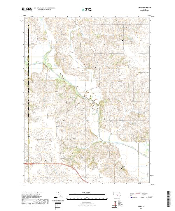 2022 Peoria2022 Print · USGSMahaska County agricultural lands are captured here in the early 2020s as the South Skunk River flows past rural townships. Family historians can locate several local burial sites like Peoria Cem, Black Oak Cem, and the Centennial Cem.
 - 2022 Map of Buxton, 2022 Print
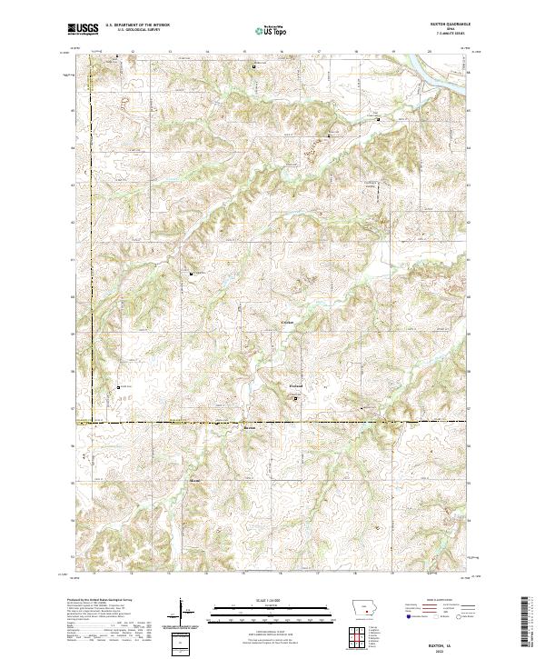 2022 Buxton2022 Print · USGSMahaska County and the surrounding tri-county borderlands are captured here in the contemporary era. Genealogists can trace family footprints across numerous rural burial sites like Buxton Cemetery and Smith Cemetery, or locate the settlements of Buxton and Miami.
 - 2022 Map of Rose Hill, 2022 Print
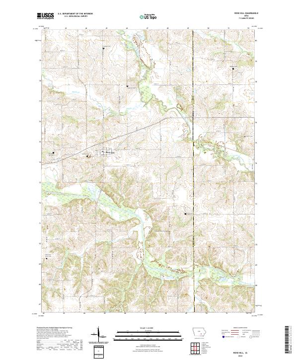 2022 Rose Hill2022 Print · USGSRose Hill and the surrounding rural townships of Mahaska and Keokuk counties appear here in meticulous modern detail. Genealogists can locate numerous burial sites across the landscape, from Old Rose Hill Cem to the remote Tioga Cem and Hewitt Cem.
 - 2022 Map of Oskaloosa, 2022 Print
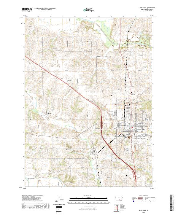 2022 Oskaloosa2022 Print · USGSMahaska County's landscape centers on the city of OSKALOOSA and its surrounding townships in this recent survey. Local researchers can identify numerous family-named burial sites like Chew Cem and McGlasson Cem, or locate the historic William Penn University campus.
 - 2022 Map of Fremont, 2022 Print
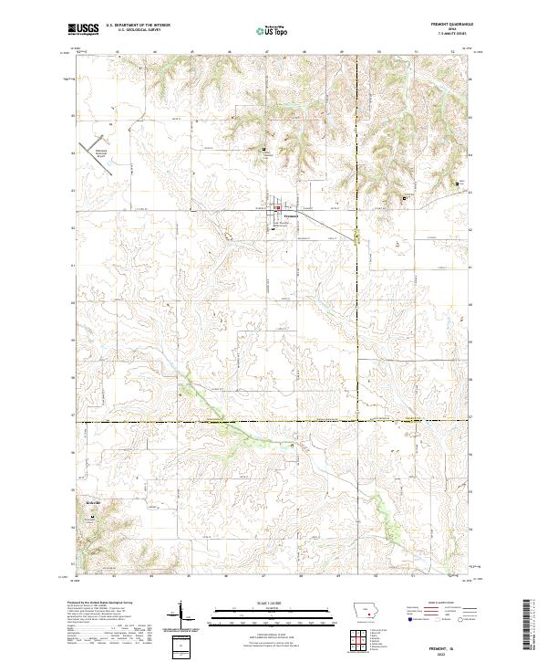 2022 Fremont2022 Print · USGSSoutheast Iowa farm country and the meeting of three counties are detailed here during the early twenty-first century. Genealogists can locate several remote burial sites including Ford Cem, Helm Cem, and the Thompson Grave near Kirkville.
 - 2022 Map of Gibson, 2022 Print
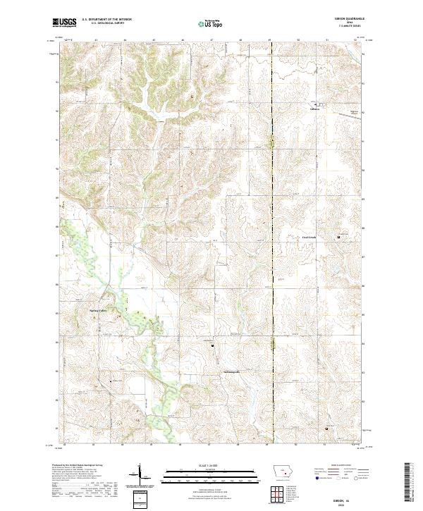 2022 Gibson2022 Print · USGSThe rural border of Mahaska and Keokuk Counties comes into focus in this contemporary survey of southeastern Iowa. Genealogists and local researchers can trace family lands near Indianapolis, Spring Valley, and historic burial sites like Friends Cem.
 - 2022 Map of University Park, 2022 Print
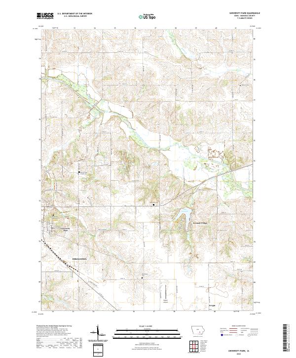 2022 University Park2022 Print · USGSUniversity Park and the eastern reaches of Oskaloosa are captured here in the early twenty-first century as they border the South Skunk River. Genealogists can locate several local burial sites like Spring Creek Friends Cem and McDonald Cem near the waters of Lake Keomah.
 - 2022 Map of Leighton, 2022 Print
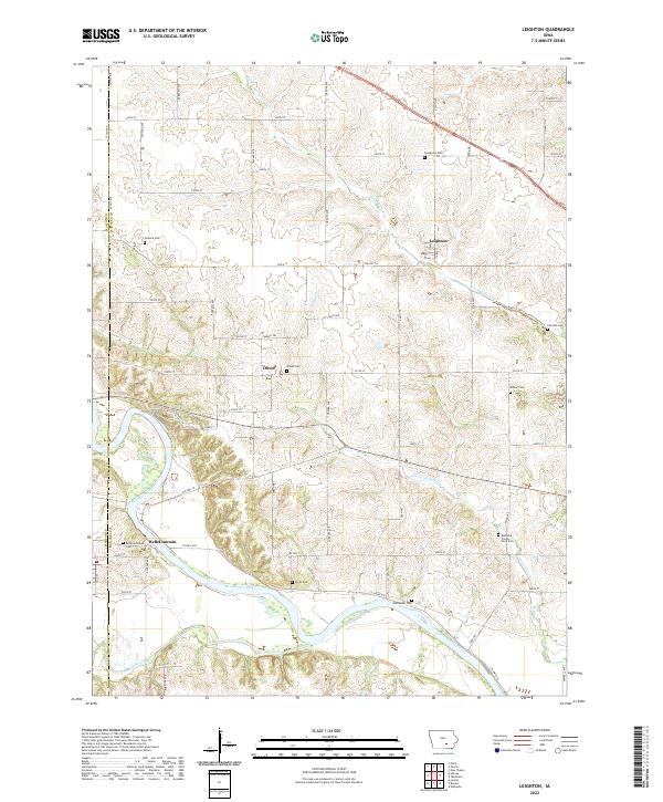 2022 Leighton2022 Print · USGSMahaska County agricultural lands and the river valley are captured here in the early twenty-first century. Researchers can trace rural lineages through numerous burial sites like Mahaska County Farm Cem, Smith Cem, and the settlement of Leighton.
 - 2022 Map of Searsboro, 2022 Print
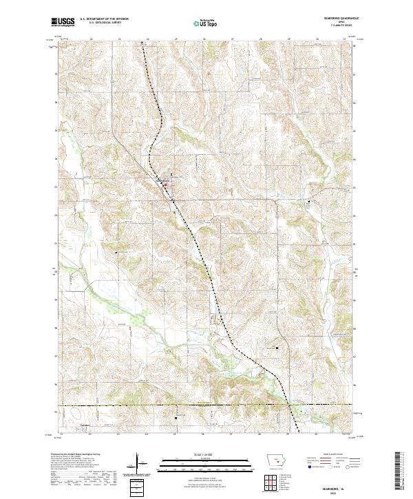 2022 Searsboro2022 Print · USGSSearsboro and the North Skunk River valley are documented here in this contemporary view of rural Poweshiek County. Researchers can locate several burial grounds like West Liberty Cemetery and Stewart Cemetery or trace the historical Diamond Trail Road.
 - 2022 Map of Kirkville, 2022 Print
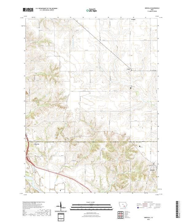 2022 Kirkville2022 Print · USGSThe borderlands of Mahaska and Wapello counties come into focus in this contemporary survey of the Des Moines River valley. Genealogists can trace family footprints across several rural burial grounds, including Westview Cem, Stump Cem, and the Funk Family Cem.
 - 2022 Map of Eddyville, 2022 Print
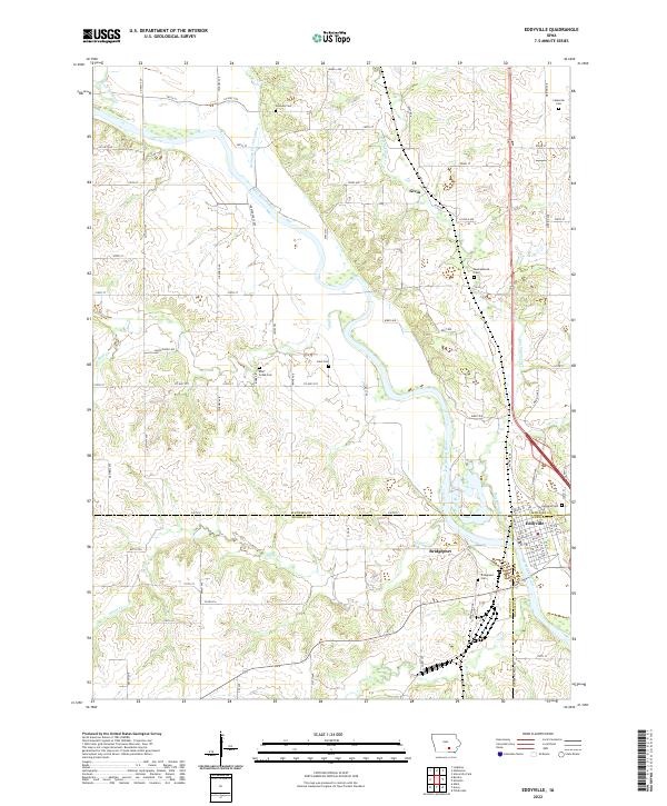 2022 Eddyville2022 Print · USGSThe confluence of Mahaska, Monroe, and Wapello counties comes to life in this recent study of the Des Moines River valley. Genealogists can locate several family burial sites like Henness Cem and Crain Cem near the historic river town of Eddyville.
 - 2022 Map of Union Mills, 2022 Print
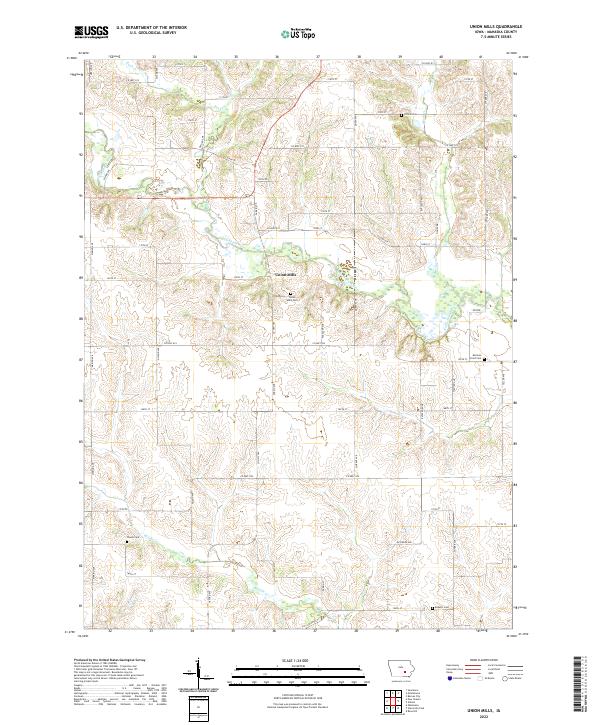 2022 Union Mills2022 Print · USGSMahaska County is mapped here in the early 2020s, showing a traditional Iowa agricultural landscape defined by the North Skunk River. Researchers can locate family landmarks like Mormon Point Cem, Union Mills Cem, and the settlement of Union Mills.
 - 2022 Map of New Sharon, 2022 Print
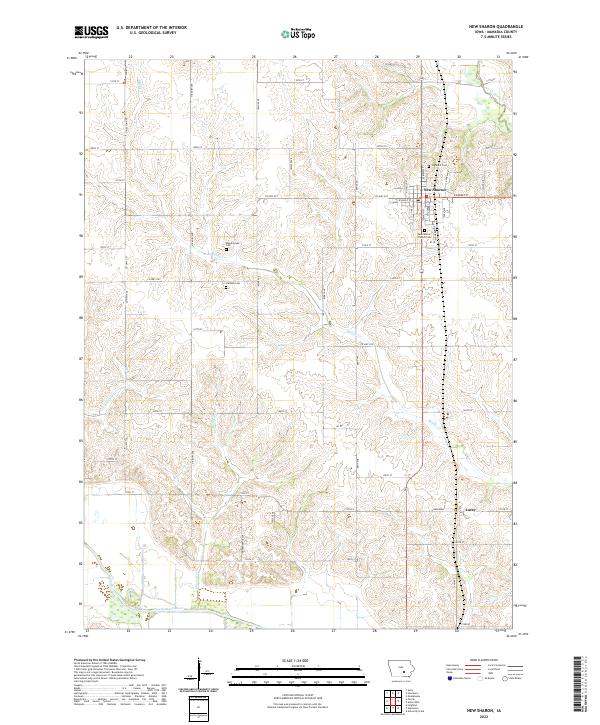 2022 New Sharon2022 Print · USGSMahaska County agricultural lands and river valleys are captured here in the early 2020s. Genealogists can locate several local burial sites including Highland Cem and New Sharon Friends Cem near the town of New Sharon.
 - 2022 Map of Sully, 2022 Print
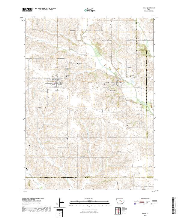 2022 Sully2022 Print · USGSJasper County agricultural lands and river valleys are captured here in the early twenty-first century. Researchers can trace rural lineages through numerous local sites like Sully Cem, Dairy Grove Cem, and the riverfront community of Lynnville.
 - 2022 Map of Montezuma, 2022 Print
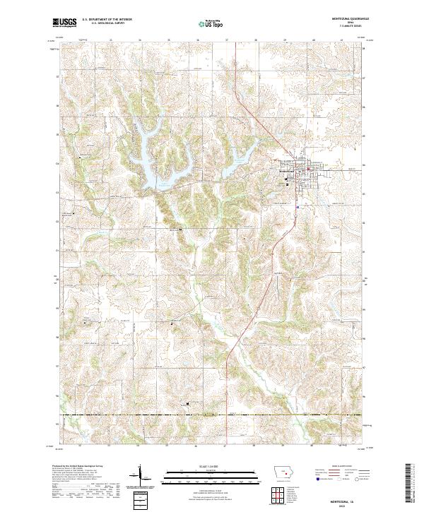 2022 Montezuma2022 Print · USGSMontezuma and its surrounding townships are shown here in the early twenty-first century, centered on the county seat and its courthouse square. Local historians can trace family roots through numerous burial grounds like Bone-McCoy Cem, Beason Cem, and Forest Home Cem.
End of results
Showing maps 1-16 of 16
Top cities of Mahaska County
- Oskaloosa historical maps
- New Sharon historical maps
- Fremont historical maps
- University Park historical maps
- Beacon historical maps
- Leighton historical maps
See more
Frequently asked questions
- What are the different types of historical maps available for Mahaska County?
- What is the oldest map of Mahaska County?
- Where can I purchase historical maps of Mahaska County for my home or office?
- Where can I download high-res historical maps of Mahaska County?
- Are there historical topographic maps available for Mahaska County?
- Is there historical aerial imagery available for Mahaska County?
- Where are historical maps of Mahaska County sourced from?