Old Maps of Mahaska County, Iowa for Hiking & Exploration
Hike through history with 106 historic maps of Mahaska County. Explore old trails, ghost towns, and forgotten backroads — perfect for outdoor adventurers and local explorers.
- Rediscover forgotten places: Map out old mining camps, roads, and footpaths that no longer exist on modern maps.
- Layer with modern tools: Combine with LiDAR or satellite views to plan hikes through historical terrain.
- Made for exploration: Popular among hikers, overlanders, and local history lovers.
Use these maps to find adventure and explore the hidden past of Mahaska County.
Mahaska County, IA maps
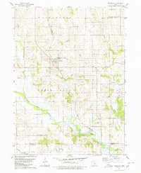
(106)- 1910 Map of Pella, 1958 Print
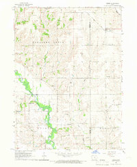
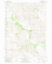
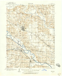 1910 Pella1958 Print · USGSMarion and Mahaska counties at the peak of the rail era show a landscape dotted with country schools and river settlements. Genealogists and historians can locate vanished schoolhouses like Bunker Hill School and trace the paths of the Chicago Rock Island and Pacific through Pella and Leighton.2 unique versions available
 - 1912 Map of Pella
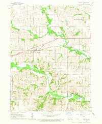
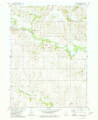
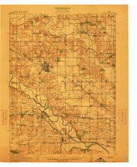 1912 Pella1912 Print · USGSThe river valleys of Marion County come alive in this pre-World War I portrait of a thriving agricultural and rail corridor. Researchers can pinpoint early homesteads near dozens of rural landmarks, including Pella, Salem Church, and the West Amsterdam School.2 unique versions available
 - 1929 Map of Albia
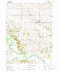
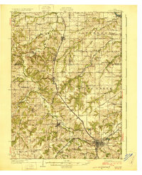 1929 Albia1929 Print · USGSMonroe County was a bustling coal and rail corridor during the late twenties, anchored by the junction at Albia. Genealogists and historians can trace defunct mining camps like Hiteman and dozens of rural school sites such as Halfway Prairie Sch.3 unique versions available
 - 1954 Map of Des Moines, 1973 Print
 1954 Des Moines1973 Print · USGSCentral Iowa's evolving landscape is captured here in the early seventies, just as major reservoirs were reshaping the river valleys. Genealogists and historians can trace the rail corridors of the Burlington Northern or locate family roots near Pella, Indianola, and Knoxville.2 unique versions available
 - 1956 Map of Des Moines
 1956 Des Moines1956 Print · USGSCentral Iowa in the mid-fifties shows a landscape defined by bustling rail hubs and deep-rooted agricultural research. Genealogists and researchers can trace the growth of Des Moines and Ames, locate the Sac and Fox Indian Reservation, or study the paths of the Skunk River and South Skunk River.
 - 1956 Map of Ottumwa North, 1958 Print
 1956 Ottumwa North1958 Print · USGSMid-century Ottumwa and its surrounding townships show a bustling river-and-rail economy as the region expanded in the fifties. Genealogists can trace family sites at Memorial Lawn Cemetery and locate vanished rural landmarks like Shiloh Church.
 - 1957 Map of Des Moines
 1957 Des Moines1957 Print · USGSCentral Iowa's post-war landscape is defined here by the converging rail lines and river valleys that shaped its earliest settlements. Genealogists and historians can trace the paths of the Rock Island Railroad and locate community landmarks in Des Moines, Ames, and Newton.
 - 1965 Map of Gibson, 1966 Print
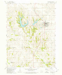
 1965 Gibson1966 Print · USGSThe border of Mahaska and Keokuk counties is documented here in the mid-1960s, showing a landscape defined by river bends and rail lines. Researchers can locate Indianapolis, the Kroses Airpark, and several family cemeteries like Friends Cem.
 - 1965 Map of Rose Hill, 1966 Print
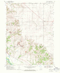
 1965 Rose Hill1966 Print · USGSMahaska County farmland in the mid-sixties is captured here, centered on the village of Rose Hill along the Chicago Rock Island and Pacific tracks. Genealogists can trace local roots through landmarks like Hopewell Cem, White Oak Ch, and the North White Oak Sch.
 - 1968 Map of University Park, 1970 Print
 1968 University Park1970 Print · USGSUniversity Park and the surrounding Mahaska County farmland are shown here in the late sixties, just as the regional rail system remained a vital artery. Trace family history at Quaker Cem or explore the grounds of Vennard College and Lake Keomah State Park.
 - 1968 Map of Barnes City, 1970 Print
 1968 Barnes City1970 Print · USGSMid-century Iowa farm country is captured here during the late 1960s, centered on the tri-county border at Barnes City. Genealogists and local historians can trace family land near Lisor Cem or follow the path of the Chicago Rock Island and Pacific railroad.
 - 1968 Map of Oskaloosa, 1970 Print
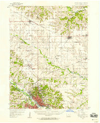
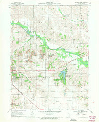
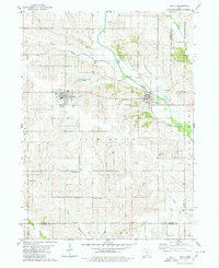
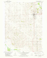
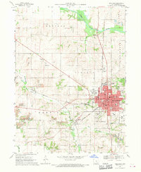 1968 Oskaloosa1970 Print · USGSOskaloosa and the surrounding Mahaska County townships are captured here in the late sixties as the area's coal-mining past shaped its modern landscape. Researchers can locate numerous local institutions from William Penn College to Forest Cemetery and trace the influence of the Chicago and North Western railroad.
 - 1968 Map of Kirkville, 1971 Print
 1968 Kirkville1971 Print · USGSSoutheast Iowa's coal and gravel country comes into focus in the late sixties as industrial mining reshapes the Mahaska and Wapello County line. Researchers can trace the rail sidings of the Chicago and North Western or locate Westview Cemetery and the Eddyville School.
 - 1968 Map of Eddyville, 1971 Print
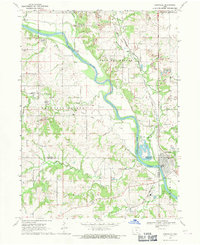 1968 Eddyville1971 Print · USGSThe Des Moines River valley in the late sixties reveals a landscape shaped by coal mining and heavy rail. Genealogists and researchers can trace local history through the streets of Eddyville, several rural cemeteries like Henness Cem, and the path of the Pacific railroad.
 - 1969 Map of Des Moines
 1969 Des Moines1969 Print · USGSCentral Iowa's fertile plains and growing capital are captured here during the late sixties, a time of major highway expansion and reservoir construction. Genealogists and researchers can trace rural township boundaries, local cemeteries, and rail lines serving towns like Pella, Grinnell, and Oskaloosa.
 - 1979 Map of Montezuma, 1980 Print
 1979 Montezuma1980 Print · USGSMontezuma and its surrounding townships are shown here in the late seventies, just as recreation and conservation areas began to shape the landscape. Researchers can locate several historic burial sites like Twp Cem and Sheley Cem, or trace the shores of Lake Ponderosa.
 - 1979 Map of Searsboro, 1980 Print
 1979 Searsboro1980 Print · USGSPoweshiek and Mahaska counties are captured here in the late seventies, showing the rural landscape around Searsboro and the North Skunk River. Local historians can trace the Chicago and North Western rail line, the Searsboro-Sully-Lynnville Sch, and several family cemeteries.
 - 1980 Map of Union Mills
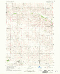
 1980 Union Mills1980 Print · USGSMahaska County, Iowa, is captured here in the late twentieth century as a landscape of steady agricultural tradition and quiet townships. Researchers can trace local lineage through several burial sites including Union Mills Cem, Mormon Point Cem, and Roberts Cem near the North Skunk River.
 - 1980 Map of Leighton
 1980 Leighton1980 Print · USGSMahaska County as it appeared in the late 1970s shows a landscape of river bends and active industrial sites. Researchers can trace the rail line through Leighton or locate family plots at Butler Cem and Sand Ridge Cem.
 - 1980 Map of Sully
 1980 Sully1980 Print · USGSCentral Iowa farmland meets the North Skunk River in the early eighties, centered on the growing communities of Sully and Lynnville. Researchers can locate numerous family burial grounds like Swans Cem and Dairy Grove Cem, along with local landmarks like the Municipal Landing Strip.
 - 1980 Map of Peoria
 1980 Peoria1980 Print · USGSMahaska County and Marion County farmlands are captured in the late seventies, showing the transition of rural Iowa townships. Genealogists and historians can trace family roots through landmarks like Appel Cem, the Christian Sch, and the South Skunk River.
 - 1980 Map of New Sharon
 1980 New Sharon1980 Print · USGSMahaska County agricultural life and rail commerce are on full display in the late twentieth century. Genealogists and local historians can trace the foundations of New Sharon and Lacey along the Chicago and North Western railroad line.
 - 1980 Map of Fremont, 1981 Print
 1980 Fremont1981 Print · USGSThe town of Fremont sits at a crossroads of three counties in the early 1980s, anchoring a landscape of precision-surveyed farmland and prairie creeks. Researchers can trace local heritage at Township Memorial Cem, Ford Cem, and the rural Helm Cem.
 - 1982 Map of Oskaloosa
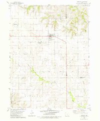
 1982 Oskaloosa1982 Print · USGSSoutheast Iowa's river valleys and rail hubs are meticulously detailed in the early eighties, showing a landscape of productive farmland and growing municipal centers. Researchers can trace the legacy of small-town life and local industry through features like Union Mills, What Cheer, and the extensive Burlington Northern rail network.
 - 1982 Map of Buxton, 1983 Print
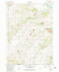 1982 Buxton1983 Print · USGSMahaska and Monroe counties are seen here in the early 1980s, where the legacy of Iowa coal mining is etched across the terrain. Researchers can locate the site of Buxton, trace an Old Railroad Grade, or find family names at Weldon Cem and Union Liberty Ch.
Showing maps 1-25 of 106
Top cities of Mahaska County
- Oskaloosa historical maps
- New Sharon historical maps
- Fremont historical maps
- University Park historical maps
- Beacon historical maps
- Leighton historical maps
See more
Frequently asked questions
- What are the different types of historical maps available for Mahaska County?
- What is the oldest map of Mahaska County?
- Where can I purchase historical maps of Mahaska County for my home or office?
- Where can I download high-res historical maps of Mahaska County?
- Are there historical topographic maps available for Mahaska County?
- Is there historical aerial imagery available for Mahaska County?
- Where are historical maps of Mahaska County sourced from?