1970s Maps of Marshall County, Iowa
Explore 8 historic maps of Marshall County from the 1970s. These maps offer a rare glimpse into what life looked like during the 1970s — showing old roads, neighborhoods, homes, and landmarks that have changed or disappeared over time.
Whether you're researching your family's past, planning a metal detecting trip, or studying how Marshall County's landscape evolved across the 1970s, these high-resolution maps are a powerful tool for exploring the history of this region.
- Focus on a specific era: All maps on this page are from the 1970s, giving you a focused view of this time period.
- See what’s changed: Compare century-old streets, trails, and buildings to today's modern landscape using overlays and satellite layers.
- Research with precision: Use these maps for genealogy, historical research, land use analysis, or educational projects.
- View, download, or print: Maps are fully viewable online in high resolution, and can be downloaded or printed for your own records.
Start exploring Marshall County's history through authentic maps from the 1970s. This is your window into the past.
Marshall County, IA maps
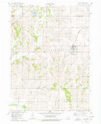
(8)- 1975 Map of State Center NW, 1978 Print
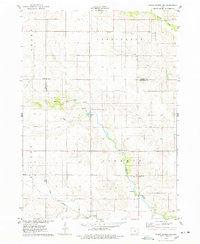 1975 State Center NW1978 Print · USGSMarshall County farmsteads and creek valleys are documented here in the mid-seventies, showing the rural landscape before further consolidation. Researchers can locate St Anthony, several Gravel Pits, and local landmarks like Illinois Grove Cem.
 - 1975 Map of State Center, 1978 Print
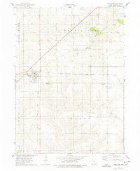
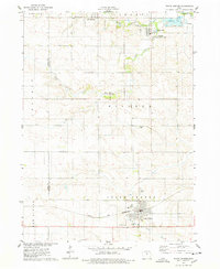 1975 State Center1978 Print · USGSCentral Marshall County thrived in the mid-seventies as a hub of rail activity and rural settlement. Researchers can trace the Chicago and Northwestern line or locate family sites like Sacred Heart Cem and St Johns Ch.
 - 1975 Map of Union, 1978 Print
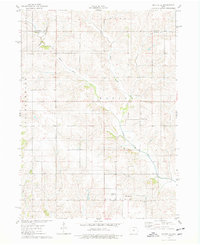
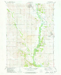 1975 Union1978 Print · USGSHardin and Marshall counties meet along the winding Iowa River in the mid-seventies, where agriculture and rail lines define the landscape. Genealogists can trace family roots through several local burial sites like Union Cem, Bangor Cem, and Gaer-Ballard Cem.
 - 1975 Map of Rhodes, 1978 Print
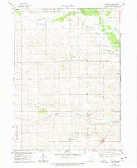
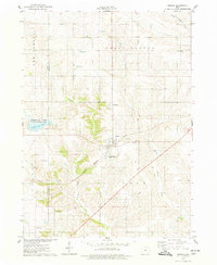 1975 Rhodes1978 Print · USGSRhodes and the surrounding Marshall County farmland are captured in the mid-seventies, showing a landscape defined by rail and river. Genealogists can locate several rural burial grounds including Wilkey Cem, Day Cem, and St Josephs Cem alongside the Chicago Milwaukee St Paul and Pacific tracks.
 - 1975 Map of Baxter, 1978 Print
 1975 Baxter1978 Print · USGSThe town of Baxter and its surrounding townships are shown here during the mid-1970s, capturing the organized grid of Iowa's agricultural heartland. Genealogists and local historians can locate several rural burial grounds, including Restland Cem and Independence Cem, alongside the CHICAGO AND NORTH WESTERN rail line.
 - 1975 Map of Melbourne, 1978 Print
 1975 Melbourne1978 Print · USGSMelbourne and the surrounding Marshall County countryside are caught in the mid-1970s, showcasing a landscape defined by its vital rail junctions. Genealogists and local historians can trace rural roots at Maple Grove Cem, the small settlement of Van Cleve, and the historic Chicago and North Western rail lines.
 - 1975 Map of Baxter SE, 1978 Print
 1975 Baxter SE1978 Print · USGSJasper County farmland in the mid-1970s is defined by the winding North Skunk River and a network of rural townships. Genealogists and local historians can locate several family burial grounds including Bethany Cem and the Wittenberg Grange Hall.
 - 1975 Map of La Moille, 1978 Print
 1975 La Moille1978 Print · USGSMid-century Marshall County agriculture and river life come into focus as the Iowa River winds past Moningers and Marietta. Genealogists and historians can trace family roots through the La Moille Cem, Hixite Cem, and the old County Home grounds.
End of results
Showing maps 1-8 of 8
Top cities of Marshall County
Frequently asked questions
- What are the different types of historical maps available for Marshall County?
- What is the oldest map of Marshall County?
- Where can I purchase historical maps of Marshall County for my home or office?
- Where can I download high-res historical maps of Marshall County?
- Are there historical topographic maps available for Marshall County?
- Is there historical aerial imagery available for Marshall County?
- Where are historical maps of Marshall County sourced from?