2020s Maps of Mills County, Iowa
Explore 14 historic maps of Mills County from the 2020s. These maps offer a rare glimpse into what life looked like during the 2020s — showing old roads, neighborhoods, homes, and landmarks that have changed or disappeared over time.
Whether you're researching your family's past, planning a metal detecting trip, or studying how Mills County's landscape evolved across the 2020s, these high-resolution maps are a powerful tool for exploring the history of this region.
- Focus on a specific era: All maps on this page are from the 2020s, giving you a focused view of this time period.
- See what’s changed: Compare century-old streets, trails, and buildings to today's modern landscape using overlays and satellite layers.
- Research with precision: Use these maps for genealogy, historical research, land use analysis, or educational projects.
- View, download, or print: Maps are fully viewable online in high resolution, and can be downloaded or printed for your own records.
Start exploring Mills County's history through authentic maps from the 2020s. This is your window into the past.
Mills County, IA maps
(14)- 2021 Map of Rock Bluff, 2021 Print
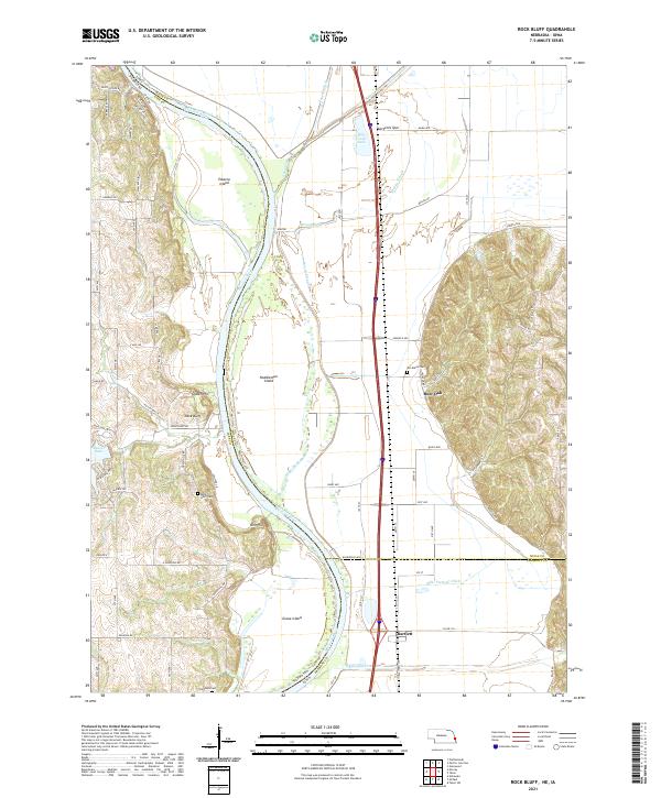 2021 Rock Bluff2021 Print · USGSThe Missouri River floodplain comes to life in this contemporary survey of the Nebraska-Iowa borderlands. Family historians can trace ancestral sites like Rock Bluff Cem and Kenosha Cem or locate the old riverfront settlements of Rock Bluff and Bartlett.
 - 2021 Map of Omaha South, 2021 Print
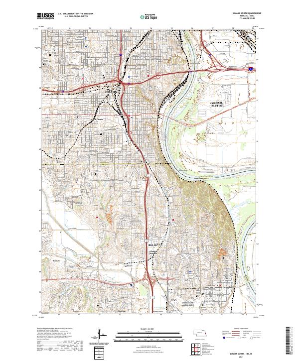 2021 Omaha South2021 Print · USGSGreater Omaha and Council Bluffs are captured here in the early twenty-first century as they span the river valley. Researchers can trace the extensive borders of Offutt Air Force Base or locate family plots in Graceland Park Cem and Bohemian Cem.
 - 2021 Map of Plattsmouth, 2021 Print
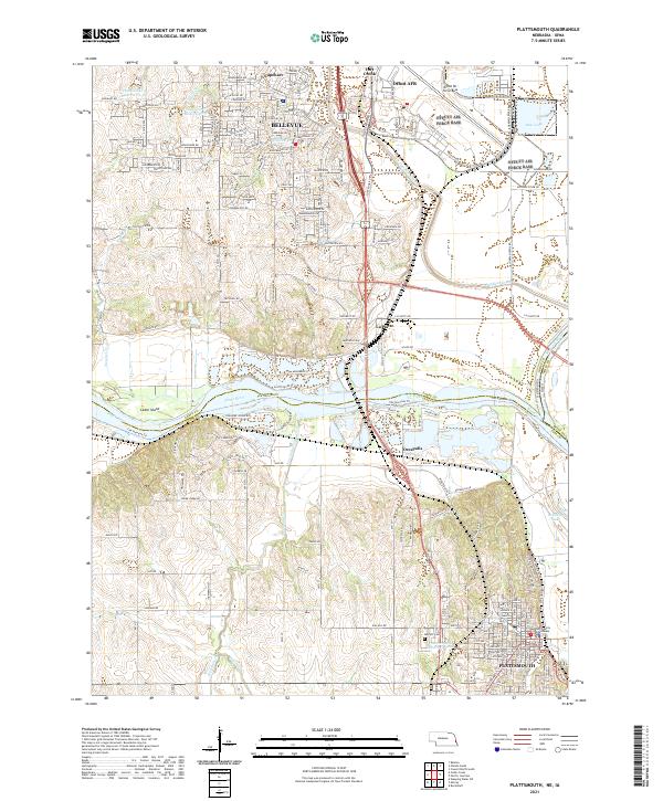 2021 Plattsmouth2021 Print · USGSThe Missouri and Platte rivers meet in this 2021 survey of the Cass and Sarpy county border. Trace local history through the Cass County Courthouse, Oak Hill Cem, and the massive military footprint of Offutt AFB.
 - 2022 Map of Tabor NE, 2022 Print
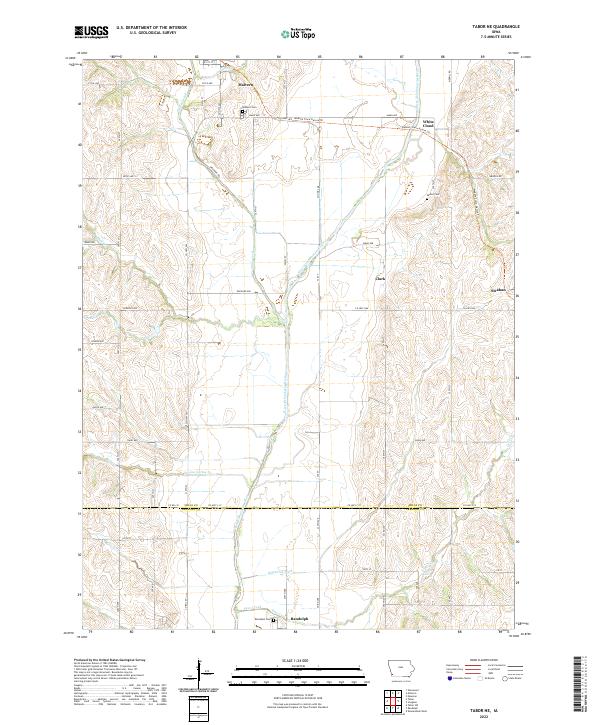 2022 Tabor NE2022 Print · USGSSouthwestern Iowa’s agricultural and rail heritage is well-preserved in this modern survey of the Mills and Fremont County line. Researchers can trace the path of the Wabash Trace Nature Trl through Malvern or locate family burial sites at Parker Cem and Randolph Cem.
 - 2022 Map of Tabor, 2022 Print
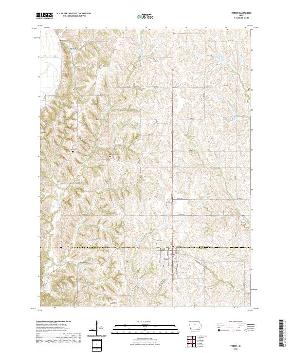 2022 Tabor2022 Print · USGSThe border of Mills and Fremont counties comes to life in this contemporary study of the southwest Iowa prairie. Genealogists and local researchers can trace numerous family burial sites, including Linville Farm Cem, Mackey Cem, and the streets of Tabor.
 - 2022 Map of Council Bluffs South, 2022 Print
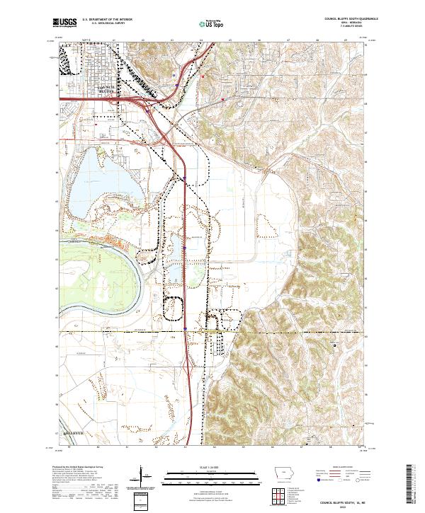 2022 Council Bluffs South2022 Print · USGSThe southern edges of Council Bluffs meet the Missouri River floodplain in this recent survey. Researchers can trace the boundaries of Lake Manawa, locate the Iowa School for Deaf, or find family names at Plumer Cem and Saar Cem.
 - 2022 Map of Carson, 2022 Print
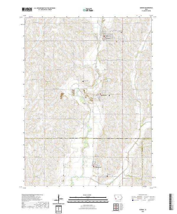 2022 Carson2022 Print · USGSWestern Iowa's river valleys and historic trail corridors are documented here in the early twenty-first century. Genealogists and historians can locate several local burial sites like Old Town Cem and trace the paths of the Iowa Mormon Trl and Pioneer Trl.
 - 2022 Map of Mineola, 2022 Print
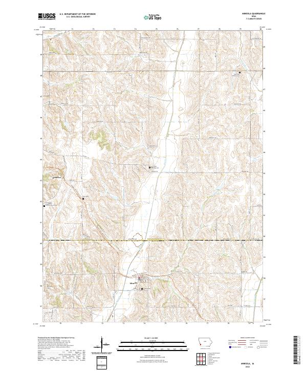 2022 Mineola2022 Print · USGSThe rolling farm country south of Council Bluffs appears in this recent survey, centered on the Pottawattamie and Mills county line. You can trace family roots at Mineola Cem or follow the historic rail corridor along the Wabash Trace Nature Trl.
 - 2022 Map of Treynor, 2022 Print
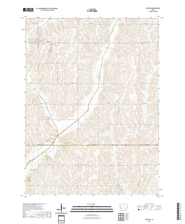 2022 Treynor2022 Print · USGSTreynor and the surrounding Pottawattamie County hills are captured here in the early twenty-first century. Genealogists and local historians can locate the Zion Congregational Cem and trace the many branches of Silver Creek through the rural township grid.
 - 2022 Map of Glenwood, 2022 Print
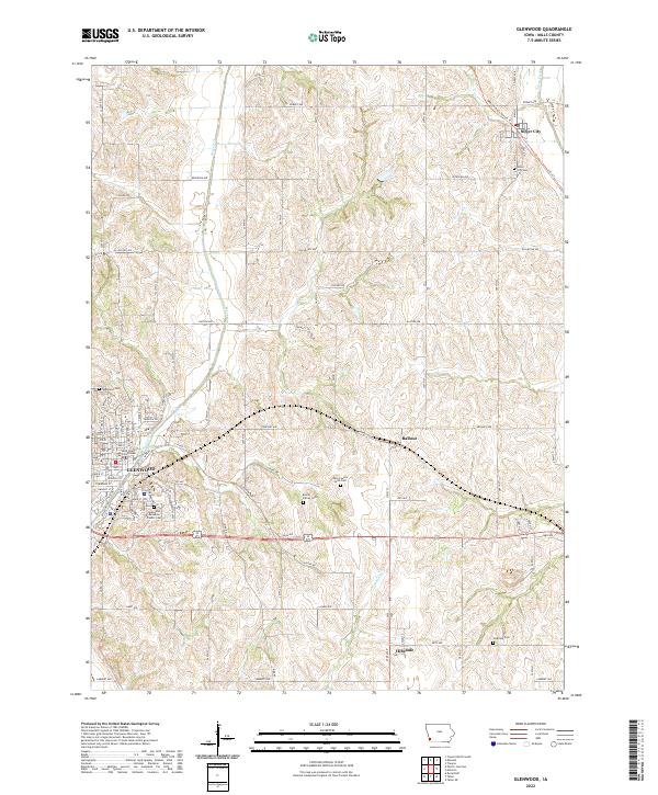 2022 Glenwood2022 Print · USGSGlenwood and the surrounding hills of Mills County are shown here in the early twenty-first century, featuring a landscape deeply tied to its county seat and rural cemeteries. Researchers can trace family sites at Bomar Family Cem, locate the Mills County Courthouse, or follow the Wabash Trace Nature Trl through Silver City.
 - 2022 Map of Pacific Junction, 2022 Print
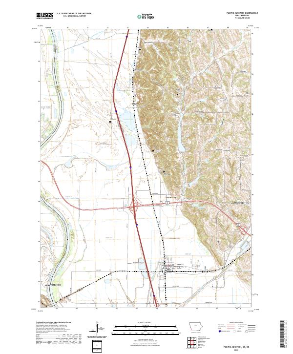 2022 Pacific Junction2022 Print · USGSPacific Junction and the Mills County bottomlands are shown here in the modern era as the Missouri River valley meets the eastern bluffs. Researchers can trace family history through numerous rural burial grounds like Gowen-Turner Cem and Saar Cem, or locate the small settlements of Folsom and Pacific City.
 - 2022 Map of Imogene, 2022 Print
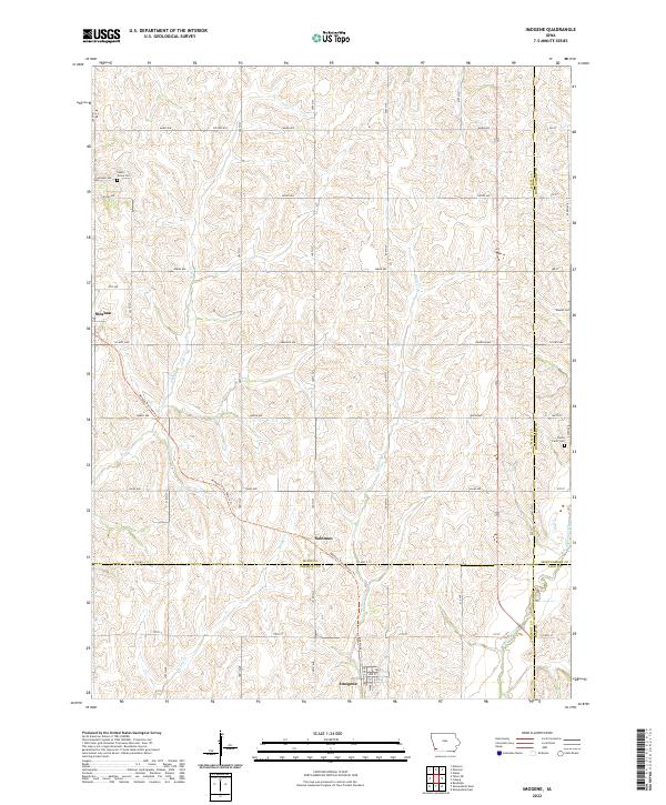 2022 Imogene2022 Print · USGSImogene and the surrounding Fremont County prairie are shown here in the 2020s, highlighting the enduring rural landscape of southwest Iowa. Researchers can trace the diagonal path of the Wabash Trace Nature Trail through Solomon or locate family plots at South Grove Cemetery and Walnut Cemetery.
 - 2022 Map of Emerson, 2022 Print
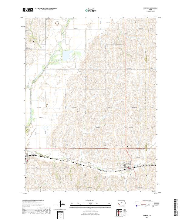 2022 Emerson2022 Print · USGSMills and Montgomery Counties were well-established farming territories when this contemporary survey was conducted. Genealogists can trace family burial sites across the landscape at Wesley Chapel Cem, North Grove Cem, and Hastings Cem.
 - 2022 Map of Malvern, 2022 Print
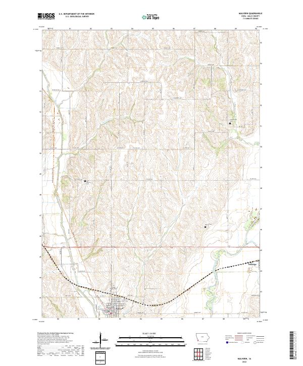 2022 Malvern2022 Print · USGSMills County's agricultural heartland is documented here in the early 2020s, centered on the communities of Malvern and Hastings. Researchers can trace old family sites and rural landmarks like Cottonwood Cem, East Liberty Cem, and the Wabash Trace Nature Trl.
End of results
Showing maps 1-14 of 14
Top cities of Mills County
- Glenwood historical maps
- Malvern historical maps
- Emerson historical maps
- Silver City historical maps
- Henderson historical maps
- Mineola historical maps
See more
Frequently asked questions
- What are the different types of historical maps available for Mills County?
- What is the oldest map of Mills County?
- Where can I purchase historical maps of Mills County for my home or office?
- Where can I download high-res historical maps of Mills County?
- Are there historical topographic maps available for Mills County?
- Is there historical aerial imagery available for Mills County?
- Where are historical maps of Mills County sourced from?