1970s Maps of Mills County, Iowa
Explore 3 historic maps of Mills County from the 1970s. These maps offer a rare glimpse into what life looked like during the 1970s — showing old roads, neighborhoods, homes, and landmarks that have changed or disappeared over time.
Whether you're researching your family's past, planning a metal detecting trip, or studying how Mills County's landscape evolved across the 1970s, these high-resolution maps are a powerful tool for exploring the history of this region.
- Focus on a specific era: All maps on this page are from the 1970s, giving you a focused view of this time period.
- See what’s changed: Compare century-old streets, trails, and buildings to today's modern landscape using overlays and satellite layers.
- Research with precision: Use these maps for genealogy, historical research, land use analysis, or educational projects.
- View, download, or print: Maps are fully viewable online in high resolution, and can be downloaded or printed for your own records.
Start exploring Mills County's history through authentic maps from the 1970s. This is your window into the past.
Mills County, IA maps
(3)- 1978 Map of Carson
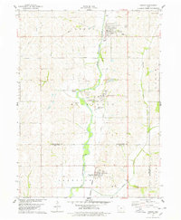 1978 Carson1978 Print · USGSThe West Nishnabotna River valley near the Pottawattamie and Mills county line is captured here in the late seventies. Researchers can trace the legacy of regional transport through the Burlington Northern line and the Old Railroad Grade, or find family roots at Carson Cem and Farm Creek Cem.
 - 1978 Map of Emerson
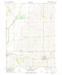 1978 Emerson1978 Print · USGSMills and Montgomery counties are captured here in the late seventies as the rail-and-river economy centered on Emerson and Hastings flourished. Genealogists can locate several local burial grounds including Hastings Cem and landmarks like the Nishua Valley Community Sch.
 - 1978 Map of Imogene
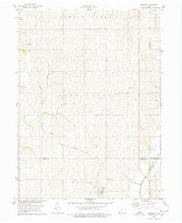 1978 Imogene1978 Print · USGSThe rural landscape of Fremont County is captured here in the late seventies, showing the rail-dependent settlement of Imogene and the surrounding farm country. Genealogists can trace family landmarks like Champion Hill Ch, the South Grove Cem, and the path of the Norfolk and Western railroad.
End of results
Showing maps 1-3 of 3
Top cities of Mills County
- Glenwood historical maps
- Malvern historical maps
- Emerson historical maps
- Silver City historical maps
- Henderson historical maps
- Mineola historical maps
See more
Frequently asked questions
- What are the different types of historical maps available for Mills County?
- What is the oldest map of Mills County?
- Where can I purchase historical maps of Mills County for my home or office?
- Where can I download high-res historical maps of Mills County?
- Are there historical topographic maps available for Mills County?
- Is there historical aerial imagery available for Mills County?
- Where are historical maps of Mills County sourced from?