1900s (20th Century) Maps of Mills County, Iowa
Explore 31 historic maps of Mills County from the 1900s (20th Century). These maps offer a rare glimpse into what life looked like during the 1900s — showing old roads, neighborhoods, homes, and landmarks that have changed or disappeared over time.
Whether you're researching your family's past, planning a metal detecting trip, or studying how Mills County's landscape evolved across the 1900s, these high-resolution maps are a powerful tool for exploring the history of this region.
- Focus on a specific era: All maps on this page are from the 1900s, giving you a focused view of this time period.
- See what’s changed: Compare century-old streets, trails, and buildings to today's modern landscape using overlays and satellite layers.
- Research with precision: Use these maps for genealogy, historical research, land use analysis, or educational projects.
- View, download, or print: Maps are fully viewable online in high resolution, and can be downloaded or printed for your own records.
Start exploring Mills County's history through authentic maps from the 1900s. This is your window into the past.
Mills County, IA maps
(31)- 1935 Map of Nehawka
 1935 Nehawka1935 Print · USGSThe Missouri River valley along the Nebraska-Iowa border appears here during the mid-1930s, showing a landscape defined by riverside bluffs and fertile bottomlands. Genealogists can trace family roots through numerous local landmarks, from Sargents Spur and Nehawka to rural schools like Ameck Sch and Eight Mile Grove Sch.2 unique versions available
 - 1940 Map of Nehawka
 1940 Nehawka1940 Print · USGSThe Missouri River valley comes to life in this pre-war survey of Cass County and the Iowa border. Genealogists can locate family names at Youngs Cem or trace dozens of rural school sites like Cottonwood Sch and Eightmile Grove Sch.3 unique versions available
 - 1954 Map of Omaha, 1967 Print
 1954 Omaha1967 Print · USGSMid-century development radiates from the river bluffs into the agricultural heartland during this period of post-war growth. Genealogists and historians can trace rail-connected towns like Atlantic and Red Oak or locate the sprawling grounds of Offutt Air Force Base and Manawa Lake.3 unique versions available
 - 1955 Map of Nebraska City, 1967 Print
 1955 Nebraska City1967 Print · USGSThe four-state region surrounding the Missouri River valley appears here in the mid-1950s, a landscape of rail-dependent market towns and rural school districts. Genealogists can locate family landmarks like the Rock Bluff School, St Oswald Church, and the Clarinda State Hospital.3 unique versions available
 - 1956 Map of Glenwood, 1957 Print
 1956 Glenwood1957 Print · USGSMills County at the mid-century mark shows a landscape of rail-connected towns and a vanishing world of rural schoolhouses. Genealogists and local historians can trace family locations near landmarks like Silver City, Hillsdale Cem, and the State School.3 unique versions available
 - 1956 Map of Mineola, 1957 Print
 1956 Mineola1957 Print · USGSMid-century Mills and Pottawattamie counties are captured here during a time of thriving small-town rail commerce and rural school districts. Genealogists can trace family roots through sites like St Paul Cem, Dumfries, and schools such as Letal Sch and Sunnyside Sch.2 unique versions available
 - 1956 Map of Rock Bluff, 1957 Print
 1956 Rock Bluff1957 Print · USGSThe Missouri River valley in the mid-fifties shows a landscape of river islands and bluff-side quarries. Genealogists can trace family sites at Rock Bluff and the Rock Bluff Cem, or locate rural schoolhouses like Kenosha Sch.3 unique versions available
 - 1956 Map of Plattsmouth, 1958 Print
 1956 Plattsmouth1958 Print · USGSThe confluence of the Platte and Missouri rivers comes into sharp focus during the mid-fifties, showing the region's transition from river town to strategic military hub. Researchers can trace the development of Plattsmouth, find local landmarks like Oak Hill Cemetery, or locate rural schoolhouses such as Trumble Sch.5 unique versions available
 - 1956 Map of Pacific Junction, 1958 Print
 1956 Pacific Junction1958 Print · USGSPacific Junction and the Missouri River bluffs are documented here during the mid-1950s at the height of the railroad era. Researchers can trace rural school districts and family burial sites such as West Liberty Sch No 3, Bethlehem Sch, and Gowen Cem.4 unique versions available
 - 1956 Map of Treynor, 1958 Print
 1956 Treynor1958 Print · USGSThe rural landscapes of Pottawattamie and Mills counties are captured here in the mid-1950s, centered on the community of Treynor. Genealogists and local historians can locate country landmarks like Boxelder Sch and early river crossings such as BR 1075.2 unique versions available
 - 1956 Map of Council Bluffs South, 1958 Print
 1956 Council Bluffs South1958 Print · USGSCouncil Bluffs and its southern environs appear in the mid-fifties as a vital rail and river hub. Local historians can trace the foundations of Lake Manawa State Park and locate vanished landmarks like the Council Bluffs Municipal Airport and Eureka Sch.3 unique versions available
 - 1956 Map of Malvern, 1958 Print
 1956 Malvern1958 Print · USGSThe agricultural heart of Mills County comes alive in the mid-1950s, centered on the rail junction at Malvern. Researchers can trace old township schoolhouses like Centerline Sch and Pleasant Valley Sch alongside the West Nishnabotna River.2 unique versions available
 - 1956 Map of Omaha South, 1958 Print
 1956 Omaha South1958 Print · USGSThe mid-century expansion of Omaha and Bellevue is captured here as neighborhoods pushed toward the Missouri River and massive rail yards. Researchers can trace family sites among dozens of landmarks like West Lawn Cemetery, Offutt Air Force Base, and South Omaha schools.6 unique versions available
 - 1957 Map of Nebraska City
 1957 Nebraska City1957 Print · USGSThe four-state junction of Nebraska, Iowa, Missouri, and Kansas comes alive in this mid-fifties survey of the Missouri River valley. Genealogists and historians can trace the rail-and-road networks connecting Nebraska City, Maryville, and the Squaw Creek National Wildlife Refuge.
 - 1957 Map of Omaha
 1957 Omaha1957 Print · USGSWestern Iowa and the Missouri River valley are seen here in the mid-fifties during the height of the rail-and-road era. Researchers can trace the sprawling rail lines of the Chicago And North Western or locate Cold War landmarks like Offutt Air Force Base.
 - 1957 Map of Tabor, 1958 Print
 1957 Tabor1958 Print · USGSThe borderlands of Mills and Fremont counties are captured here in the late fifties as rural life shifted toward consolidation. Researchers can trace defunct schoolhouses like Elm Grove Sch and family-named burial sites including Mackey Cem.2 unique versions available
 - 1957 Map of Tabor NE, 1958 Print
 1957 Tabor NE1958 Print · USGSSouthwestern Iowa in the late 1950s was defined by its railroad arteries and shifting rural school system. Researchers can trace the WABASH rail line and identify vanished school sites like Mt Vernon Sch and Barrett Sch across the landscape.
 - 1958 Map of Omaha
 1958 Omaha1958 Print · USGSOmaha and Council Bluffs stand at the center of this mid-fifties landscape, where the Missouri River splits the urban plains of Nebraska from the rolling hills of western Iowa. Genealogists can trace the rail lines of the Wabash RR and Illinois Central RR to rural settlements like Missouri Valley and Red Oak.2 unique versions available
 - 1958 Map of Nebraska City
 1958 Nebraska City1958 Print · USGSThe Missouri River Valley and its fertile four-state borderlands are captured here during the mid-century expansion of the regional highway and rail networks. Genealogists can trace family roots through numerous rural landmarks like Moulton School, Shady Grove Church, and the Clarinda State Hospital.
 - 1978 Map of Carson
 1978 Carson1978 Print · USGSThe West Nishnabotna River valley near the Pottawattamie and Mills county line is captured here in the late seventies. Researchers can trace the legacy of regional transport through the Burlington Northern line and the Old Railroad Grade, or find family roots at Carson Cem and Farm Creek Cem.
 - 1978 Map of Emerson
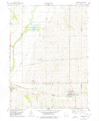 1978 Emerson1978 Print · USGSMills and Montgomery counties are captured here in the late seventies as the rail-and-river economy centered on Emerson and Hastings flourished. Genealogists can locate several local burial grounds including Hastings Cem and landmarks like the Nishua Valley Community Sch.
 - 1978 Map of Imogene
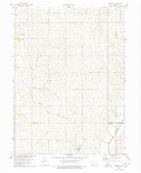 1978 Imogene1978 Print · USGSThe rural landscape of Fremont County is captured here in the late seventies, showing the rail-dependent settlement of Imogene and the surrounding farm country. Genealogists can trace family landmarks like Champion Hill Ch, the South Grove Cem, and the path of the Norfolk and Western railroad.
 - 1985 Map of Nebraska City
 1985 Nebraska City1985 Print · USGSThe Missouri River borderlands of Nebraska, Iowa, and Missouri come into focus in the mid-1980s, showcasing a landscape of river navigation and rail-fed agriculture. Researchers can trace the heritage of Nebraska City, follow the Burlington Northern tracks, or explore river landmarks like Jones Point and McKissick Island.
 - 1985 Map of Omaha
 1985 Omaha1985 Print · USGSMid-century development and heavy rail infrastructure define the Missouri River corridor between Nebraska and Iowa. Genealogists and local historians can trace the footprints of Offutt Air Force Base, Forest Lawn Cemetery, and the Iowa School for the Deaf.2 unique versions available
 - 1993 Map of Nebraska City
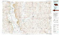 1993 Nebraska City1993 Print · USGSThe Missouri River valley and the rolling farmland of southwest Iowa are captured here in the early nineties, showing a landscape defined by water and rail. Researchers can trace the Burlington Northern lines or explore local landmarks like Arbor Lodge State Park and College Springs.
Showing maps 1-25 of 31
Top cities of Mills County
- Glenwood historical maps
- Malvern historical maps
- Emerson historical maps
- Silver City historical maps
- Henderson historical maps
- Mineola historical maps
See more
Frequently asked questions
- What are the different types of historical maps available for Mills County?
- What is the oldest map of Mills County?
- Where can I purchase historical maps of Mills County for my home or office?
- Where can I download high-res historical maps of Mills County?
- Are there historical topographic maps available for Mills County?
- Is there historical aerial imagery available for Mills County?
- Where are historical maps of Mills County sourced from?