
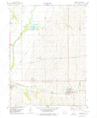
1978 Map of Carson
USGS Topo · Published 1978About this map
The West Nishnabotna River serves as the central artery for this portion of western Iowa, where the river valley carves through the agricultural lands of Carson, Macedonia, and Henderson. By the late 1970s, the landscape reflected a long history of settlement and infrastructure shifts, most notably evidenced by the Old Railroad Grade and Old RR Grade running parallel to the river near Macedonia. While the Burlington Northern line remained active further south through Henderson, these former rail corridors point to the evolving transportation network of the county. Local history is deeply etched into the landscape via sites like Old Town Cem and the Olde Town County Park, preserving the memory of earlier community centers. The map also documents the area's utility and industry, from the Gravel Pits north of Macedonia to the Weigh Station and Water Tank supporting the local economy.
Find a feature on this map
29 named features on this map. Tap any name to fly to it.
Don’t see what you’re looking for? This feature index may not catch every label — zoom into the map to look around manually.
Map Details
Editions of this 1978 Carson Map
This is the sole edition of this map. No revisions or reprints were ever made.
Other maps of this area

1954 · Omaha
USGS Topo · 1:250,000

1956 · Treynor
USGS Topo · 1:24,000

1956 · Malvern
USGS Topo · 1:24,000

1957 · Omaha
USGS Topo · 1:250,000

1957 · Taylor
USGS Topo · 1:24,000

1958 · Omaha
USGS Topo · 1:250,000

1963 · Avoca SE
USGS Topo · 1:24,000

1963 · Oakland
USGS Topo · 1:24,000
1978 · Emerson
USGS Topo · 1:24,000

1978 · Wales
USGS Topo · 1:24,000