
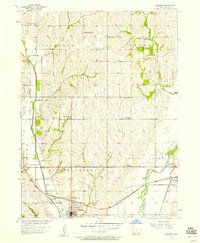
1956 Map of Malvern
USGS Topo · Published 1958About this map
Malvern serves as the focal point of this mid-century portrait of Mills County, situated at the busy intersection of the Chicago Burlington and Quincy and Wabash railroads. The landscape is defined by the broad valley of the West Nishnabotna River to the east and Silver Creek to the west. This era reveals a well-distributed network of rural infrastructure, including numerous one-room schoolhouses like Prairie Creek Sch and Wearin Sch that once anchored these farming townships. To the northeast, Hastings sits near the Hastings Cem, while spiritual life in the countryside is marked by St Johns Ch and East Liberty Ch. The map also captures specialized industrial markers of the time, such as the Gaging Sta on Silver Creek, illustrating the sophisticated water and transport management of the 1950s Iowa grain belt.
Find a feature on this map
24 named features on this map. Tap any name to fly to it.
Don’t see what you’re looking for? This feature index may not catch every label — zoom into the map to look around manually.
Map Details
Editions of this 1956 Malvern Map
2 editions found
Other maps of this area

1954 · Omaha
USGS Topo · 1:250,000

1955 · Nebraska City
USGS Topo · 1:250,000

1956 · Glenwood
USGS Topo · 1:24,000

1956 · Mineola
USGS Topo · 1:24,000

1956 · Treynor
USGS Topo · 1:24,000

1957 · Nebraska City
USGS Topo · 1:250,000

1957 · Omaha
USGS Topo · 1:250,000

1957 · Tabor
USGS Topo · 1:24,000

1957 · Tabor NE
USGS Topo · 1:24,000

1958 · Omaha
USGS Topo · 1:250,000