
1956 Map of Mineola
USGS Topo · Published 1957About this map
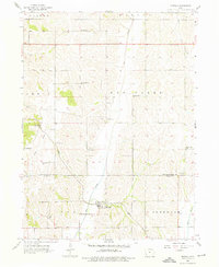
Mineola serves as the primary hub of this mid-century western Iowa landscape, situated at the junction of the Wabash railroad and the winding valley of Keg Creek. The map documents a strictly organized rural society defined by its townships, including Hardin, Lewis, and Ingraham, where the density of country schools like Sunnyside Sch and Evergreen Sch reflects the population distribution before the era of widespread school consolidation. The topography is dominated by the complex drainage systems of Silver Creek and Pony Creek, which carve deep into the loess hills typical of the Missouri River bluff lands.
Find a feature on this map
26 named features on this map. Tap any name to fly to it.
Don’t see what you’re looking for? This feature index may not catch every label — zoom into the map to look around manually.
Map Details
Editions of this 1956 Mineola Map
2 editions found
Other maps of this area

1893 · Omaha
USGS Topo · 1:62,500

1954 · Omaha
USGS Topo · 1:250,000

1956 · Glenwood
USGS Topo · 1:24,000

1956 · Council Bluffs North
USGS Topo · 1:24,000

1956 · Pacific Junction
USGS Topo · 1:24,000

1956 · Treynor
USGS Topo · 1:24,000

1956 · Mc Clelland
USGS Topo · 1:24,000

1956 · Council Bluffs South
USGS Topo · 1:24,000

1956 · Malvern
USGS Topo · 1:24,000

1957 · Omaha
USGS Topo · 1:250,000