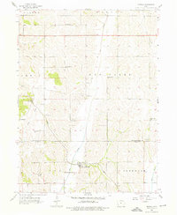
1956 Map of Mineola
USGS Topo · Published 1976About this map
Mineola sits at the heart of this mid-century rural landscape, positioned where the Wabash railroad line follows the valley of Keg Creek. The area is characterized by a dense network of country schools and churches that served the farming communities across Keg Creek and Ingraham townships. Genealogists will find significant value in the distribution of local landmarks, including St Paul Cem and the Evangelical Cem, alongside numerous small schoolhouses like Sunnyside Sch and Evergreen Sch. The inclusion of the Radio Range Station northwest of the Pottawattamie Co and Mills Co border highlights the technological infrastructure of the era. The settlement at Dumfries further reflects the historical development of these southwest Iowa prairie lands prior to the consolidation of rural districts.
Find a feature on this map
26 named features on this map. Tap any name to fly to it.
Don’t see what you’re looking for? This feature index may not catch every label — zoom into the map to look around manually.
Map Details
Editions of this 1956 Mineola Map
2 editions found
Other maps of this area

1893 · Omaha
USGS Topo · 1:62,500

1954 · Omaha
USGS Topo · 1:250,000

1956 · Glenwood
USGS Topo · 1:24,000

1956 · Mineola
USGS Topo · 1:24,000

1956 · Council Bluffs North
USGS Topo · 1:24,000

1956 · Pacific Junction
USGS Topo · 1:24,000

1956 · Treynor
USGS Topo · 1:24,000

1956 · Mc Clelland
USGS Topo · 1:24,000

1956 · Council Bluffs South
USGS Topo · 1:24,000

1956 · Malvern
USGS Topo · 1:24,000