Old Maps of Mitchell County, Iowa
Explore 116 old maps of Mitchell County, spanning from 1954 to today. These high-resolution historic maps reveal how streets, neighborhoods, landmarks, and natural features evolved over time — perfect for genealogy, metal detecting, research, and local history exploration.
What you can do with these maps:
- See how Mitchell County changed over time: Compare historical maps to modern-day views to trace roads, homesites, rail lines & more.
- View detailed metadata: Each map includes creators, publishers, year, scale, and archive source.
- Overlay maps with satellite & LiDAR: Visualize the past alongside modern tools to explore terrain & human change.
- Trusted historical sources: Maps sourced from the USGS, Library of Congress, and other archives.
- Access maps your way: View online, download high-res files, or order prints for personal or research use.
Start exploring old maps of Mitchell County to uncover forgotten places, hidden landmarks, and the deep history beneath your feet.
Mitchell County, IA maps
(116)- 1954 Map of Austin, 1956 Print
 1954 Austin1956 Print · USGSPost-war Mower County thrives as a rail and agricultural center during the mid-fifties. Researchers can locate numerous country schools and churches, from School No 101 to Hoffanda Ch, and trace the rail lines serving Austin and Rose Creek.2 unique versions available
 - 1954 Map of Mason City, 1967 Print
 1954 Mason City1967 Print · USGSSouthern Minnesota and northern Iowa are shown here at the height of the mid-century rail era, centered on the regional hubs of Mason City and Rochester. Researchers can trace the vanished paths of the Chicago Great Western and find local landmarks like Pilot Knob and Bear Lake.2 unique versions available
 - 1957 Map of Mason City
 1957 Mason City1957 Print · USGSThe Minnesota-Iowa border region comes alive in this mid-century survey, from the industrial plants of Mason City to the medical hub of Rochester. Researchers can trace the rail-and-river economy through the Chicago Great Western Railway and the Shell Rock River.
 - 1958 Map of Mason City
 1958 Mason City1958 Print · USGSSouthern Minnesota and northern Iowa are shown during the mid-fifties when railroads still anchored the regional economy. Genealogists and historians can trace the intricate rail networks of the Illinois Central and find local landmarks in Mason City, Albert Lea, and Austin.
 - 1959 Map of Mason City, 1961 Print
 1959 Mason City1961 Print · USGSNorth Central Iowa’s rail and river networks are captured here during the late fifties, centered on the bustling hub of Mason City. Genealogists and local historians can trace rural schools and cemeteries like Bath Sch No 9 and Rock Falls Cem alongside the industrial Claypits.
 - 1959 Map of Nora Springs, 1966 Print
 1959 Nora Springs1966 Print · USGSNora Springs and the Shell Rock River valley are captured here in the late fifties at a peak of mid-century rail and river industry. Genealogists and local historians can trace the Chicago Rock Island and Pacific rail lines, find Spring Grove Cem, or locate the Spotts Landing Field.
 - 1965 Map of Le Roy, 1966 Print
 1965 Le Roy1966 Print · USGSLe Roy was a bustling rail hub in the mid-1960s, situated at the junction of two major lines near the Iowa border. Genealogists and historians can trace local families through St Patricks Cem or explore the early layout of Lake Louise State Park.
 - 1965 Map of Adams, 1967 Print
 1965 Adams1967 Print · USGSSoutheast Minnesota's prairie border is shown here in the mid-1960s, where the grain-hauling rail lines of the era intersect at the village of Adams. Genealogists and researchers can trace the vicinity of Taopi, local churches like Marshall Ch, and the Woodlawn Cem.2 unique versions available
 - 1971 Map of Orchard, 1973 Print
 1971 Orchard1973 Print · USGSThe Cedar River valley in North Iowa is captured here in the early 1970s, showing a landscape defined by riverside conservation and small-town rail commerce. Genealogists and local historians can locate the Illinois Central tracks near Orchard or trace family sites at Tucker Cem and St Johns Ch.
 - 1971 Map of Rudd, 1973 Print
 1971 Rudd1973 Print · USGSThe rail-and-river corridor between Nora Springs and Rudd is documented here during the early 1970s. Researchers can locate local landmarks like Eden Ch, Evergreen Cem, and industrial sites such as the Quarry along the Rock Creek valley.
 - 1971 Map of Colwell, 1973 Print
 1971 Colwell1973 Print · USGSUpper Iowa farm country and the meeting of four counties are captured here in the early seventies as the rail era left its mark on the land. Genealogists and historians can trace the Old Grade Railroad, find St Cecilia Ch, and locate Beckwith Cem.
 - 1971 Map of Floyd, 1973 Print
 1971 Floyd1973 Print · USGSThe Little Cedar River valley in the early seventies shows a transition between traditional Iowa farmsteads and modern infrastructure. You can trace the path of the Illinois Central and an Old Railroad Grade past Floyd and Howardville Cem.
 - 1972 Map of Osage, 1974 Print
 1972 Osage1974 Print · USGSMitchell County in the early seventies centers on the bustling seat of Osage and the banks of the Cedar River. Genealogists and local historians can trace the foundations of the community through Sacred Heart Church, Oak Grove Cemetery, and the Old Grade Railroad.
 - 1972 Map of St. Ansgar, 1974 Print
 1972 St. Ansgar1974 Print · USGSMitchell County and the Minnesota border come into focus in the 1970s as the rail-and-river economy centers on the Cedar River. Genealogists can trace family names through rural landmarks like Rustad Cem, Ogden Cem, and the small settlement of Toeterville.
 - 1972 Map of Mc Intire, 1974 Print
 1972 Mc Intire1974 Print · USGSThe northern Iowa borderlands near the Minnesota line appear here in the early seventies, centered on the McIntire rail corridor. Researchers can find Wayne Cem, trace the winding Wapsipinicon River, and locate several stretches of Old Railroad Grade.
 - 1972 Map of Little Cedar, 1974 Print
 1972 Little Cedar1974 Print · USGSThe Mitchell County borderlands appear in the early 1970s as a landscape shaped by river valleys and old transport routes. Genealogists and historians can trace family ties at St Patrick Cem or locate the village of Little Cedar and the Old Railroad Grade.
 - 1972 Map of New Haven, 1974 Print
 1972 New Haven1974 Print · USGSThe Mitchell County countryside in the early 1970s shows a landscape defined by the Little Cedar River and local townships. Researchers can trace the Old Railroad Grade, locate the community of New Haven, and explore the grounds of Pioneer State Park.
 - 1972 Map of Riceville, 1974 Print
 1972 Riceville1974 Print · USGSRiceville and the surrounding townships in the early seventies remain centered on the Wapsipinicon River and the Chicago and North Western line. Genealogists and local historians can locate several rural burial grounds like St Peters Cem and Reckner Cem, or trace the small settlement at Dishinger.
 - 1972 Map of Osage SW, 1974 Print
 1972 Osage SW1974 Print · USGSMitchell County in the early seventies shows a landscape defined by the winding Cedar River and its rail connections. Genealogists can locate several local burial grounds including Brakestad Cem and St Johns Cem, alongside the historic settlement at St Ansgar.
 - 1972 Map of Stacyville, 1974 Print
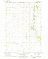 1972 Stacyville1974 Print · USGSStacyville and the surrounding Mitchell County townships are captured here in the early seventies as the local agricultural and rail economy thrived. Researchers can trace family history at Toeter Cem, locate the Union Ch, and follow the Illinois Central Gulf railroad tracks through the heart of town.
 - 1972 Map of Grafton, 1975 Print
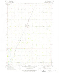 1972 Grafton1975 Print · USGSWorth County's agricultural heartland is captured here in the early seventies, showing a landscape defined by rail lines and section-grid farming. Genealogists and local historians can trace family farmsteads near Grafton, find the Grafton Cem, and follow the Shell Rock River past Plymouth.
 - 1972 Map of Carpenter, 1975 Print
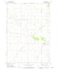 1972 Carpenter1975 Print · USGSThe Iowa-Minnesota border region is captured here in the early 1970s as a thriving rail and agricultural corridor. Genealogists and local historians can trace the rural landscape through landmarks like Newburg Cem, the village of Meltonville, and Deer Creek Ch.
 - 1982 Map of Rose Creek, 1983 Print
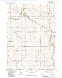 1982 Rose Creek1983 Print · USGSSouthern Minnesota farmland meets the Iowa border in the early 1980s, centered on the rail-side community of Rose Creek. Genealogists and local historians can trace the tracks of the Milwaukee Road, locate the rural Johnsburg settlement, and find family markers at St Peter Cem.
 - 1985 Map of Mason City
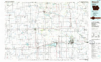 1985 Mason City1985 Print · USGSThe Northern Iowa and Southern Minnesota borderlands are captured here in the mid-eighties, showing a region defined by agricultural drainage and rail heritage. Genealogists and historians can trace the grid of rural townships and find local landmarks like Pilot Knob State Park, Nora Springs, and Clear Lake State Park.2 unique versions available
 - 1985 Map of Charles City
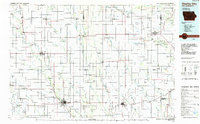 1985 Charles City1985 Print · USGSNorthern Iowa and the Minnesota borderlands are mapped here in the mid-1980s as a thriving network of rail-side towns and river valleys. Trace local history through the Reilly Settlement, Stacyville Junction, and aviation sites like Ellen Church Field.2 unique versions available
Showing maps 1-25 of 116
Top cities of Mitchell County
- Osage historical maps
- Saint Ansgar historical maps
- Stacyville historical maps
- Mitchell historical maps
- McIntire historical maps
- Carpenter historical maps
See more
Frequently asked questions
- What are the different types of historical maps available for Mitchell County?
- What is the oldest map of Mitchell County?
- Where can I purchase historical maps of Mitchell County for my home or office?
- Where can I download high-res historical maps of Mitchell County?
- Are there historical topographic maps available for Mitchell County?
- Is there historical aerial imagery available for Mitchell County?
- Where are historical maps of Mitchell County sourced from?