1960s Maps of Mitchell County, Iowa
Explore 2 historic maps of Mitchell County from the 1960s. These maps offer a rare glimpse into what life looked like during the 1960s — showing old roads, neighborhoods, homes, and landmarks that have changed or disappeared over time.
Whether you're researching your family's past, planning a metal detecting trip, or studying how Mitchell County's landscape evolved across the 1960s, these high-resolution maps are a powerful tool for exploring the history of this region.
- Focus on a specific era: All maps on this page are from the 1960s, giving you a focused view of this time period.
- See what’s changed: Compare century-old streets, trails, and buildings to today's modern landscape using overlays and satellite layers.
- Research with precision: Use these maps for genealogy, historical research, land use analysis, or educational projects.
- View, download, or print: Maps are fully viewable online in high resolution, and can be downloaded or printed for your own records.
Start exploring Mitchell County's history through authentic maps from the 1960s. This is your window into the past.
Mitchell County, IA maps
(2)- 1965 Map of Le Roy, 1966 Print
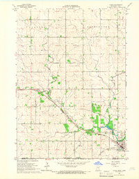 1965 Le Roy1966 Print · USGSLe Roy was a bustling rail hub in the mid-1960s, situated at the junction of two major lines near the Iowa border. Genealogists and historians can trace local families through St Patricks Cem or explore the early layout of Lake Louise State Park.
 - 1965 Map of Adams, 1967 Print
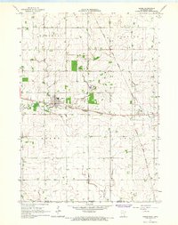 1965 Adams1967 Print · USGSSoutheast Minnesota's prairie border is shown here in the mid-1960s, where the grain-hauling rail lines of the era intersect at the village of Adams. Genealogists and researchers can trace the vicinity of Taopi, local churches like Marshall Ch, and the Woodlawn Cem.2 unique versions available
End of results
Showing maps 1-2 of 2
Top cities of Mitchell County
- Osage historical maps
- Saint Ansgar historical maps
- Stacyville historical maps
- Mitchell historical maps
- McIntire historical maps
- Carpenter historical maps
See more
Frequently asked questions
- What are the different types of historical maps available for Mitchell County?
- What is the oldest map of Mitchell County?
- Where can I purchase historical maps of Mitchell County for my home or office?
- Where can I download high-res historical maps of Mitchell County?
- Are there historical topographic maps available for Mitchell County?
- Is there historical aerial imagery available for Mitchell County?
- Where are historical maps of Mitchell County sourced from?