1960s Maps of O'Brien County, Iowa
Explore 7 historic maps of O'Brien County from the 1960s. These maps offer a rare glimpse into what life looked like during the 1960s — showing old roads, neighborhoods, homes, and landmarks that have changed or disappeared over time.
Whether you're researching your family's past, planning a metal detecting trip, or studying how O'Brien County's landscape evolved across the 1960s, these high-resolution maps are a powerful tool for exploring the history of this region.
- Focus on a specific era: All maps on this page are from the 1960s, giving you a focused view of this time period.
- See what’s changed: Compare century-old streets, trails, and buildings to today's modern landscape using overlays and satellite layers.
- Research with precision: Use these maps for genealogy, historical research, land use analysis, or educational projects.
- View, download, or print: Maps are fully viewable online in high resolution, and can be downloaded or printed for your own records.
Start exploring O'Brien County's history through authentic maps from the 1960s. This is your window into the past.
O'Brien County, IA maps
(7)- 1964 Map of Sheldon SE, 1965 Print
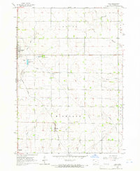
 1964 Sheldon SE1965 Print · USGSO'Brien and Sioux Counties appear in the mid-1960s as a structured landscape of established farmsteads and rural townships. Researchers can trace local landmarks like Philby, the Baker Ch, and the corridor of the Illinois Central railroad.
 - 1964 Map of Sheldon, 1965 Print
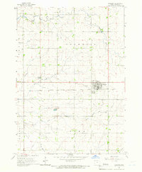
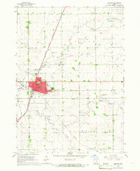 1964 Sheldon1965 Print · USGSSheldon was a bustling rail hub in the mid-1960s where three major lines converged amidst the fertile farmland of the Sioux and O'Brien county line. Researchers can trace the city's growth through landmarks like the Municipal Airport, St Patricks Sch, and the Illinois Central tracks.
 - 1964 Map of Primghar, 1966 Print
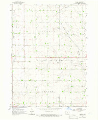
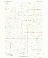
 1964 Primghar1966 Print · USGSPrimghar and the surrounding O'Brien County prairie are captured in the mid-1960s as a well-ordered landscape of agriculture and rail transport. Genealogists and local historians can locate early burial sites at Pleasant Hill Cem or trace the Illinois Central line through Archer.
 - 1964 Map of Plessis, 1966 Print
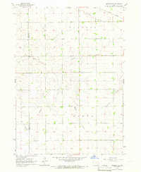
 1964 Plessis1966 Print · USGSO'Brien County farmland in the mid-1960s is defined by a dense grid of rural townships and the convergence of two major rail lines. Genealogists can trace the rural infrastructure around Plessis and Epping or locate the local Cem near Little Waterman Creek.
 - 1964 Map of Gaza, 1966 Print
 1964 Gaza1966 Print · USGSNorthwest Iowa's farm country comes into focus in the mid-1960s as small railroad towns like Gaza and Primghar thrive. Genealogists and historians can trace the Illinois Central tracks, family-named waterways, and local sites like the Lutheran Cem and Doyle Cem.
 - 1964 Map of Sanborn, 1966 Print
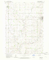
 1964 Sanborn1966 Print · USGSMid-century O'Brien County is captured here at a time when the Milwaukee Road still anchored the town of Sanborn. Genealogists and local historians can trace family plots at Roseland Cem or follow the meandering Floyd River through the townships of Franklin and Summit.
 - 1969 Map of Granville East, 1971 Print
 1969 Granville East1971 Print · USGSNorthwest Iowa's farm country comes into focus in the late sixties, where rail lines and section roads define the prairie. Genealogists and local historians can trace family ties at St Josephs Cem or locate the village of Germantown near Whiskey Creek.
End of results
Showing maps 1-7 of 7
Top cities of O'Brien County
- Sheldon historical maps
- Hartley historical maps
- Sanborn historical maps
- Paullina historical maps
- Primghar historical maps
- Sutherland historical maps
See more
Frequently asked questions
- What are the different types of historical maps available for O'Brien County?
- What is the oldest map of O'Brien County?
- Where can I purchase historical maps of O'Brien County for my home or office?
- Where can I download high-res historical maps of O'Brien County?
- Are there historical topographic maps available for O'Brien County?
- Is there historical aerial imagery available for O'Brien County?
- Where are historical maps of O'Brien County sourced from?