Old Maps of O'Brien County, Iowa for Genealogy
Trace your family roots with 103 historic maps of O'Brien County. These high-res maps reveal old neighborhoods, homesites, landmarks, and streets — helping you uncover where your ancestors lived and how the area evolved over time.
- Explore historic neighborhoods: Identify where your relatives may have lived in the 1800s or 1900s.
- Compare maps over time: Trace the changes in streets, buildings, and landmarks for multi-generational research.
- Perfect for genealogy & ancestry research: Used by family historians and researchers to map out lineage and migration.
These maps are an incredible resource for exploring your personal connection to O'Brien County's past.
O'Brien County, IA maps
(103)- 1954 Map of Fairmont, 1967 Print
 1954 Fairmont1967 Print · USGSThe prairie landscape of southern Minnesota and northern Iowa comes alive in this mid-century survey of the Coteau des Prairies. Genealogists and historians can trace the rail-connected growth of Fairmont and Blue Earth or locate family roots near St Kilian Ch and Union Slough National Wildlife Refuge.3 unique versions available
 - 1954 Map of Fort Dodge, 1968 Print
 1954 Fort Dodge1968 Print · USGSNorthwest Iowa is shown here during a period of steady industrial and rail activity in the mid-fifties. Researchers can trace the extensive rail lines connecting Fort Dodge to mining and manufacturing sites like Gypsum and Industry Station.3 unique versions available
 - 1957 Map of Fort Dodge
 1957 Fort Dodge1957 Print · USGSWest-central Iowa thrived as a network of rail-linked agricultural hubs and river towns during the mid-fifties. Researchers can trace the development of the Des Moines River valley and locate historic landmarks in Fort Dodge, Storm Lake, and Lehigh.
 - 1958 Map of Fort Dodge
 1958 Fort Dodge1958 Print · USGSWestern Iowa in the mid-1950s reveals a productive landscape of river-valley industry and prairie agricultural hubs. Researchers can trace the development of the Des Moines River corridor through Fort Dodge and locate vanished local landmarks near Coalville or Storm Lake.
 - 1958 Map of Fairmont
 1958 Fairmont1958 Print · USGSThe borderlands of southern Minnesota and northern Iowa come alive in the mid-1950s, showing a landscape defined by glacial lakes and rail-line commerce. Researchers can trace historic landmarks like Lakeside Laboratory, Gridley Station, and the Bancroft Wildlife Refuge across the prairie.
 - 1964 Map of Sheldon SE, 1965 Print
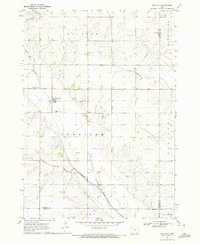
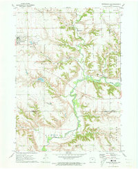
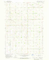 1964 Sheldon SE1965 Print · USGSO'Brien and Sioux Counties appear in the mid-1960s as a structured landscape of established farmsteads and rural townships. Researchers can trace local landmarks like Philby, the Baker Ch, and the corridor of the Illinois Central railroad.
 - 1964 Map of Sheldon, 1965 Print
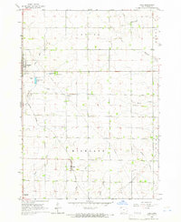
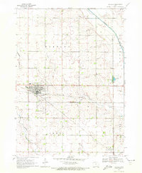
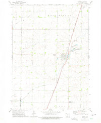
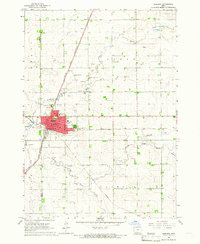 1964 Sheldon1965 Print · USGSSheldon was a bustling rail hub in the mid-1960s where three major lines converged amidst the fertile farmland of the Sioux and O'Brien county line. Researchers can trace the city's growth through landmarks like the Municipal Airport, St Patricks Sch, and the Illinois Central tracks.
 - 1964 Map of Primghar, 1966 Print
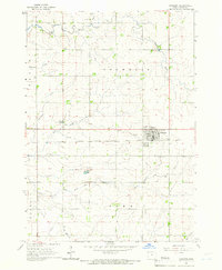
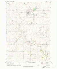
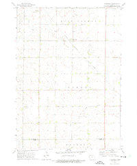
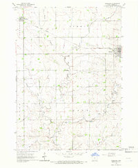 1964 Primghar1966 Print · USGSPrimghar and the surrounding O'Brien County prairie are captured in the mid-1960s as a well-ordered landscape of agriculture and rail transport. Genealogists and local historians can locate early burial sites at Pleasant Hill Cem or trace the Illinois Central line through Archer.
 - 1964 Map of Plessis, 1966 Print
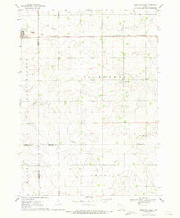
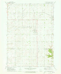
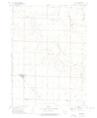
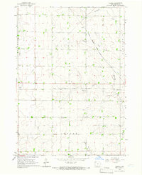 1964 Plessis1966 Print · USGSO'Brien County farmland in the mid-1960s is defined by a dense grid of rural townships and the convergence of two major rail lines. Genealogists can trace the rural infrastructure around Plessis and Epping or locate the local Cem near Little Waterman Creek.
 - 1964 Map of Gaza, 1966 Print
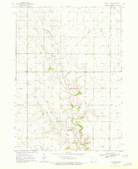
 1964 Gaza1966 Print · USGSNorthwest Iowa's farm country comes into focus in the mid-1960s as small railroad towns like Gaza and Primghar thrive. Genealogists and historians can trace the Illinois Central tracks, family-named waterways, and local sites like the Lutheran Cem and Doyle Cem.
 - 1964 Map of Sanborn, 1966 Print
 1964 Sanborn1966 Print · USGSMid-century O'Brien County is captured here at a time when the Milwaukee Road still anchored the town of Sanborn. Genealogists and local historians can trace family plots at Roseland Cem or follow the meandering Floyd River through the townships of Franklin and Summit.
 - 1969 Map of Granville East, 1971 Print
 1969 Granville East1971 Print · USGSNorthwest Iowa's farm country comes into focus in the late sixties, where rail lines and section roads define the prairie. Genealogists and local historians can trace family ties at St Josephs Cem or locate the village of Germantown near Whiskey Creek.
 - 1970 Map of Hartley SW, 1972 Print
 1970 Hartley SW1972 Print · USGSNorthwestern Iowa farm country is documented here during the early seventies, showing the section-line roads and stream networks of O’Brien and Clay counties. Researchers can trace land ownership patterns across Grant and Omega or follow the winding courses of Waterman Creek and McCreath Creek.
 - 1970 Map of Hartley, 1972 Print
 1970 Hartley1972 Print · USGSNorthwest Iowa's farm country is documented here during the early seventies, centered on the bustling rail junction at Hartley. Genealogists and local historians can trace the town's development through its High School, Pleasant View Cemetery, and the small southern settlement of Moneta.
 - 1970 Map of May City, 1972 Print
 1970 May City1972 Print · USGSOsceola County and its neighbors are shown here in the early seventies, a landscape of section-line roads and river valleys. Genealogists can locate Mennonite Cemetery and Harrison Cemetery near the crossroads of May City.
 - 1971 Map of Paullina, 1973 Print
 1971 Paullina1973 Print · USGSNorthwestern Iowa's agricultural landscape is captured here in the early 1970s, centered on the rail-connected town of Paullina. Researchers can locate family landmarks like West Prairie View Cem, the Oakdale Ch, and early recreation at Mill Creek State Park.
 - 1971 Map of Sutherland West, 1973 Print
 1971 Sutherland West1973 Print · USGSNorthwestern Iowa farm country is captured here in the early seventies, centered on the rail communities of Sutherland and Calumet. Genealogists and local researchers can trace family lands near Liberty Cem or locate old industrial sites like the local Gravel Pits.
 - 1971 Map of Sutherland East, 1973 Print
 1971 Sutherland East1973 Print · USGSSutherland and the Little Sioux River valley are captured here in the early 1970s, showing a landscape defined by prairie agriculture and river bluffs. Researchers can locate Waterman Cem, the Chicago and North Western line, and Indian Village State Park.
 - 1972 Map of Ashton, 1975 Print
 1972 Ashton1975 Print · USGSOsceola County and the town of Ashton are captured in the early seventies, showcasing a landscape of rail-connected commerce and prairie agriculture. Genealogists and local historians can trace family plots at St Marys Cem or locate the site of Willemssen along the county line.
 - 1972 Map of Cloverdale, 1975 Print
 1972 Cloverdale1975 Print · USGSOsceola County and O'Brien County are captured in the early 1970s, showcasing a rural Iowa landscape defined by sectioned farmland and rail transit. Trace the corridor of the Chicago Rock Island and Pacific railroad through the settlement of Cloverdale and along the North Fork Floyd River.
 - 1972 Map of Melvin, 1975 Print
 1972 Melvin1975 Print · USGSThe rural landscape of Osceola County is captured in the early 1970s, centered on the rail-side community of Melvin. Researchers can trace the Chicago Rock Island and Pacific railroad line, locate the Township Cem, and follow the Little Ocheyedan River as it winds through the prairie.
 - 1985 Map of Storm Lake
 1985 Storm Lake1985 Print · USGSNorthwest Iowa's agricultural heartland is documented here in the mid-eighties, showing the vital rail-and-river network of the Little Sioux valley. Researchers can trace the legacy of regional hubs and smaller rail towns like Sutherland, Paullina, and Cherokee.3 unique versions available
 - 1985 Map of Iowa Great Lakes
 1985 Iowa Great Lakes1985 Print · USGSNorthwest Iowa’s glacial lakes and prairie towns are captured here in the mid-1980s, showing a landscape balanced between agriculture and lakeside recreation. Genealogists and historians can locate family sites near Holman Cem or trace the early rail corridors of the Chicago and North Western and the Chicago Milwaukee St Paul and Pacific.2 unique versions available
 - 2010 Map of Granville East, 2010 Print
 2010 Granville East2010 Print · USGSCovers O'Brien County, including Granville, Germantown, and other nearby areas
 - 2010 Map of Paullina, 2010 Print
 2010 Paullina2010 Print · USGSCovers O'Brien County, including Paullina, Cherokee County, and other nearby areas
Showing maps 1-25 of 103
Top cities of O'Brien County
- Sheldon historical maps
- Hartley historical maps
- Sanborn historical maps
- Paullina historical maps
- Primghar historical maps
- Sutherland historical maps
See more
Frequently asked questions
- What are the different types of historical maps available for O'Brien County?
- What is the oldest map of O'Brien County?
- Where can I purchase historical maps of O'Brien County for my home or office?
- Where can I download high-res historical maps of O'Brien County?
- Are there historical topographic maps available for O'Brien County?
- Is there historical aerial imagery available for O'Brien County?
- Where are historical maps of O'Brien County sourced from?