1970s Maps of O'Brien County, Iowa
Explore 9 historic maps of O'Brien County from the 1970s. These maps offer a rare glimpse into what life looked like during the 1970s — showing old roads, neighborhoods, homes, and landmarks that have changed or disappeared over time.
Whether you're researching your family's past, planning a metal detecting trip, or studying how O'Brien County's landscape evolved across the 1970s, these high-resolution maps are a powerful tool for exploring the history of this region.
- Focus on a specific era: All maps on this page are from the 1970s, giving you a focused view of this time period.
- See what’s changed: Compare century-old streets, trails, and buildings to today's modern landscape using overlays and satellite layers.
- Research with precision: Use these maps for genealogy, historical research, land use analysis, or educational projects.
- View, download, or print: Maps are fully viewable online in high resolution, and can be downloaded or printed for your own records.
Start exploring O'Brien County's history through authentic maps from the 1970s. This is your window into the past.
O'Brien County, IA maps
(9)- 1970 Map of Hartley SW, 1972 Print
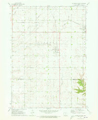
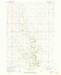 1970 Hartley SW1972 Print · USGSNorthwestern Iowa farm country is documented here during the early seventies, showing the section-line roads and stream networks of O’Brien and Clay counties. Researchers can trace land ownership patterns across Grant and Omega or follow the winding courses of Waterman Creek and McCreath Creek.
 - 1970 Map of Hartley, 1972 Print
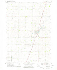
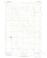
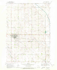 1970 Hartley1972 Print · USGSNorthwest Iowa's farm country is documented here during the early seventies, centered on the bustling rail junction at Hartley. Genealogists and local historians can trace the town's development through its High School, Pleasant View Cemetery, and the small southern settlement of Moneta.
 - 1970 Map of May City, 1972 Print
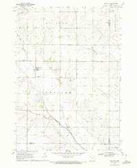 1970 May City1972 Print · USGSOsceola County and its neighbors are shown here in the early seventies, a landscape of section-line roads and river valleys. Genealogists can locate Mennonite Cemetery and Harrison Cemetery near the crossroads of May City.
 - 1971 Map of Paullina, 1973 Print
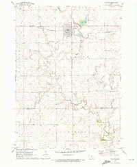 1971 Paullina1973 Print · USGSNorthwestern Iowa's agricultural landscape is captured here in the early 1970s, centered on the rail-connected town of Paullina. Researchers can locate family landmarks like West Prairie View Cem, the Oakdale Ch, and early recreation at Mill Creek State Park.
 - 1971 Map of Sutherland West, 1973 Print
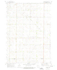
 1971 Sutherland West1973 Print · USGSNorthwestern Iowa farm country is captured here in the early seventies, centered on the rail communities of Sutherland and Calumet. Genealogists and local researchers can trace family lands near Liberty Cem or locate old industrial sites like the local Gravel Pits.
 - 1971 Map of Sutherland East, 1973 Print
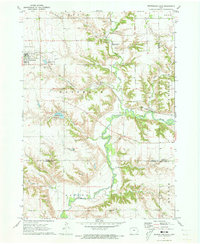 1971 Sutherland East1973 Print · USGSSutherland and the Little Sioux River valley are captured here in the early 1970s, showing a landscape defined by prairie agriculture and river bluffs. Researchers can locate Waterman Cem, the Chicago and North Western line, and Indian Village State Park.
 - 1972 Map of Ashton, 1975 Print
 1972 Ashton1975 Print · USGSOsceola County and the town of Ashton are captured in the early seventies, showcasing a landscape of rail-connected commerce and prairie agriculture. Genealogists and local historians can trace family plots at St Marys Cem or locate the site of Willemssen along the county line.
 - 1972 Map of Cloverdale, 1975 Print
 1972 Cloverdale1975 Print · USGSOsceola County and O'Brien County are captured in the early 1970s, showcasing a rural Iowa landscape defined by sectioned farmland and rail transit. Trace the corridor of the Chicago Rock Island and Pacific railroad through the settlement of Cloverdale and along the North Fork Floyd River.
 - 1972 Map of Melvin, 1975 Print
 1972 Melvin1975 Print · USGSThe rural landscape of Osceola County is captured in the early 1970s, centered on the rail-side community of Melvin. Researchers can trace the Chicago Rock Island and Pacific railroad line, locate the Township Cem, and follow the Little Ocheyedan River as it winds through the prairie.
End of results
Showing maps 1-9 of 9
Top cities of O'Brien County
- Sheldon historical maps
- Hartley historical maps
- Sanborn historical maps
- Paullina historical maps
- Primghar historical maps
- Sutherland historical maps
See more
Frequently asked questions
- What are the different types of historical maps available for O'Brien County?
- What is the oldest map of O'Brien County?
- Where can I purchase historical maps of O'Brien County for my home or office?
- Where can I download high-res historical maps of O'Brien County?
- Are there historical topographic maps available for O'Brien County?
- Is there historical aerial imagery available for O'Brien County?
- Where are historical maps of O'Brien County sourced from?