2020s Maps of Merrill, Iowa
Explore 2 historic maps of Merrill from the 2020s. These maps offer a rare glimpse into what life looked like during the 2020s — showing old roads, neighborhoods, homes, and landmarks that have changed or disappeared over time.
Whether you're researching your family's past, planning a metal detecting trip, or studying how Merrill's landscape evolved across the 2020s, these high-resolution maps are a powerful tool for exploring the history of this region.
- Focus on a specific era: All maps on this page are from the 2020s, giving you a focused view of this time period.
- See what’s changed: Compare century-old streets, trails, and buildings to today's modern landscape using overlays and satellite layers.
- Research with precision: Use these maps for genealogy, historical research, land use analysis, or educational projects.
- View, download, or print: Maps are fully viewable online in high resolution, and can be downloaded or printed for your own records.
Start exploring Merrill's history through authentic maps from the 2020s. This is your window into the past.
Merrill, IA maps
(2)- 2022 Map of Hinton, 2022 Print
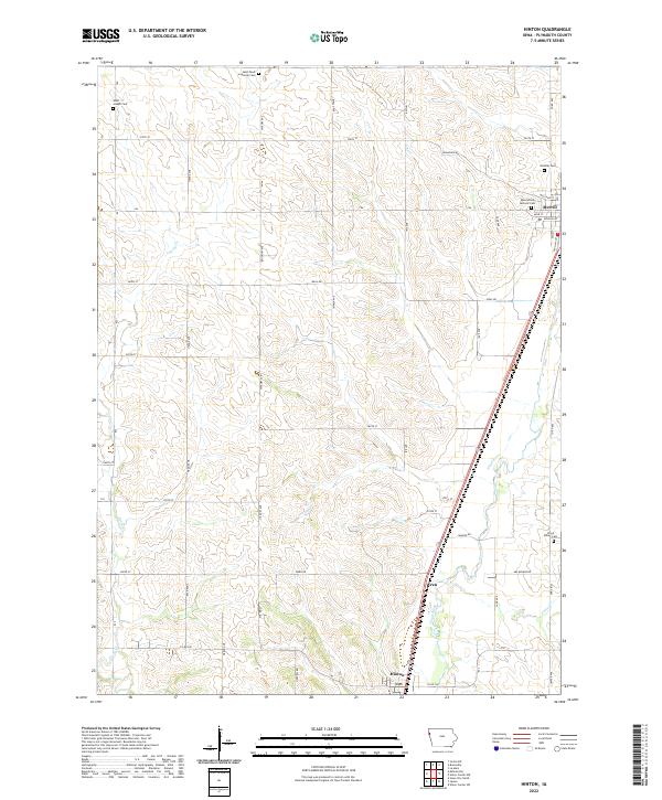 2022 Hinton2022 Print · USGSWestern Iowa's agricultural heartland is documented here in the early 2020s as it follows the Floyd River corridor. Genealogists can locate several local burial sites including Saint Pauls Lutheran Cem and Hillside Cem near the town of Merrill.
 - 2022 Map of Union Center NW, 2022 Print
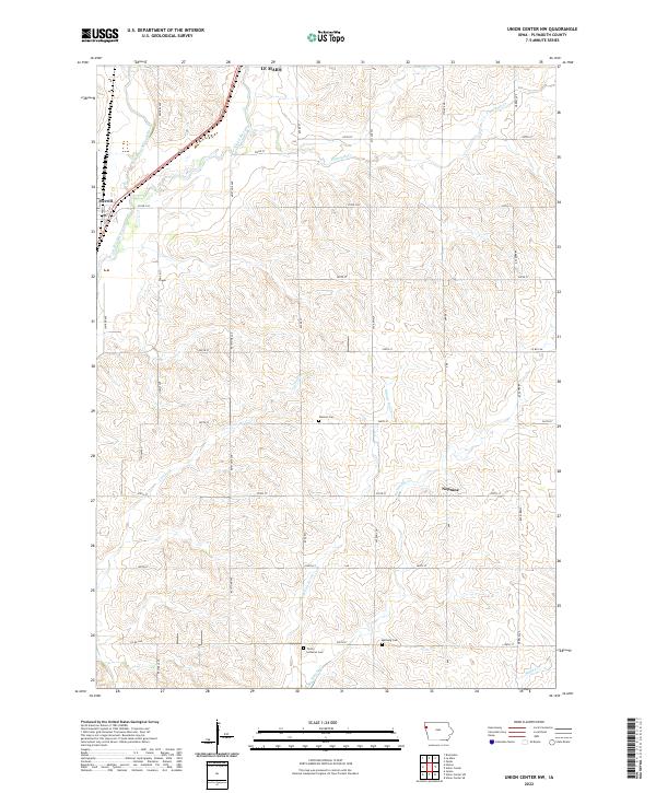 2022 Union Center NW2022 Print · USGSPlymouth County's agricultural heartland is documented here in the early 2020s, showing the rural grid south of Le Mars. Genealogists can locate family landmarks like Stanton Cem, Mathwig Cem, and the riverside settlement of Merrill along the Floyd River.
End of results
Showing maps 1-2 of 2
Top cities near Merrill
- Sioux City historical maps
- Le Mars historical maps
- Dakota Dunes historical maps
- Moville historical maps
- Hinton historical maps
- Brunsville historical maps
See more
Frequently asked questions
- What are the different types of historical maps available for Merrill?
- What is the oldest map of Merrill?
- Where can I purchase historical maps of Merrill for my home or office?
- Where can I download high-res historical maps of Merrill?
- Are there historical topographic maps available for Merrill?
- Is there historical aerial imagery available for Merrill?
- Where are historical maps of Merrill sourced from?