Old Maps of Moville, Iowa
Explore 18 old maps of Moville, spanning from 1955 to today. These high-resolution historic maps reveal how streets, neighborhoods, landmarks, and natural features evolved over time — perfect for genealogy, metal detecting, research, and local history exploration.
What you can do with these maps:
- See how Moville changed over time: Compare historical maps to modern-day views to trace roads, homesites, rail lines & more.
- View detailed metadata: Each map includes creators, publishers, year, scale, and archive source.
- Overlay maps with satellite & LiDAR: Visualize the past alongside modern tools to explore terrain & human change.
- Trusted historical sources: Maps sourced from the USGS, Library of Congress, and other archives.
- Access maps your way: View online, download high-res files, or order prints for personal or research use.
Start exploring old maps of Moville to uncover forgotten places, hidden landmarks, and the deep history beneath your feet.
Moville, IA maps
(18)- 1955 Map of Sioux City, 1959 Print
 1955 Sioux City1959 Print · USGSThe Missouri River valley in the mid-fifties is captured here during a time of major engineering and social transition. Genealogists and historians can trace the foundations of Gavins Point Dam, tribal boundaries on the Santee Sioux Indian Reservation, and local landmarks like the Norfolk State Hospital.4 unique versions available
 - 1958 Map of Sioux City
 1958 Sioux City1958 Print · USGSThe Missouri River valley in the late fifties was a bustling intersection of tribal lands, rail corridors, and river towns. Genealogists can trace family roots through specific rural sites like Daisy Valley School, St Johns Church and School, and Yankton State Hospital.
 - 1959 Map of Sioux City
 1959 Sioux City1959 Print · USGSThe tri-state region surrounding the Missouri River is captured here in the late fifties, showing the convergence of Nebraska, South Dakota, and Iowa. Researchers can trace rural lineages through numerous country schoolhouses like Cemetery School and the many numbered Washington School districts.
 - 1962 Map of Union Center, 1964 Print
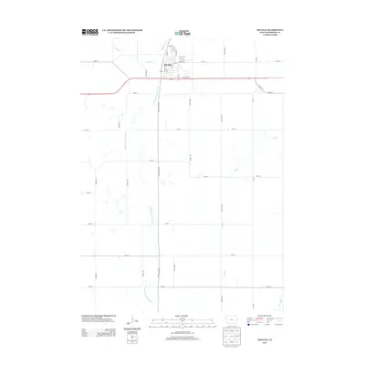
 1962 Union Center1964 Print · USGSThe agricultural heartland of Plymouth and Woodbury Counties is documented here in the early sixties, showing a landscape defined by rail lines and section roads. Researchers can locate family landmarks like St Josephs Cem, the small settlement of Neptune, and the path of the Illinois Central Railroad through Merrill.
 - 1964 Map of Moville, 1966 Print
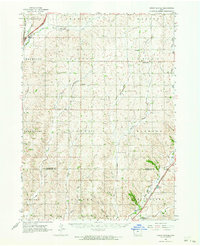
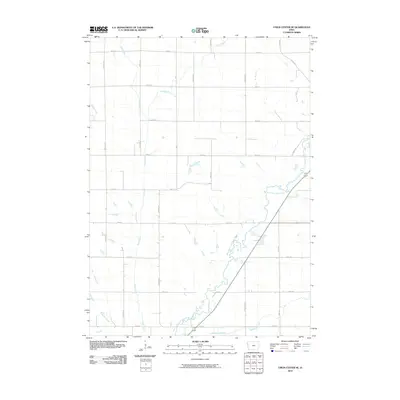
 1964 Moville1966 Print · USGSMoville and the surrounding Woodbury County townships are documented here during the mid-1960s, showcasing a classic Iowa agricultural and rail landscape. Genealogists and local researchers can locate Arlington Cem, the Fairground, and the route of the Chicago and North Western railroad.
 - 1985 Map of Union Center SE, 1986 Print
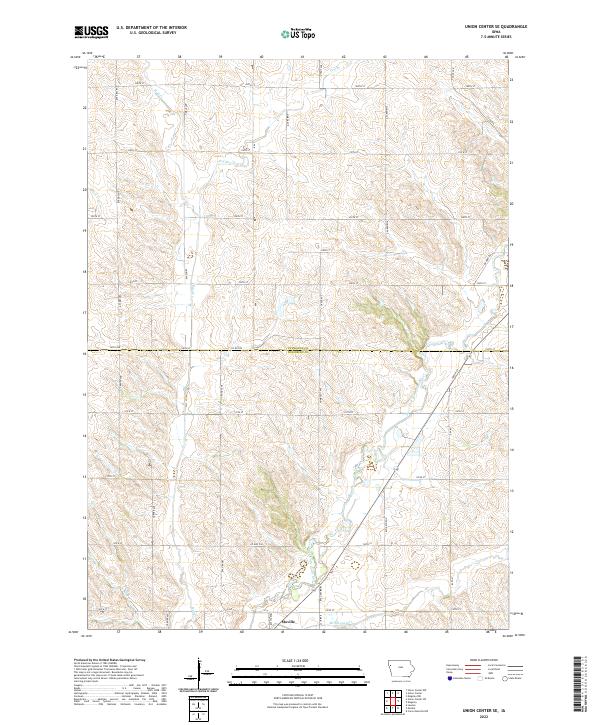
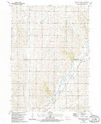 1985 Union Center SE1986 Print · USGSThe rural borderlands of Woodbury and Plymouth Counties are captured here in the mid-eighties, defined by the winding Little Sioux River. Researchers can trace old property lines across LINCOLN and ARLINGTON townships or locate land markers like Southeast Wildwood County Park and various Gravel Pits.
 - 1986 Map of Sioux City North
 1986 Sioux City North1986 Print · USGSThe tri-state borderlands of Iowa, South Dakota, and Nebraska are captured here in the mid-eighties as the region's agricultural and academic centers thrived. Researchers can trace historic rail lines like the Illinois Central Gulf and locate landmarks from Briar Cliff College to the heights of Spirit Mound.2 unique versions available
 - 1986 Map of Sioux City South
 1986 Sioux City South1986 Print · USGSThe tri-state borderlands of Iowa, Nebraska, and South Dakota come into focus in the mid-1980s as a landscape of tribal lands and rail corridors. Researchers can trace the extensive boundaries of the Winnebago Indian Reservation and find local landmarks like Morningside College and Martin Field.2 unique versions available
 - 2010 Map of Moville, 2010 Print
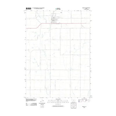 2010 Moville2010 Print · USGSCovers Moville, including Woodbury County, United States, and other nearby areas
 - 2010 Map of Union Center SE, 2010 Print
 2010 Union Center SE2010 Print · USGSCovers Moville, including Woodbury County, Plymouth County, and other nearby areas
 - 2013 Map of Union Center SE, 2013 Print
 2013 Union Center SE2013 Print · USGSCovers Moville, including Woodbury County, Plymouth County, and other nearby areas
 - 2013 Map of Moville, 2013 Print
 2013 Moville2013 Print · USGSCovers Moville, including Woodbury County, United States, and other nearby areas
 - 2015 Map of Union Center SE, 2015 Print
 2015 Union Center SE2015 Print · USGSCovers Moville, including Woodbury County, Plymouth County, and other nearby areas
 - 2015 Map of Moville, 2015 Print
 2015 Moville2015 Print · USGSCovers Moville, including Woodbury County, United States, and other nearby areas
 - 2018 Map of Union Center SE, 2018 Print
 2018 Union Center SE2018 Print · USGSCovers Moville, including Woodbury County, Plymouth County, and other nearby areas
 - 2018 Map of Moville, 2018 Print
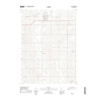 2018 Moville2018 Print · USGSCovers Moville, including Woodbury County, United States, and other nearby areas
 - 2022 Map of Union Center SE, 2022 Print
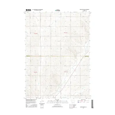
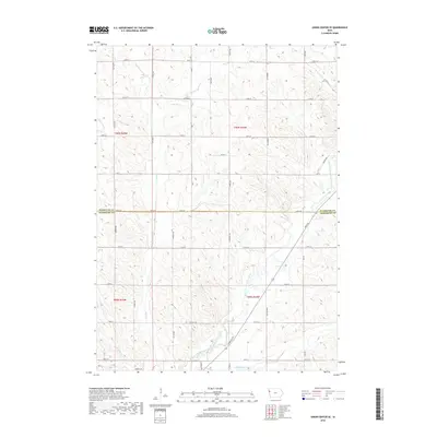
 2022 Union Center SE2022 Print · USGSNorthwestern Iowa farm country and the northern outskirts of Moville appear here in the early twenty-first century. Genealogists and local historians can trace the rural road network from Nature Ave to the banks of the West Fork Little Sioux River.
 - 2022 Map of Moville, 2022 Print
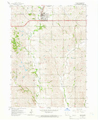
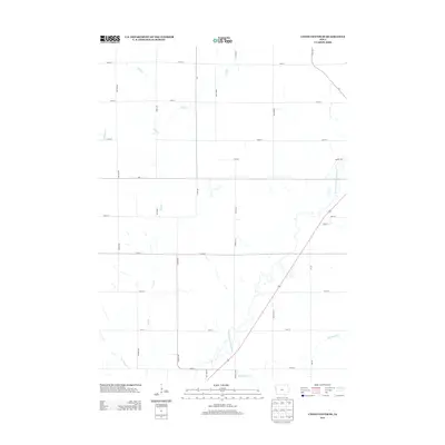
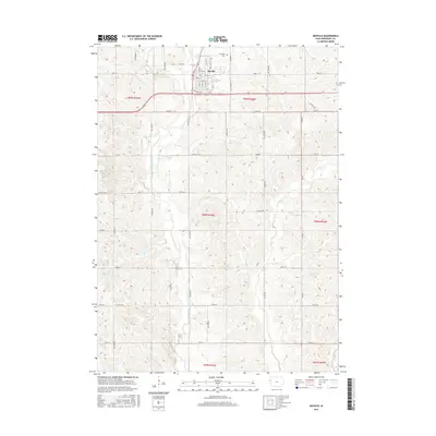
 2022 Moville2022 Print · USGSMoville and its surrounding Woodbury County farmlands are captured here in the early twenty-first century. Researchers can locate family plots at Arlington Cem or trace the winding course of the W Fork Little Sioux River and Wolf Cr.
End of results
Showing maps 1-18 of 18
Top cities near Moville
- Kingsley historical maps
- Lawton historical maps
- Hinton historical maps
- Merrill historical maps
- Anthon historical maps
- Pierson historical maps
See more
Frequently asked questions
- What are the different types of historical maps available for Moville?
- What is the oldest map of Moville?
- Where can I purchase historical maps of Moville for my home or office?
- Where can I download high-res historical maps of Moville?
- Are there historical topographic maps available for Moville?
- Is there historical aerial imagery available for Moville?
- Where are historical maps of Moville sourced from?